How to get to Sprung Instant Structures by bus?
Click on the bus route to see step by step directions with maps, line arrival times and updated time schedules.
From New Day Meadery Tap Room & Production Facility, Indianapolis City (Balance)
59 minFrom Brightview, Indianapolis City (Balance)
111 minFrom RSC Developments, Indianapolis City (Balance)
92 minFrom Fastenal, Indianapolis City (Balance)
81 minFrom Texense, Indianapolis City (Balance)
77 minFrom 21st St & Spencer Ave, Indianapolis City (Balance)
54 minFrom Chanel, Indianapolis City (Balance)
23 minFrom Early Learning Indiana, Indianapolis City (Balance)
116 minFrom IU Health Methodist Professional Center 1, Indianapolis City (Balance)
43 min
Bus stops near Sprung Instant Structures in Indianapolis City (Balance)
Bus lines to Sprung Instant Structures in Indianapolis City (Balance)
What are the closest stations to Sprung Instant Structures?
The closest stations to Sprung Instant Structures are:
- College Ave & 64th St is 192 yards away, 3 min walk.
- Broad Ripple Ave & Guilford Ave is 493 yards away, 6 min walk.
- 66th Station is 564 yards away, 7 min walk.
Which bus lines stop near Sprung Instant Structures?
These bus lines stop near Sprung Instant Structures: 19, 82, 90.
What’s the nearest bus station to Sprung Instant Structures in Indianapolis City (Balance)?
The nearest bus station to Sprung Instant Structures in Indianapolis City (Balance) is College Ave & 64th St. It’s a 3 min walk away.
What time is the first bus to Sprung Instant Structures in Indianapolis City (Balance)?
The 90 is the first bus that goes to Sprung Instant Structures in Indianapolis City (Balance). It stops nearby at 4:53 AM.
What time is the last bus to Sprung Instant Structures in Indianapolis City (Balance)?
The 90 is the last bus that goes to Sprung Instant Structures in Indianapolis City (Balance). It stops nearby at 1:10 AM.
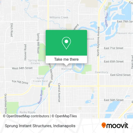
See Sprung Instant Structures, Indianapolis City (Balance), on the map
Public Transit to Sprung Instant Structures in Indianapolis City (Balance)
Wondering how to get to Sprung Instant Structures in Indianapolis City (Balance)? Moovit helps you find the best way to get to Sprung Instant Structures with step-by-step directions from the nearest public transit station.
Moovit provides free maps and live directions to help you navigate through your city. View schedules, routes, timetables, and find out how long does it take to get to Sprung Instant Structures in real time.
Looking for the nearest stop or station to Sprung Instant Structures? Check out this list of stops closest to your destination: College Ave & 64th St; Broad Ripple Ave & Guilford Ave; 66th Station.
Bus: 19, 82, 90.
Want to see if there’s another route that gets you there at an earlier time? Moovit helps you find alternative routes or times. Get directions from and directions to Sprung Instant Structures easily from the Moovit App or Website.
We make riding to Sprung Instant Structures easy, which is why over 1.5 million users, including users in Indianapolis City (Balance), trust Moovit as the best app for public transit. You don’t need to download an individual bus app or train app, Moovit is your all-in-one transit app that helps you find the best bus time or train time available.
For information on prices of bus, costs and ride fares to Sprung Instant Structures, please check the Moovit app.
Use the app to navigate to popular places including to the airport, hospital, stadium, grocery store, mall, coffee shop, school, college, and university.
Sprung Instant Structures Address: 6412 Carrollton Ave Indianapolis, IN 46220 street in Indianapolis City (Balance)
- Dawn @ Sabai,
- MS-Il Staffing,
- Certified Inspection Services,
- Kelly Walsh Studio at Sabai Salon,
- Greenfield Companies,
- Pure Development,
- Elce,
- Rooted Lawn & Landscape,
- Denise Wilson, Realtor,
- McAnlis Law,
- Brett Young - Remax,
- Exceptional Pools,
- Indianapolis Indiana,
- Clip Zone,
- The Potter's House,
- Seattle Sutton's Healthy Eating,
- Harmony,
- CZ & Co.,
- Lisa Ackermann,
- Jarvis Virginia Coiffures
Places Near Sprung Instant Structures (Indianapolis City (Balance))
- Indianapolis Airport Zone 2, Indianapolis City (Balance),
- Lilly Corporate Center (Eli Lilly & Co), Indianapolis City (Balance),
- Indiana, Indianapolis City (Balance),
- I-465 / I-65 Interchange, Indianapolis City (Balance),
- St. Vincent Hospital - Indianapolis, Indianapolis City (Balance),
- St. Vincent entrance #1, Indianapolis City (Balance),
- THE BALT, Indianapolis City (Balance),
- 119 W 19th St Parking, Indianapolis City (Balance),
- I U Health Methodist Hospital, Indianapolis City (Balance),
- Plainfield, IN, Plainfield,
- Lucas Oil Stadium, Indianapolis City (Balance),
- Castleton Square Mall, Indianapolis,
- Eskenazi Hospital, Indianapolis City (Balance),
- Train Ride At Castleton Mall, Indianapolis City (Balance),
- Methodist Hospital of Indianapolis, Indianapolis City (Balance),
- Indiana Convention Center, Indianapolis City (Balance),
- Gainbridge Fieldhouse, Indianapolis City (Balance),
- Cotter's Massage Parlor With Happy Endings, Indianapolis City (Balance),
- Jersey Barn, Indianapolis City (Balance),
- Indianapolis Motor Speedway, Speedway
How to get to popular places in Indianapolis with public transit
Get around Indianapolis City (Balance) by public transit!
Traveling around Indianapolis City (Balance) has never been so easy. See step by step directions as you travel to any attraction, street or major public transit station. View bus and train schedules, arrival times, service alerts and detailed routes on a map, so you know exactly how to get to anywhere in Indianapolis City (Balance).
When traveling to any destination around Indianapolis City (Balance) use Moovit's Live Directions with Get Off Notifications to know exactly where and how far to walk, how long to wait for your line, and how many stops are left. Moovit will alert you when it's time to get off — no need to constantly re-check whether yours is the next stop.
Wondering how to use public transit in Indianapolis City (Balance) or how to pay for public transit in Indianapolis City (Balance)? Moovit public transit app can help you navigate your way with public transit easily, and at minimum cost. It includes public transit fees, ticket prices, and costs. Looking for a map of Indianapolis City (Balance) public transit lines? Moovit public transit app shows all public transit maps in Indianapolis City (Balance) with all bus routes and stops on an interactive map.
Indianapolis has 1 transit type(s), including: bus, operated by several transit agencies, including IndyGo, FlixBus-us and Greyhound-us