How to get to Square Kelly by bus?
Click on the bus route to see step by step directions with maps, line arrival times and updated time schedules.
From Chantilly, VA, Fairfax County
40 minFrom Walmart, Fairfax County
66 minFrom Inova Fairfax Hospital North Tower Building, Fairfax County
41 minFrom Inova Fair Oaks Hospital, Fairfax County
43 minFrom Defense Health Headquarters (DHHQ), Fairfax County
55 minFrom Leesburg VA-684, Fairfax County
68 minFrom [I-495] Exit 54 - Braddock Road, Fairfax County
54 minFrom Inova Fairfax Hospital, Fairfax County
36 minFrom Inova employee Shuttle, Fairfax County
39 min
Bus stops near Square Kelly in Fairfax
Bus lines to Square Kelly in Fairfax
What are the closest stations to Square Kelly?
The closest stations to Square Kelly are:
- W Main St @ Oak St is 115 yards away, 2 min walk.
- Main St at Oak St (Nb) is 120 yards away, 2 min walk.
- Main St at Oak St (Sb) is 133 yards away, 2 min walk.
Which bus lines stop near Square Kelly?
These bus lines stop near Square Kelly: 610, GOLD 1, GOLD 2.
What’s the nearest bus station to Square Kelly in Fairfax?
The nearest bus stations to Square Kelly in Fairfax are W Main St @ Oak St, Main St at Oak St (Nb) and Main St at Oak St (Sb). The closest one is a 2 min walk away.
What time is the first bus to Square Kelly in Fairfax?
The 610 is the first bus that goes to Square Kelly in Fairfax. It stops nearby at 5:44 AM.
What time is the last bus to Square Kelly in Fairfax?
The GOLD 1 is the last bus that goes to Square Kelly in Fairfax. It stops nearby at 10:45 PM.
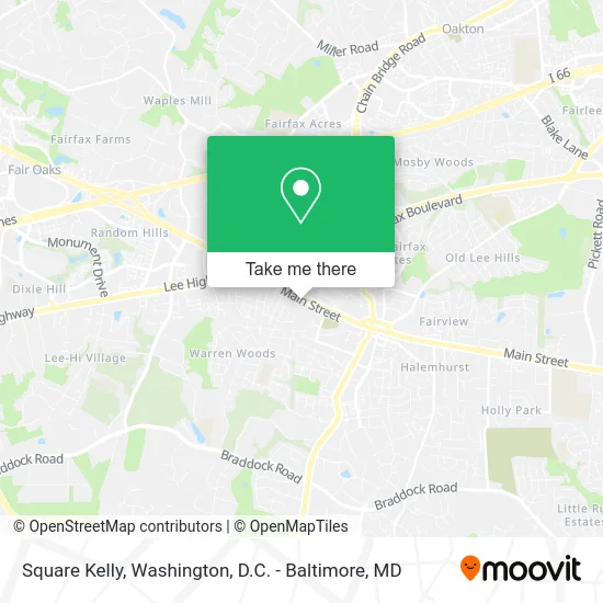
See Square Kelly, Fairfax, on the map
Public Transit to Square Kelly in Fairfax
Wondering how to get to Square Kelly in Fairfax? Moovit helps you find the best way to get to Square Kelly with step-by-step directions from the nearest public transit station.
Moovit provides free maps and live directions to help you navigate through your city. View schedules, routes, timetables, and find out how long does it take to get to Square Kelly in real time.
Looking for the nearest stop or station to Square Kelly? Check out this list of stops closest to your destination: W Main St @ Oak St; Main St at Oak St (Nb); Main St at Oak St (Sb).
Bus: 610, GOLD 1, GOLD 2.
Want to see if there’s another route that gets you there at an earlier time? Moovit helps you find alternative routes or times. Get directions from and directions to Square Kelly easily from the Moovit App or Website.
We make riding to Square Kelly easy, which is why over 1.5 million users, including users in Fairfax, trust Moovit as the best app for public transit. You don’t need to download an individual bus app or train app, Moovit is your all-in-one transit app that helps you find the best bus time or train time available.
For information on prices of bus and metro, costs and ride fares to Square Kelly, please check the Moovit app.
Use the app to navigate to popular places including to the airport, hospital, stadium, grocery store, mall, coffee shop, school, college, and university.
Square Kelly Address: 10777 Main St street in Fairfax
- Falls Church City,
- USPS Collection Box - Blue Box,
- Birthplace Of The Confederate Flag,
- Occupational Physical Fairfax Therapy Therapist,
- Dish Network,
- Dr Michael D. Kim M.D.,
- Stair Creations,
- Law Office of Afsana Chowdhury,
- Luna Aesthetics Skin Care I Non-Evasive Body Sculpting, Fat Removal, Body Contouring,
- Carlos the Medium,
- 3D & 4d Ultrasound,
- Eun Soo Choi,
- LabCorp,
- Mark Lopiano MD,
- VA Dryer Vent & Air Duct Cleaning Pro,
- Rosay Properties,
- Glowby Rahi,
- WJFK-FM (106.7 The Fan),
- Family Med-Surg Clinic,
- Dr Lynn Field, PHD
Places Near Square Kelly (Fairfax)
- National Theatre, Washington,
- The Anthem, Washington,
- M&T Bank Stadium, Baltimore,
- Georgetown, Washington,
- Warner Theatre, Washington,
- National Zoo, Washington,
- Basilica of the National Shrine, Washington,
- Capital One Arena, Washington,
- Marriott Marquis Washington, DC, Washington,
- Museum Of The Bible, Washington,
- Sibley Memorial Hospital, Washington,
- Washington DC VA Medical Center, Washington,
- Pennsylvania Ave NW (3rd st and pennsylvania), Washington,
- National Museum of African American History and Culture, Washington,
- Amazon Hq2, Arlington County,
- Rock Creek Tennis Center, Washington,
- PG Mall, Prince George's County,
- Washington National Cathedral, Washington,
- Westfield Montgomery Mall, Montgomery County,
- Camden Yards, Baltimore
How to get to popular places in Washington, D.C. - Baltimore, MD with public transit
Get around Fairfax by public transit!
Traveling around Fairfax has never been so easy. See step by step directions as you travel to any attraction, street or major public transit station. View bus and train schedules, arrival times, service alerts and detailed routes on a map, so you know exactly how to get to anywhere in Fairfax.
When traveling to any destination around Fairfax use Moovit's Live Directions with Get Off Notifications to know exactly where and how far to walk, how long to wait for your line, and how many stops are left. Moovit will alert you when it's time to get off — no need to constantly re-check whether yours is the next stop.
Wondering how to use public transit in Fairfax or how to pay for public transit in Fairfax? Moovit public transit app can help you navigate your way with public transit easily, and at minimum cost. It includes public transit fees, ticket prices, and costs. Looking for a map of Fairfax public transit lines? Moovit public transit app shows all public transit maps in Fairfax with all Bus, Train, Metro, Light Rail and Ferry routes and stops on an interactive map.
Washington, D.C. - Baltimore, MD has 5 transit type(s), including: Bus, Train, Metro, Light Rail and Ferry, operated by several transit agencies, including WMATA, Montgomery County Ride On, Fairfax Connector, TheBus, PRTC, DASH - Alexandria, Arlington Transit (ART), RTA of Central Maryland, MDOT MTA, MDOT MTA Light RailLink, MDOT MTA Commuter Bus, MDOT MTA Local Bus, FXBGO!, Virginia Railway Express (VRE) and MARC