How to get to Square One by bus?
Click on the bus route to see step by step directions with maps, line arrival times and updated time schedules.
How to get to Square One by train?
Click on the train route to see step by step directions with maps, line arrival times and updated time schedules.
How to get to Square One by subway?
Click on the subway route to see step by step directions with maps, line arrival times and updated time schedules.
Bus stops near Square One in Manhattan
Subway stations near Square One in Manhattan
Train station near Square One in Manhattan
- 14th Street, 7 min walk,VIEW
Bus lines to Square One in Manhattan
- M14A-SBS, Select Bus Les Grand-Fdr Via 14 St,VIEW
- M14D-SBS, Select Bus Union Sq Via 14 St,VIEW
- SIM1C, Eltngvlle Trans Ctr Via Hylan Via Rich,VIEW
- SIM3C, Pt Rchmnd Via Narrows Rd N Via Watchogue,VIEW
- SIM4C, Huguenot Via Richmond Av Via Arthur Kill,VIEW
- X28, Coney Island Sea Gate Via Broadway,VIEW
- SIM33C, Mariners Harbor Via N Gannon Av,VIEW
- DOWNTOWN LOCAL, Downtown Local,VIEW
- SHORTLINE HUDSON, 500 - Monroe - Chester - Goshen,VIEW
- SHORTLINE HUDSON, 200 - Northern District – Nanuet,VIEW
- SHORTLINE HUDSON, 800 - Pennsylvania,VIEW
- SHORTLINE HUDSON, 700 - Newburgh - Poughkeepsie,VIEW
- M1, Soho Centre St Via 5 Av/ Via Broadway,VIEW
- M2, East Village 8 St Via 5 Av,VIEW
- M3, 125 St St. Nicholas Av,VIEW
- M55, South Ferry,VIEW
- GREENWICH, Midtown / W 39th Street,VIEW
- X27, Bay Ridge Shore Rd Via Broadway,VIEW
- SIM7, Eltvlle Trans Ctr Via Hylan Via Richmond,VIEW
- SIM9, Eltingville Via F Cap Via Hylan Bl,VIEW
What are the closest stations to Square One?
The closest stations to Square One are:
- E 14 St/University Pl is 23 yards away, 1 min walk.
- Broadway/E 13 St is 148 yards away, 2 min walk.
- Broadway & E 14th St is 174 yards away, 3 min walk.
- 5 Av/W 14 St is 211 yards away, 3 min walk.
- 5th Ave & W 13th St is 242 yards away, 3 min walk.
- 14 St-Union Sq is 301 yards away, 4 min walk.
- 14 St/6 Av is 471 yards away, 6 min walk.
- 14th Street is 514 yards away, 7 min walk.
Which bus lines stop near Square One?
These bus lines stop near Square One: BM3, M1, M2, X27.
Which train lines stop near Square One?
These train lines stop near Square One: 2, BLU, YEL.
Which subway lines stop near Square One?
These subway lines stop near Square One: 5, 6, F, N, Q, R, W.
What’s the nearest subway station to Square One in Manhattan?
The nearest subway station to Square One in Manhattan is 14 St-Union Sq. It’s a 4 min walk away.
What’s the nearest train station to Square One in Manhattan?
The nearest train station to Square One in Manhattan is 14th Street. It’s a 7 min walk away.
What’s the nearest bus station to Square One in Manhattan?
The nearest bus station to Square One in Manhattan is E 14 St/University Pl. It’s a 1 min walk away.
What time is the first subway to Square One in Manhattan?
The 6 is the first subway that goes to Square One in Manhattan. It stops nearby at 3:00 AM.
What time is the last subway to Square One in Manhattan?
The N is the last subway that goes to Square One in Manhattan. It stops nearby at 3:55 AM.
What time is the first train to Square One in Manhattan?
The ATW is the first train that goes to Square One in Manhattan. It stops nearby at 3:17 AM.
What time is the last train to Square One in Manhattan?
The ATW is the last train that goes to Square One in Manhattan. It stops nearby at 3:17 AM.
What time is the first bus to Square One in Manhattan?
The M14A-SBS is the first bus that goes to Square One in Manhattan. It stops nearby at 3:08 AM.
What time is the last bus to Square One in Manhattan?
The M2 is the last bus that goes to Square One in Manhattan. It stops nearby at 2:58 AM.
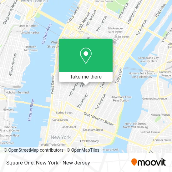
See Square One, Manhattan, on the map
Public Transit to Square One in Manhattan
Wondering how to get to Square One in Manhattan? Moovit helps you find the best way to get to Square One with step-by-step directions from the nearest public transit station.
Moovit provides free maps and live directions to help you navigate through your city. View schedules, routes, timetables, and find out how long does it take to get to Square One in real time.
Looking for the nearest stop or station to Square One? Check out this list of stops closest to your destination: E 14 St/University Pl; Broadway/E 13 St; Broadway & E 14th St; 5 Av/W 14 St; 5th Ave & W 13th St; 14 St-Union Sq; 14 St/6 Av; 14th Street.
Bus: BM3, M1, M2, X27, M14A-SBS, M14D-SBS, SIM1C, SIM3C, SIM4C, X28, SIM33C, DOWNTOWN LOCAL, SHORTLINE HUDSON, SHORTLINE HUDSON, SHORTLINE HUDSON, SHORTLINE HUDSON.Train: 2, BLU, YEL, ATW.Subway: 5, 6, F, N, Q, R, W, L, D, FX, M.
Want to see if there’s another route that gets you there at an earlier time? Moovit helps you find alternative routes or times. Get directions from and directions to Square One easily from the Moovit App or Website.
We make riding to Square One easy, which is why over 1.5 million users, including users in Manhattan, trust Moovit as the best app for public transit. You don’t need to download an individual bus app or train app, Moovit is your all-in-one transit app that helps you find the best bus time or train time available.
For information on prices of subway, bus and train, costs and ride fares to Square One, please check the Moovit app.
Use the app to navigate to popular places including to the airport, hospital, stadium, grocery store, mall, coffee shop, school, college, and university.
Square One Address: 32 E 14th St street in Manhattan
- Popeyes,
- Popeyes Louisiana Kitchen,
- Compton's,
- Trattoria Dell'Arte,
- East 14th Street New York - Gamestop,
- Bank Of America Financial Center & Walk-Up Atm | Union Square-14th St,
- Lush Cosmetics,
- The Halal Kitchen,
- Scarlette Creative Events,
- Kids Foot Locker,
- Nelson Evans,
- Steve Blatz Architect,
- E 14th St (14th street union square),
- University Union,
- The New School Printmaking Studio,
- Kids Foot Locker,
- Reebok,
- Flower Delivery Union Square,
- Greenwich Village Chelsea Chamber,
- Michael MC Crum Architects
Places Near Square One (Manhattan)
- Pier 83, Manhattan,
- Katz's Deli, Manhattan,
- San Gennaro Feast, Manhattan,
- Chinatown, Manhattan,
- 1 Police Plaza, Manhattan,
- Queens Center Mall, Queens,
- 111 Centre New York City Supreme Court, Manhattan,
- 911 Memorial, Manhattan,
- Bellevue Hospital, Manhattan,
- Hudson Yards, Manhattan,
- Wall Street, Manhattan,
- 376 Hudson Street, Manhattan,
- Rockefeller Center, Manhattan,
- SoHo, Manhattan,
- Mountainside Hospital, Glen Ridge,
- 26 Federal Plaza, Manhattan,
- 66 John Street, Manhattan,
- 3 Stone St, Manhattan,
- Times Square, Manhattan,
- qqqq, Manhattan
How to get to popular places in New York - New Jersey with public transit
Get around Manhattan by public transit!
Traveling around Manhattan has never been so easy. See step by step directions as you travel to any attraction, street or major public transit station. View bus and train schedules, arrival times, service alerts and detailed routes on a map, so you know exactly how to get to anywhere in Manhattan.
When traveling to any destination around Manhattan use Moovit's Live Directions with Get Off Notifications to know exactly where and how far to walk, how long to wait for your line, and how many stops are left. Moovit will alert you when it's time to get off — no need to constantly re-check whether yours is the next stop.
Wondering how to use public transit in Manhattan or how to pay for public transit in Manhattan? Moovit public transit app can help you navigate your way with public transit easily, and at minimum cost. It includes public transit fees, ticket prices, and costs. Looking for a map of Manhattan public transit lines? Moovit public transit app shows all public transit maps in Manhattan with all Bus, Train, Subway, Light Rail, Ferry and Cable Car routes and stops on an interactive map.
New York - New Jersey has 6 transit type(s), including: Bus, Train, Subway, Light Rail, Ferry and Cable Car, operated by several transit agencies, including MTA Subway, Metro-North Railroad, LIRR, PATH, MTA New York City Transit - Express routes, MTA Bus, NJ Transit, NYC Ferry, NICE bus, Bee-Line Bus, NJ Transit Rail, Norwalk Transit District, Hartford Line, River Valley Transit and HART