How to get to Squire Patton Boggs by bus?
Click on the bus route to see step by step directions with maps, line arrival times and updated time schedules.
From Punch Bowl Social, Arlington County
45 minFrom Marymount University Campus, Arlington County
46 minFrom Defense Health Agency Headquarters, Fairfax County
72 minFrom Kaiser Permanente - Falls Church Medical Center, Falls Church
26 minFrom Intelligence Community Campus—Bethesda, Montgomery County
115 minFrom Inova employee Shuttle, Fairfax County
37 minFrom Sibley Memorial Hospital, Washington
124 minFrom Lake Fairfax Park, Fairfax County
77 minFrom King's Dominion, Fairfax County
79 minFrom Exit 39 - MD 190 (River Road) / Potomac, Washington, Montgomery County
120 min
How to get to Squire Patton Boggs by metro?
Click on the metro route to see step by step directions with maps, line arrival times and updated time schedules.
Bus stops near Squire Patton Boggs in Fairfax County
Metro stations near Squire Patton Boggs in Fairfax County
Bus lines to Squire Patton Boggs in Fairfax County
What are the closest stations to Squire Patton Boggs?
The closest stations to Squire Patton Boggs are:
- Magarity @ Lunceford is 127 yards away, 2 min walk.
- Tysons Corner Center is 388 yards away, 5 min walk.
- Tysons Corner Ctr+Parking Terrace C (Stop 1) is 405 yards away, 6 min walk.
- Tysons Corner Ctr+Parking Terrace C (Stop 2) is 444 yards away, 6 min walk.
- Spring Hill is 576 yards away, 8 min walk.
- Gallows Rd @ Madrillon Rd is 618 yards away, 8 min walk.
- International Dr @ Fletcher St is 662 yards away, 9 min walk.
- West Falls Church-Vt is 3486 yards away, 41 min walk.
Which bus lines stop near Squire Patton Boggs?
These bus lines stop near Squire Patton Boggs: 401, 402, 798, A70, F20.
Which metro line stops near Squire Patton Boggs?
SILVER (Ashburn)
What’s the nearest metro station to Squire Patton Boggs in Fairfax County?
The nearest metro station to Squire Patton Boggs in Fairfax County is Spring Hill. It’s a 8 min walk away.
What’s the nearest bus station to Squire Patton Boggs in Fairfax County?
The nearest bus station to Squire Patton Boggs in Fairfax County is Magarity @ Lunceford. It’s a 2 min walk away.
What time is the first metro to Squire Patton Boggs in Fairfax County?
The SILVER is the first metro that goes to Squire Patton Boggs in Fairfax County. It stops nearby at 5:07 AM.
What time is the last metro to Squire Patton Boggs in Fairfax County?
The SILVER is the last metro that goes to Squire Patton Boggs in Fairfax County. It stops nearby at 12:43 AM.
What time is the first bus to Squire Patton Boggs in Fairfax County?
The 401 is the first bus that goes to Squire Patton Boggs in Fairfax County. It stops nearby at 4:26 AM.
What time is the last bus to Squire Patton Boggs in Fairfax County?
The F20 is the last bus that goes to Squire Patton Boggs in Fairfax County. It stops nearby at 2:03 AM.
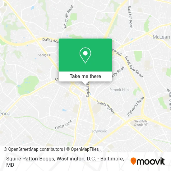
See Squire Patton Boggs, Fairfax County, on the map
Public Transit to Squire Patton Boggs in Fairfax County
Wondering how to get to Squire Patton Boggs in Fairfax County? Moovit helps you find the best way to get to Squire Patton Boggs with step-by-step directions from the nearest public transit station.
Moovit provides free maps and live directions to help you navigate through your city. View schedules, routes, timetables, and find out how long does it take to get to Squire Patton Boggs in real time.
Looking for the nearest stop or station to Squire Patton Boggs? Check out this list of stops closest to your destination: Magarity @ Lunceford; Tysons Corner Center; Tysons Corner Ctr+Parking Terrace C (Stop 1); Tysons Corner Ctr+Parking Terrace C (Stop 2); Spring Hill; Gallows Rd @ Madrillon Rd; International Dr @ Fletcher St; West Falls Church-Vt.
Bus: 401, 402, 798, A70, F20, 703, 721.Metro: SILVER, ORANGE.
Want to see if there’s another route that gets you there at an earlier time? Moovit helps you find alternative routes or times. Get directions from and directions to Squire Patton Boggs easily from the Moovit App or Website.
We make riding to Squire Patton Boggs easy, which is why over 1.7 million users, including users in Fairfax County, trust Moovit as the best app for public transit. You don’t need to download an individual bus app or train app, Moovit is your all-in-one transit app that helps you find the best bus time or train time available.
For information on prices of bus and metro, costs and ride fares to Squire Patton Boggs, please check the Moovit app.
Use the app to navigate to popular places including to the airport, hospital, stadium, grocery store, mall, coffee shop, school, college, and university.
Squire Patton Boggs Address: 8000 Towers Cres Dr 14th Floor street in Fairfax County
- The Tower Club,
- Chima Tysons Corner,
- Capital One,
- Appian Corporation,
- Capital One Towers Crescent,
- Microstrategy Hq,
- Tysons Corner Marriott,
- Exit 47A-B/Leesburg Pike/S,
- Chima Steakhouse,
- Tgi Friday's,
- Nordstrom Tysons Corner Center,
- Abercrombie & Fitch,
- Barnes & Noble,
- UNIQLO,
- Tysons Corner Parking Garage,
- AMC Tysons Corner 16,
- Coastal Flats,
- Bloomingdale's,
- 7900 Tysons One Pl,
- American Girl Store
Places Near Squire Patton Boggs (Fairfax County)
- Capital One Arena, Washington,
- Sibley Memorial Hospital, Washington,
- Georgetown, Washington,
- Basilica of the National Shrine, Washington,
- Warner Theatre, Washington,
- Pennsylvania Ave NW (3rd st and pennsylvania), Washington,
- Washington DC VA Medical Center, Washington,
- The Anthem, Washington,
- Washington National Cathedral, Washington,
- National Museum of African American History and Culture, Washington,
- Camden Yards, Baltimore,
- Museum Of The Bible, Washington,
- Marriott Marquis Washington, DC, Washington,
- PG Mall, Prince George's County,
- Westfield Montgomery Mall, Montgomery County,
- Amazon Hq2, Arlington County,
- National Zoo, Washington,
- National Theatre, Washington,
- M&T Bank Stadium, Baltimore,
- Rock Creek Tennis Center, Washington
How to get to popular places in Washington, D.C. - Baltimore, MD with public transit
Get around Fairfax County by public transit!
Traveling around Fairfax County has never been so easy. See step by step directions as you travel to any attraction, street or major public transit station. View bus and train schedules, arrival times, service alerts and detailed routes on a map, so you know exactly how to get to anywhere in Fairfax County.
When traveling to any destination around Fairfax County use Moovit's Live Directions with Get Off Notifications to know exactly where and how far to walk, how long to wait for your line, and how many stops are left. Moovit will alert you when it's time to get off — no need to constantly re-check whether yours is the next stop.
Wondering how to use public transit in Fairfax County or how to pay for public transit in Fairfax County? Moovit public transit app can help you navigate your way with public transit easily, and at minimum cost. It includes public transit fees, ticket prices, and costs. Looking for a map of Fairfax County public transit lines? Moovit public transit app shows all public transit maps in Fairfax County with all Bus, Train, Metro, Light Rail and Ferry routes and stops on an interactive map.
Washington, D.C. - Baltimore, MD has 5 transit type(s), including: Bus, Train, Metro, Light Rail and Ferry, operated by several transit agencies, including WMATA, Montgomery County Ride On, Fairfax Connector, TheBus, PRTC, DASH - Alexandria, Arlington Transit (ART), RTA of Central Maryland, MDOT MTA, MDOT MTA Light RailLink, MDOT MTA Commuter Bus, MDOT MTA Local Bus, FXBGO!, Virginia Railway Express (VRE) and MARC