Directions to St Marys School (Lynn) with public transportation
The following transit lines have routes that pass near St Marys School
 Bus: 426, 429, 436, 442, 455.
- Train: NEWBURYPORT/ROCKPORT.
- Ferry: LYNN FERRY.
How to get to St Marys School by bus?
Click on the bus route to see step by step directions with maps, line arrival times and updated time schedules.
From Constitution Beach, Boston
61 minFrom Homewood Suites by Hilton Boston Logan Airport Chelsea, Chelsea
55 minFrom Winthrop, Winthrop Town
59 minFrom North Shore Mall, Peabody
47 minFrom Holiday Inn Express-Saugus, Saugus
58 minFrom Kowloon Restaurant, Saugus
48 minFrom Melrose, MA, Melrose
68 minFrom Chelsea, MA, Chelsea
53 minFrom Salem Witch Museum, Salem
43 min
How to get to St Marys School by train?
Click on the train route to see step by step directions with maps, line arrival times and updated time schedules.
Bus stops near St Marys School in Lynn
Ferry station near St Marys School in Lynn
- Blossom Street Pier, 31 min walk,VIEW
Train station near St Marys School in Lynn
- River Works, 48 min walk,VIEW
Bus lines to St Marys School in Lynn
- 429, Kings Lynn,VIEW
- 436, Central Square,VIEW
- 426, Haymarket Via Cliftondale,VIEW
- 442, West Lynn Garage Via Central Square & Humphrey St,VIEW
- 455, West Lynn Garage Via Central Square,VIEW
- 441, Wonderland Via Paradise Rd & Central Square,VIEW
- 435, Central Square Via Malls,VIEW
- 439, Nahant,VIEW
- 456, Central Square,VIEW
- 441/442, Ocean St Via Central Square,VIEW
- NEWBURYPORT LINE SHUTTLE, Oak Grove (Local Shuttle),VIEW
- NEWBURYPORT/ROCKPORT LINE SHUTTLE, Swampscott (Shuttle),VIEW
- NEWBURYPORT/ROCKPORT LINE SHUTTLE, Beverly (Shuttle),VIEW
What are the closest stations to St Marys School?
The closest stations to St Marys School are:
- Oxford St @ Washington St is 433 yards away, 6 min walk.
- Market St @ Liberty St is 513 yards away, 7 min walk.
- S Common St @ Market St is 723 yards away, 9 min walk.
- Neptune Blvd @ Blossom St is 729 yards away, 9 min walk.
- Market Street @ Lynn Commuter Rail is 982 yards away, 12 min walk.
- Blossom Street Pier is 2636 yards away, 31 min walk.
- River Works is 4035 yards away, 48 min walk.
Which bus lines stop near St Marys School?
These bus lines stop near St Marys School: 426, 429, 436, 442, 455.
Which train line stops near St Marys School?
NEWBURYPORT/ROCKPORT (#125 | Newburyport)
What’s the nearest bus station to St Marys School in Lynn?
The nearest bus station to St Marys School in Lynn is Oxford St @ Washington St. It’s a 6 min walk away.
What time is the first train to St Marys School in Lynn?
The NEWBURYPORT/ROCKPORT is the first train that goes to St Marys School in Lynn. It stops nearby at 5:27 AM.
What time is the last train to St Marys School in Lynn?
The NEWBURYPORT/ROCKPORT is the last train that goes to St Marys School in Lynn. It stops nearby at 12:20 AM.
What time is the first bus to St Marys School in Lynn?
The 455 is the first bus that goes to St Marys School in Lynn. It stops nearby at 4:45 AM.
What time is the last bus to St Marys School in Lynn?
The 426 is the last bus that goes to St Marys School in Lynn. It stops nearby at 1:46 AM.
What time is the first ferry to St Marys School in Lynn?
The LYNN FERRY is the first ferry that goes to St Marys School in Lynn. It stops nearby at 6:00 AM.
What time is the last ferry to St Marys School in Lynn?
The LYNN FERRY is the last ferry that goes to St Marys School in Lynn. It stops nearby at 7:55 PM.
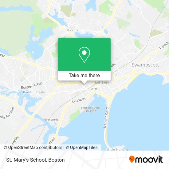
See St Marys School, Lynn, on the map
Public Transit to St Marys School in Lynn
Wondering how to get to St Marys School in Lynn? Moovit helps you find the best way to get to St Marys School with step-by-step directions from the nearest public transit station.
Moovit provides free maps and live directions to help you navigate through your city. View schedules, routes, timetables, and find out how long does it take to get to St Marys School in real time.
Looking for the nearest stop or station to St Marys School? Check out this list of stops closest to your destination: Oxford St @ Washington St; Market St @ Liberty St; S Common St @ Market St; Neptune Blvd @ Blossom St; Market Street @ Lynn Commuter Rail; Blossom Street Pier; River Works.
Bus: 426, 429, 436, 442, 455, 441, 435.Train: NEWBURYPORT/ROCKPORT.Ferry: LYNN FERRY.
Want to see if there’s another route that gets you there at an earlier time? Moovit helps you find alternative routes or times. Get directions from and directions to St Marys School easily from the Moovit App or Website.
We make riding to St Marys School easy, which is why over 1.7 million users, including users in Lynn, trust Moovit as the best app for public transit. You don’t need to download an individual bus app or train app, Moovit is your all-in-one transit app that helps you find the best bus time or train time available.
For information on prices of bus, train and subway, costs and ride fares to St Marys School, please check the Moovit app.
Use the app to navigate to popular places including to the airport, hospital, stadium, grocery store, mall, coffee shop, school, college, and university.
St Marys School Address: 35 Tremont St street in Lynn
- Mailboxes & Much More,
- Populus,
- Lynn Spanish Branch,
- Isabella Med Spa,
- Law Office of Thomas O. Mason,
- Moving Storage & Long Distance Service,
- American Locksmith,
- Masis Staffing Solutions,
- Ians Jewelry Services and Collectibles,
- J & M Dollar Store,
- Sunny Patch Daycare,
- DUNKIN',
- Lynn Long Distance Movers,
- Evelins Closet 2,
- D'Amici's Artistry in Banking,
- High Grade Shade & Screen Co,
- Project Rise,
- Godoy,
- Alison M. Griffin, Licsw,
- Botanica Yemaya Y los 7 Mares
Places Near St Marys School (Lynn)
- Leader Bank Pavilion (Leader Bank Pavillion), Boston,
- House Of Blues, Boston,
- Quincy Market, Boston,
- Wang Theater, Boston,
- Boston Medical Center, Boston,
- Massachusetts General Hospital, Boston,
- Museum Of Science, Boston,
- Td Garden, Boston,
- Cheers, Boston,
- Boston Convention & Exhibition Center, Boston,
- Boston Common, Boston,
- Wilbur Theatre, Boston,
- Castle Island, Boston,
- Boston Children's Hospital, Boston,
- North End, Boston,
- Isabella Stewart Gardner Museum, Boston,
- Faneuil Hall, Boston,
- Seaport District, Boston,
- Prudential Center, Boston,
- Mgm Music Hall, Boston
How to get to popular places in Boston with public transit
Get around Lynn by public transit!
Traveling around Lynn has never been so easy. See step by step directions as you travel to any attraction, street or major public transit station. View bus and train schedules, arrival times, service alerts and detailed routes on a map, so you know exactly how to get to anywhere in Lynn.
When traveling to any destination around Lynn use Moovit's Live Directions with Get Off Notifications to know exactly where and how far to walk, how long to wait for your line, and how many stops are left. Moovit will alert you when it's time to get off — no need to constantly re-check whether yours is the next stop.
Wondering how to use public transit in Lynn or how to pay for public transit in Lynn? Moovit public transit app can help you navigate your way with public transit easily, and at minimum cost. It includes public transit fees, ticket prices, and costs. Looking for a map of Lynn public transit lines? Moovit public transit app shows all public transit maps in Lynn with all Bus, Train, Subway and Ferry routes and stops on an interactive map.
Boston has 4 transit type(s), including: Bus, Train, Subway and Ferry, operated by several transit agencies, including MBTA, Southeastern Regional Transit Authority, MetroWest Regional Transit Authority, Rhode Island Public Transit Authority, WRTA, Lowell Regional Transit Authority, Merrimack Valley Transit, Montachusett Regional Transit Authority, Cape Cod Regional Transit Authority, Brockton Area Transit Authority, Martha's Vineyard Transit Authority, the WAVE - Nantucket Regional Transit Authority, GATRA, Cape Ann Transportation Authority and Massport