How to get to St.Thomas Chiropractic by bus?
Click on the bus route to see step by step directions with maps, line arrival times and updated time schedules.
From Mall del Sol Guayaquil,Ecuador, Queens
81 minFrom United Palace Theatre, Manhattan
46 minFrom Manhattan Bridge, Manhattan
89 minFrom Newport Mall Bus, Jersey City
80 minFrom Jersey City Medical Center, Jersey City
84 minFrom Liberty State Park, Jersey City
99 minFrom Community Lines, Jersey City
84 min
How to get to St.Thomas Chiropractic by train?
Click on the train route to see step by step directions with maps, line arrival times and updated time schedules.
How to get to St.Thomas Chiropractic by subway?
Click on the subway route to see step by step directions with maps, line arrival times and updated time schedules.
Bus stops near St.Thomas Chiropractic in Manhattan
Subway stations near St.Thomas Chiropractic in Manhattan
- 72 St, 7 min walk,VIEW
Bus lines to St.Thomas Chiropractic in Manhattan
What are the closest stations to St.Thomas Chiropractic?
The closest stations to St.Thomas Chiropractic are:
- W 70 St/West End Av is 56 yards away, 1 min walk.
- West End Av/W 70 St is 148 yards away, 2 min walk.
- W 72 St/Broadway is 226 yards away, 3 min walk.
- Broadway/W 72 St is 227 yards away, 3 min walk.
- Amsterdam Av/W 69 St is 256 yards away, 4 min walk.
- Amsterdam Av/W 72 St is 261 yards away, 4 min walk.
- 72 St is 546 yards away, 7 min walk.
Which bus lines stop near St.Thomas Chiropractic?
These bus lines stop near St.Thomas Chiropractic: M104, M5, M57.
Which train lines stop near St.Thomas Chiropractic?
These train lines stop near St.Thomas Chiropractic: BABYLON BRANCH, YEL.
Which subway lines stop near St.Thomas Chiropractic?
These subway lines stop near St.Thomas Chiropractic: 1, 2, 3.
What’s the nearest subway station to St.Thomas Chiropractic in Manhattan?
The nearest subway station to St.Thomas Chiropractic in Manhattan is 72 St. It’s a 7 min walk away.
What’s the nearest bus station to St.Thomas Chiropractic in Manhattan?
The nearest bus station to St.Thomas Chiropractic in Manhattan is W 70 St/West End Av. It’s a 1 min walk away.
What time is the first subway to St.Thomas Chiropractic in Manhattan?
The 1 is the first subway that goes to St.Thomas Chiropractic in Manhattan. It stops nearby at 3:00 AM.
What time is the last subway to St.Thomas Chiropractic in Manhattan?
The A is the last subway that goes to St.Thomas Chiropractic in Manhattan. It stops nearby at 4:05 AM.
What time is the first bus to St.Thomas Chiropractic in Manhattan?
The M104 is the first bus that goes to St.Thomas Chiropractic in Manhattan. It stops nearby at 3:27 AM.
What time is the last bus to St.Thomas Chiropractic in Manhattan?
The M104 is the last bus that goes to St.Thomas Chiropractic in Manhattan. It stops nearby at 2:58 AM.
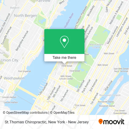
See St.Thomas Chiropractic, Manhattan, on the map
Public Transit to St.Thomas Chiropractic in Manhattan
Wondering how to get to St.Thomas Chiropractic in Manhattan? Moovit helps you find the best way to get to St.Thomas Chiropractic with step-by-step directions from the nearest public transit station.
Moovit provides free maps and live directions to help you navigate through your city. View schedules, routes, timetables, and find out how long does it take to get to St.Thomas Chiropractic in real time.
Looking for the nearest stop or station to St.Thomas Chiropractic? Check out this list of stops closest to your destination: W 70 St/West End Av; West End Av/W 70 St; W 72 St/Broadway; Broadway/W 72 St; Amsterdam Av/W 69 St; Amsterdam Av/W 72 St; 72 St.
Bus: M104, M5, M57, M72.Train: BABYLON BRANCH, YEL.Subway: 1, 2, 3, A, B, C.
Want to see if there’s another route that gets you there at an earlier time? Moovit helps you find alternative routes or times. Get directions from and directions to St.Thomas Chiropractic easily from the Moovit App or Website.
We make riding to St.Thomas Chiropractic easy, which is why over 1.5 million users, including users in Manhattan, trust Moovit as the best app for public transit. You don’t need to download an individual bus app or train app, Moovit is your all-in-one transit app that helps you find the best bus time or train time available.
For information on prices of bus, subway, train and light rail, costs and ride fares to St.Thomas Chiropractic, please check the Moovit app.
Use the app to navigate to popular places including to the airport, hospital, stadium, grocery store, mall, coffee shop, school, college, and university.
St.Thomas Chiropractic Address: 228 W 71st St street in Manhattan
- Wonder Hat Books,
- Monica Valenti,
- Catalyst Counseling,
- Haston Floral,
- Beauty Salon 82,
- Salon De Oasis Nail Spa,
- NY Window Fashion Inc,
- Tiga Nyc,
- Pangea Dance Collective,
- Shani Friedlander,
- Kofa Online Academy,
- Da Mien Martial Arts,
- Wells Fargo Advisors,
- Rock Properties,
- Fares Ethiopan Evangelistic Church,
- John Gingrich Management,
- Nyc Church Planting,
- Faithful Korean Baptist Church,
- Global Gates Network,
- Ming Spa
Places Near St.Thomas Chiropractic (Manhattan)
- Mountainside Hospital, Glen Ridge,
- Rockefeller Center, Manhattan,
- 1 Police Plaza, Manhattan,
- 66 John Street, Manhattan,
- San Gennaro Feast, Manhattan,
- 3 Stone St, Manhattan,
- qqqq, Manhattan,
- Times Square, Manhattan,
- SoHo, Manhattan,
- 26 Federal Plaza, Manhattan,
- 376 Hudson Street, Manhattan,
- Hudson Yards, Manhattan,
- Queens Center Mall, Queens,
- 911 Memorial, Manhattan,
- Bellevue Hospital, Manhattan,
- Wall Street, Manhattan,
- Pier 83, Manhattan,
- Katz's Deli, Manhattan,
- 111 Centre New York City Supreme Court, Manhattan,
- Chinatown, Manhattan
How to get to popular places in New York - New Jersey with public transit
Get around Manhattan by public transit!
Traveling around Manhattan has never been so easy. See step by step directions as you travel to any attraction, street or major public transit station. View bus and train schedules, arrival times, service alerts and detailed routes on a map, so you know exactly how to get to anywhere in Manhattan.
When traveling to any destination around Manhattan use Moovit's Live Directions with Get Off Notifications to know exactly where and how far to walk, how long to wait for your line, and how many stops are left. Moovit will alert you when it's time to get off — no need to constantly re-check whether yours is the next stop.
Wondering how to use public transit in Manhattan or how to pay for public transit in Manhattan? Moovit public transit app can help you navigate your way with public transit easily, and at minimum cost. It includes public transit fees, ticket prices, and costs. Looking for a map of Manhattan public transit lines? Moovit public transit app shows all public transit maps in Manhattan with all Bus, Train, Subway, Light Rail, Ferry and Cable Car routes and stops on an interactive map.
New York - New Jersey has 6 transit type(s), including: Bus, Train, Subway, Light Rail, Ferry and Cable Car, operated by several transit agencies, including MTA Subway, Metro-North Railroad, LIRR, PATH, MTA New York City Transit - Express routes, MTA Bus, NJ Transit, NYC Ferry, NICE bus, Bee-Line Bus, NJ Transit Rail, Norwalk Transit District, Hartford Line, River Valley Transit and HART