How to get to St Timothy's by bus?
Click on the bus route to see step by step directions with maps, line arrival times and updated time schedules.
From Hopkins Plaza, Baltimore
58 minFrom Oriole Park at Camden Yards, Baltimore
58 minFrom Towson Town Center, Baltimore County
44 minFrom Patterson Park, Baltimore
64 minFrom Good Samaritan Hospital, Baltimore
45 minFrom Renaissance Baltimore Harborplace Hotel, Baltimore
47 minFrom National Aquarium, Baltimore
54 minFrom I-695 @ Exit 26 (York Rd/MD 45), Baltimore County
47 minFrom Fells Point, Baltimore
55 minFrom Towson, MD, Baltimore County
41 min
How to get to St Timothy's by metro?
Click on the metro route to see step by step directions with maps, line arrival times and updated time schedules.
Bus stops near St Timothy's in Baltimore
Metro station near St Timothy's in Baltimore
- Rogers Ave Metro, 32 min walk,VIEW
Light Rail stations near St Timothy's in Baltimore
- Cold Spring Lane, 50 min walk,VIEW
Bus lines to St Timothy's in Baltimore
What are the closest stations to St Timothy's?
The closest stations to St Timothy's are:
- Groveland Ave & Garrison Blvd Mid Wb is 150 yards away, 2 min walk.
- Belvedere Ave & Elderon Ave Nb is 186 yards away, 3 min walk.
- Garrison Blvd & Groveland Ave Sb is 292 yards away, 4 min walk.
- Belvedere Ave & Reisterstown Rd FS Wb is 394 yards away, 5 min walk.
- Reisterstown Rd & Belvedere Ave Nb is 445 yards away, 6 min walk.
- Rogers Ave Metro is 2671 yards away, 32 min walk.
- Cold Spring Lane is 4226 yards away, 50 min walk.
Which bus lines stop near St Timothy's?
These bus lines stop near St Timothy's: 28, 80, 82.
Which metro line stops near St Timothy's?
METRO (Towards Owing Mills)
What’s the nearest bus station to St Timothy's in Baltimore?
The nearest bus station to St Timothy's in Baltimore is Groveland Ave & Garrison Blvd Mid Wb. It’s a 2 min walk away.
What time is the first light rail to St Timothy's in Baltimore?
The LIGHT RAILLINK is the first light rail that goes to St Timothy's in Baltimore. It stops nearby at 4:28 AM.
What time is the last light rail to St Timothy's in Baltimore?
The LIGHT RAILLINK is the last light rail that goes to St Timothy's in Baltimore. It stops nearby at 12:45 AM.
What time is the first metro to St Timothy's in Baltimore?
The METRO is the first metro that goes to St Timothy's in Baltimore. It stops nearby at 3:45 AM.
What time is the last metro to St Timothy's in Baltimore?
The METRO is the last metro that goes to St Timothy's in Baltimore. It stops nearby at 12:23 AM.
What time is the first bus to St Timothy's in Baltimore?
The 80 is the first bus that goes to St Timothy's in Baltimore. It stops nearby at 3:01 AM.
What time is the last bus to St Timothy's in Baltimore?
The 80 is the last bus that goes to St Timothy's in Baltimore. It stops nearby at 3:19 AM.
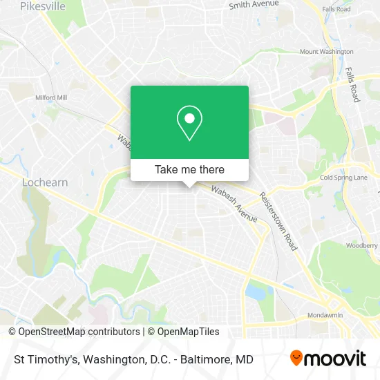
See St Timothy's, Baltimore, on the map
Public Transit to St Timothy's in Baltimore
Wondering how to get to St Timothy's in Baltimore? Moovit helps you find the best way to get to St Timothy's with step-by-step directions from the nearest public transit station.
Moovit provides free maps and live directions to help you navigate through your city. View schedules, routes, timetables, and find out how long does it take to get to St Timothy's in real time.
Looking for the nearest stop or station to St Timothy's? Check out this list of stops closest to your destination: Groveland Ave & Garrison Blvd Mid Wb; Belvedere Ave & Elderon Ave Nb; Garrison Blvd & Groveland Ave Sb; Belvedere Ave & Reisterstown Rd FS Wb; Reisterstown Rd & Belvedere Ave Nb; Rogers Ave Metro; Cold Spring Lane.
Bus: 28, 80, 82, 34, 31, 83.Metro: METRO.
Want to see if there’s another route that gets you there at an earlier time? Moovit helps you find alternative routes or times. Get directions from and directions to St Timothy's easily from the Moovit App or Website.
We make riding to St Timothy's easy, which is why over 1.5 million users, including users in Baltimore, trust Moovit as the best app for public transit. You don’t need to download an individual bus app or train app, Moovit is your all-in-one transit app that helps you find the best bus time or train time available.
For information on prices of bus and metro, costs and ride fares to St Timothy's, please check the Moovit app.
Use the app to navigate to popular places including to the airport, hospital, stadium, grocery store, mall, coffee shop, school, college, and university.
St Timothy's Address: 4003 Groveland Ave street in Baltimore
- Jehovah's Witnesses,
- Penhurst Park,
- Wabash Ave and W Belvedere Ave,
- Da Hood,
- Around the Way Towing,
- Continental Tag & Title,
- Icare Repairs,
- Precisely Yours,
- Papa Rey Carry Out,
- Chiropractic Homeopathic Medicine,
- U-Haul,
- DDK Mobile Auto Detailing,
- First United Church Sonship Recovery House of Hope,
- Forever Kidz,
- The Last Stop!,
- Wabash Ave / Garrison,
- The Official Progressive Free Will Baptist Conference Inc.,
- Devito Roofing Systems,
- Good Guys Auto,
- Ford Auto Repair
Places Near St Timothy's (Baltimore)
- Warner Theatre, Washington,
- The Anthem, Washington,
- Pennsylvania Ave NW (3rd st and pennsylvania), Washington,
- National Theatre, Washington,
- Rock Creek Tennis Center, Washington,
- National Museum of African American History and Culture, Washington,
- Sibley Memorial Hospital, Washington,
- Amazon Hq2, Arlington County,
- Camden Yards, Baltimore,
- M&T Bank Stadium, Baltimore,
- Capital One Arena, Washington,
- Washington National Cathedral, Washington,
- Basilica of the National Shrine, Washington,
- PG Mall, Prince George's County,
- National Zoo, Washington,
- Georgetown, Washington,
- Marriott Marquis Washington, DC, Washington,
- Washington DC VA Medical Center, Washington,
- Westfield Montgomery Mall, Montgomery County,
- Museum Of The Bible, Washington
How to get to popular places in Washington, D.C. - Baltimore, MD with public transit
Get around Baltimore by public transit!
Traveling around Baltimore has never been so easy. See step by step directions as you travel to any attraction, street or major public transit station. View bus and train schedules, arrival times, service alerts and detailed routes on a map, so you know exactly how to get to anywhere in Baltimore.
When traveling to any destination around Baltimore use Moovit's Live Directions with Get Off Notifications to know exactly where and how far to walk, how long to wait for your line, and how many stops are left. Moovit will alert you when it's time to get off — no need to constantly re-check whether yours is the next stop.
Wondering how to use public transit in Baltimore or how to pay for public transit in Baltimore? Moovit public transit app can help you navigate your way with public transit easily, and at minimum cost. It includes public transit fees, ticket prices, and costs. Looking for a map of Baltimore public transit lines? Moovit public transit app shows all public transit maps in Baltimore with all Bus, Train, Metro, Light Rail and Ferry routes and stops on an interactive map.
Washington, D.C. - Baltimore, MD has 5 transit type(s), including: Bus, Train, Metro, Light Rail and Ferry, operated by several transit agencies, including WMATA, Montgomery County Ride On, Fairfax Connector, TheBus, PRTC, DASH - Alexandria, Arlington Transit (ART), RTA of Central Maryland, MDOT MTA, MDOT MTA Light RailLink, MDOT MTA Commuter Bus, MDOT MTA Local Bus, FXBGO!, Virginia Railway Express (VRE) and MARC