How to get to Stack's Bowers Galleries by bus?
Click on the bus route to see step by step directions with maps, line arrival times and updated time schedules.
From CONRAD New York Downtown (CONRAD New York Hotel New York City), Manhattan
59 minFrom Tribeca Rooftop, Manhattan
52 minFrom Elizabeth Street, Manhattan
43 minFrom Division Street, Manhattan
50 minFrom Little Italy, Manhattan
45 minFrom Costco, Queens
46 minFrom Prospect Avenue, Bronx
80 minFrom Washington Heights, Manhattan
63 minFrom Radio Hotel, Manhattan
68 min
How to get to Stack's Bowers Galleries by train?
Click on the train route to see step by step directions with maps, line arrival times and updated time schedules.
How to get to Stack's Bowers Galleries by subway?
Click on the subway route to see step by step directions with maps, line arrival times and updated time schedules.
From CONRAD New York Downtown (CONRAD New York Hotel New York City), Manhattan
32 minFrom Tribeca Rooftop, Manhattan
25 minFrom Elizabeth Street, Manhattan
22 minFrom Division Street, Manhattan
29 minFrom Little Italy, Manhattan
17 minFrom Costco, Queens
33 minFrom Prospect Avenue, Bronx
54 minFrom Washington Heights, Manhattan
29 minFrom Radio Hotel, Manhattan
38 min
Bus stops near Stack's Bowers Galleries in Manhattan
Subway stations near Stack's Bowers Galleries in Manhattan
Bus lines to Stack's Bowers Galleries in Manhattan
- W44, W44/59th St,VIEW
- 57TH ST, 57th St,VIEW
- M31, Yorkville - Clinton,VIEW
- M57, East Side - West Side,VIEW
- SIM1C, Eltingville - Manhattan Express,VIEW
- SIM3, Pt. Richmond - Midtown Manhattan Express,VIEW
- SIM3C, Pt. Richmond - Manhattan Express,VIEW
- SIM10, Eltingville - Midtown Manhattan Express,VIEW
- M5, Limited Washington Heights Gw Bridge,VIEW
- M7, Harlem 147 St Via 6 Av Via Amsterdam,VIEW
- QM15, Lindenwood - Midtown Express,VIEW
- QM16, Neponsit - Midtown Express,VIEW
- QM17, Far Rockaway - Midtown Express,VIEW
- QM18, South Ozone Park - Midtown Express,VIEW
- SIM30, Rosebank Via Forest Av,VIEW
- SIM4C, Huguenot Via Richmond Av Via Arthur Kill,VIEW
- SIM33C, Midtown Via Church Via Madison Av,VIEW
- QM10, Lefrak City,VIEW
- QM12, Midtown 57 St Via 6 Av,VIEW
- QM24, Glendale 73 Pl Via Eliot Av,VIEW
What are the closest stations to Stack's Bowers Galleries?
The closest stations to Stack's Bowers Galleries are:
- W 57th St & 6th Ave (Westbound) is 39 yards away, 1 min walk.
- 59 St-Columbus Circle is 98 yards away, 2 min walk.
- 6 Av/W 57 St is 104 yards away, 2 min walk.
- W 57 St/6 Av is 157 yards away, 2 min walk.
- 6 Av/W 56 St is 192 yards away, 3 min walk.
- 5 Av/59 St is 443 yards away, 6 min walk.
- 57 St is 562 yards away, 7 min walk.
- 57 St-7 Av is 588 yards away, 8 min walk.
- 7 Av is 931 yards away, 12 min walk.
Which bus lines stop near Stack's Bowers Galleries?
These bus lines stop near Stack's Bowers Galleries: 57TH ST, BXM10, M20, M5, QM18, QM24.
Which train lines stop near Stack's Bowers Galleries?
These train lines stop near Stack's Bowers Galleries: 2, HEMPSTEAD BRANCH, YEL.
Which subway lines stop near Stack's Bowers Galleries?
These subway lines stop near Stack's Bowers Galleries: 1, A, M, Q, R.
What’s the nearest subway station to Stack's Bowers Galleries in Manhattan?
The nearest subway station to Stack's Bowers Galleries in Manhattan is 59 St-Columbus Circle. It’s a 2 min walk away.
What’s the nearest bus station to Stack's Bowers Galleries in Manhattan?
The nearest bus station to Stack's Bowers Galleries in Manhattan is W 57th St & 6th Ave (Westbound). It’s a 1 min walk away.
What time is the first subway to Stack's Bowers Galleries in Manhattan?
The F is the first subway that goes to Stack's Bowers Galleries in Manhattan. It stops nearby at 3:00 AM.
What time is the last subway to Stack's Bowers Galleries in Manhattan?
The A is the last subway that goes to Stack's Bowers Galleries in Manhattan. It stops nearby at 4:01 AM.
What time is the first bus to Stack's Bowers Galleries in Manhattan?
The SIM1C is the first bus that goes to Stack's Bowers Galleries in Manhattan. It stops nearby at 3:05 AM.
What time is the last bus to Stack's Bowers Galleries in Manhattan?
The SIM1C is the last bus that goes to Stack's Bowers Galleries in Manhattan. It stops nearby at 3:06 AM.
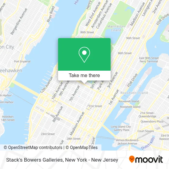
See Stack's Bowers Galleries, Manhattan, on the map
Public Transit to Stack's Bowers Galleries in Manhattan
Wondering how to get to Stack's Bowers Galleries in Manhattan? Moovit helps you find the best way to get to Stack's Bowers Galleries with step-by-step directions from the nearest public transit station.
Moovit provides free maps and live directions to help you navigate through your city. View schedules, routes, timetables, and find out how long does it take to get to Stack's Bowers Galleries in real time.
Looking for the nearest stop or station to Stack's Bowers Galleries? Check out this list of stops closest to your destination: W 57th St & 6th Ave (Westbound); 59 St-Columbus Circle; 6 Av/W 57 St; W 57 St/6 Av; 6 Av/W 56 St; 5 Av/59 St; 57 St; 57 St-7 Av; 7 Av.
Bus: 57TH ST, BXM10, M20, M5, QM18, QM24, W44, M31, M57.Train: 2, HEMPSTEAD BRANCH, YEL.Subway: 1, A, M, Q, R, B, C, D, N, W, F, E.
Want to see if there’s another route that gets you there at an earlier time? Moovit helps you find alternative routes or times. Get directions from and directions to Stack's Bowers Galleries easily from the Moovit App or Website.
We make riding to Stack's Bowers Galleries easy, which is why over 1.5 million users, including users in Manhattan, trust Moovit as the best app for public transit. You don’t need to download an individual bus app or train app, Moovit is your all-in-one transit app that helps you find the best bus time or train time available.
For information on prices of subway, bus and train, costs and ride fares to Stack's Bowers Galleries, please check the Moovit app.
Use the app to navigate to popular places including to the airport, hospital, stadium, grocery store, mall, coffee shop, school, college, and university.
Stack's Bowers Galleries Address: 470 Park Ave street in Manhattan
- Bpaynefree Therapeutic Massage,
- Aquarius,
- Decisive Element Psychotherapy,
- Cheng Tai, Dds,
- Saks Fifth Avenue Corporation Office,
- Offdental,
- Westside Dentist Pc / Dba Smiles For Life Nyc, Inc.,
- Rpg57,
- Alan H. Goldberg & Company,
- La Pause Head and Body Spa,
- Concannon Tax Solutions,
- Listening Art New York- Where Images Speak,
- Dr. Anna Fekete,
- The Audio Department Inc,
- Point To Health Acupuncture,
- Nathan Satler,
- A To Zen Acupuncture,
- New Step Wellness,
- Salchow and Sons,
- Sdk Therapy
Places Near Stack's Bowers Galleries (Manhattan)
- San Gennaro Feast, Manhattan,
- Pier 83, Manhattan,
- Bellevue Hospital, Manhattan,
- Mountainside Hospital, Glen Ridge,
- SoHo, Manhattan,
- 26 Federal Plaza, Manhattan,
- 911 Memorial, Manhattan,
- Times Square, Manhattan,
- Rockefeller Center, Manhattan,
- Queens Center Mall, Queens,
- 376 Hudson Street, Manhattan,
- Chinatown, Manhattan,
- 3 Stone St, Manhattan,
- 66 John Street, Manhattan,
- Hudson Yards, Manhattan,
- Wall Street, Manhattan,
- 111 Centre New York City Supreme Court, Manhattan,
- Katz's Deli, Manhattan,
- qqqq, Manhattan,
- 1 Police Plaza, Manhattan
How to get to popular places in New York - New Jersey with public transit
Get around Manhattan by public transit!
Traveling around Manhattan has never been so easy. See step by step directions as you travel to any attraction, street or major public transit station. View bus and train schedules, arrival times, service alerts and detailed routes on a map, so you know exactly how to get to anywhere in Manhattan.
When traveling to any destination around Manhattan use Moovit's Live Directions with Get Off Notifications to know exactly where and how far to walk, how long to wait for your line, and how many stops are left. Moovit will alert you when it's time to get off — no need to constantly re-check whether yours is the next stop.
Wondering how to use public transit in Manhattan or how to pay for public transit in Manhattan? Moovit public transit app can help you navigate your way with public transit easily, and at minimum cost. It includes public transit fees, ticket prices, and costs. Looking for a map of Manhattan public transit lines? Moovit public transit app shows all public transit maps in Manhattan with all Bus, Train, Subway, Light Rail, Ferry and Cable Car routes and stops on an interactive map.
New York - New Jersey has 6 transit type(s), including: Bus, Train, Subway, Light Rail, Ferry and Cable Car, operated by several transit agencies, including MTA Subway, Metro-North Railroad, LIRR, PATH, MTA New York City Transit - Express routes, MTA Bus, NJ Transit, NYC Ferry, NICE bus, Bee-Line Bus, NJ Transit Rail, Norwalk Transit District, Hartford Line, River Valley Transit and HART