Directions to Stadshal (Gent) with public transportation
The following transit lines have routes that pass near Stadshal
 Bus: 10, 11, 12A, 12B, 55.
- Train: IC.
- Light Rail: T1, T3.
How to get to Stadshal by bus?
Click on the bus route to see step by step directions with maps, line arrival times and updated time schedules.
How to get to Stadshal by train?
Click on the train route to see step by step directions with maps, line arrival times and updated time schedules.
Bus stops near Stadshal in Gent
- Gent Reep, 2 min walk,
- Gent Sint-Jacobs Perron 6, 5 min walk,
- Gent Sint-Jacobs Perron 4, 5 min walk,
- Gent Sint-Jacobs Perron 5, 6 min walk,
- Gent Korenmarkt Perron 3, 8 min walk,
Light Rail stations near Stadshal in Gent
- Gent Gravensteen (Sint-Veerleplein), 6 min walk,
- Gent Gravensteen (Geldmunt), 6 min walk,
Bus lines to Stadshal in Gent
- 55, Zelzate Busstation Perron 2,
- 56, Sleidinge Dorp,
- 562, Eeklo Station Perron 1,
- 563, Boekhoute Dorp,
- 564, Bassevelde Bloksheule,
- 565, Evergem Twaalfroedenstraat,
- 5A, Wondelgem Industrieweg,
- 5B, Gent Meeuwstraat,
- 16, Sint-Baafskouter - Macharius - Zuid,
- 55, Zelzate - Ertvelde - Langerbrugge - Gent Sint-Pieters,
- 56, Eeklo - Kaprijke - Sleidinge - Evergem - Gent Zuid,
- 562, Eeklo-Waarschoot-Sleidinge - Evergem - Gent Sint-Pieters,
- 563, Boekhoute - Assenede - Ertvelde - Evergem - Gent Zuid,
- 564, Bassevelde - Oosteeklo - Ertvelde - Evergem - Gent Zuid,
- 565, Doornzele - Evergem - Gent Zuid,
- 5A, Won. Industrieweg - Van Beverenplein - Zuid - Nieuw Gent,
- 5B, Meulestede - Muide - Tolpoort - Zuid,
- 11, Gent Blaarmeersen (Campinglaan),
- 11, Gentbrugge Stelplaats E17 (Afstaphalte),
- 10, Sint-Amandsberg Snellaertplein,
What are the closest stations to Stadshal?
The closest stations to Stadshal are:
- Gent Reep is 125 meters away, 2 min walk.
- Gent Sint-Jacobs Perron 6 is 364 meters away, 5 min walk.
- Gent Sint-Jacobs Perron 4 is 379 meters away, 5 min walk.
- Gent Sint-Jacobs Perron 5 is 435 meters away, 6 min walk.
- Gent Gravensteen (Sint-Veerleplein) is 446 meters away, 6 min walk.
- Gent Gravensteen (Geldmunt) is 456 meters away, 6 min walk.
- Gent Korenmarkt Perron 3 is 558 meters away, 8 min walk.
Which bus lines stop near Stadshal?
These bus lines stop near Stadshal: 10, 11, 12A, 12B, 55.
Which train line stops near Stadshal?
IC (Anvers-Central→La Panne)
Which light rail lines stop near Stadshal?
These light rail lines stop near Stadshal: T1, T3.
What’s the nearest light rail station to Stadshal in Gent?
The nearest light rail stations to Stadshal in Gent are Gent Gravensteen (Sint-Veerleplein) and Gent Gravensteen (Geldmunt). The closest one is a 6 min walk away.
What’s the nearest bus station to Stadshal in Gent?
The nearest bus station to Stadshal in Gent is Gent Reep. It’s a 2 min walk away.
What time is the first light rail to Stadshal in Gent?
The T4 is the first light rail that goes to Stadshal in Gent. It stops nearby at 5:08 AM.
What time is the last light rail to Stadshal in Gent?
The T2 is the last light rail that goes to Stadshal in Gent. It stops nearby at 1:34 AM.
What time is the first bus to Stadshal in Gent?
The 56 is the first bus that goes to Stadshal in Gent. It stops nearby at 4:50 AM.
What time is the last bus to Stadshal in Gent?
The 10 is the last bus that goes to Stadshal in Gent. It stops nearby at 1:17 AM.
See Stadshal, Gent, on the map
Public Transit to Stadshal in Gent
Wondering how to get to Stadshal in Gent? Moovit helps you find the best way to get to Stadshal with step-by-step directions from the nearest public transit station.
Moovit provides free maps and live directions to help you navigate through your city. View schedules, routes, timetables, and find out how long does it take to get to Stadshal in real time.
Looking for the nearest stop or station to Stadshal? Check out this list of stops closest to your destination: Gent Reep; Gent Sint-Jacobs Perron 6; Gent Sint-Jacobs Perron 4; Gent Sint-Jacobs Perron 5; Gent Gravensteen (Sint-Veerleplein); Gent Gravensteen (Geldmunt); Gent Korenmarkt Perron 3.
Bus: 10, 11, 12A, 12B, 55, 56, 562, 563, 564, 16, 56, 562, 563.Train: IC.Light Rail: T1, T3.
Want to see if there’s another route that gets you there at an earlier time? Moovit helps you find alternative routes or times. Get directions from and directions to Stadshal easily from the Moovit App or Website.
We make riding to Stadshal easy, which is why over 1.5 million users, including users in Gent, trust Moovit as the best app for public transit. You don’t need to download an individual bus app or train app, Moovit is your all-in-one transit app that helps you find the best bus time or train time available.
For information on prices of bus, train and light rail, costs and ride fares to Stadshal, please check the Moovit app.
Use the app to navigate to popular places including to the airport, hospital, stadium, grocery store, mall, coffee shop, school, college, and university.
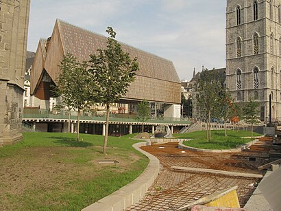
Stadshal Address: Goudenleeuwplein street in Gent
- Amadeus,
- Mammelokker,
- Stadhuis Gent,
- Novotel Gent Centrum Ghent,
- Novotel Gent Centrum,
- Champagnekelder,
- Novotel Parking,
- Hotel NH Gent Belfort,
- Ero Swing,
- Cora Kemperman,
- Festival,
- NH Gent Belfort Ghent,
- Nh Gent Belfort,
- Proximus,
- Hd 400,
- Sint Baafshuis,
- Ibis St. Baafs Kathedraal,
- Peek & Cloppenburg ( P&c),
- Restaurant Carvery,
- Alexander Snoeck
Places Near Stadshal (Gent)
- Heysel - Heizel, Brussel,
- Lotto Arena, Antwerpen,
- Schipperskwartier / Red Light District , Antwerpen,
- KMSKA, Antwerpen,
- Hendrik Conscienceplein, Antwerpen,
- Villa Empain, Brussel,
- Hôpital Erasme, Brussel,
- Flanders Expo, Gent,
- Middenvijver, Antwerpen,
- Docks Bruxsel, Brussel,
- Korenmarkt, Gent,
- avenue Louise, Brussel,
- Atomium, Brussel,
- Tour Et Taxi, Brussel,
- Zna Middelheim, Antwerpen,
- Grand-Place, Brussel,
- Sportpaleis Antwerpen, Antwerpen,
- Kiss en Ride Centraal Station, Antwerpen,
- Brussels Expo, Brussel,
- Sportpaleis, Antwerpen
How to get to popular places in Belgium with public transit
Get around Gent by public transit!
Traveling around Gent has never been so easy. See step by step directions as you travel to any attraction, street or major public transit station. View bus and train schedules, arrival times, service alerts and detailed routes on a map, so you know exactly how to get to anywhere in Gent.
When traveling to any destination around Gent use Moovit's Live Directions with Get Off Notifications to know exactly where and how far to walk, how long to wait for your line, and how many stops are left. Moovit will alert you when it's time to get off — no need to constantly re-check whether yours is the next stop.
Wondering how to use public transit in Gent or how to pay for public transit in Gent? Moovit public transit app can help you navigate your way with public transit easily, and at minimum cost. It includes public transit fees, ticket prices, and costs. Looking for a map of Gent public transit lines? Moovit public transit app shows all public transit maps in Gent with all Bus, Train, Subway, Light Rail and Ferry routes and stops on an interactive map.
Belgium has 5 transit type(s), including: Bus, Train, Subway, Light Rail and Ferry, operated by several transit agencies, including STIB, Brussels City Shuttle, NMBS/SNCB, De Lijn, TEC Liège - Verviers, TEC Charleroi, TEC Namur - Luxembourg, TEC Brabant Wallon, TEC Hainaut and DeWaterbus