How to get to Stained Glass Chapel by bus?
Click on the bus route to see step by step directions with maps, line arrival times and updated time schedules.
From Threat Museum petting zoo, Nellis Afb
64 minFrom The Westin Las Vegas Hotel, Casino & Spa, Paradise
64 minFrom MB Delano Dellas Kitchen Hot Line, Paradise
64 minFrom Best in the West Shopping Center, Las Vegas
64 minFrom Del Sol Academy of the Performing Arts, Paradise
53 minFrom Lo-Lo's Chicken and Waffles, Las Vegas
62 minFrom Las Vegas Hair Clinic, Las Vegas
52 minFrom Yardbird Southern Table & Bar, Paradise
43 minFrom Ulta Beauty, Las Vegas
62 minFrom The Palazzo at The Venetian® Las Vegas, Paradise
43 min
Bus stops near Stained Glass Chapel in Las Vegas
Monorail station near Stained Glass Chapel in Las Vegas
- Sls Station, 28 min walk,VIEW
Bus lines to Stained Glass Chapel in Las Vegas
What are the closest stations to Stained Glass Chapel?
The closest stations to Stained Glass Chapel are:
- Wb Stewart After 6th is 161 yards away, 2 min walk.
- Nb Las Vegas After Stewart is 191 yards away, 3 min walk.
- Wb Carson After 9th is 269 yards away, 4 min walk.
- Sb Lv Blvd at Fremont St Experience is 375 yards away, 5 min walk.
- Sb Maryland Before Carson is 469 yards away, 6 min walk.
- Fremont East is 486 yards away, 6 min walk.
- Sls Station is 2314 yards away, 28 min walk.
Which bus lines stop near Stained Glass Chapel?
These bus lines stop near Stained Glass Chapel: 207, 208, BHX, DEUCE.
What’s the nearest bus station to Stained Glass Chapel in Las Vegas?
The nearest bus station to Stained Glass Chapel in Las Vegas is Wb Stewart After 6th. It’s a 2 min walk away.
What’s the nearest Monorail station to Stained Glass Chapel in Las Vegas?
The nearest Monorail station to Stained Glass Chapel in Las Vegas is Sls Station. It’s a 28 min walk away.
What time is the first bus to Stained Glass Chapel in Las Vegas?
The DEUCE is the first bus that goes to Stained Glass Chapel in Las Vegas. It stops nearby at 3:04 AM.
What time is the last bus to Stained Glass Chapel in Las Vegas?
The BHX is the last bus that goes to Stained Glass Chapel in Las Vegas. It stops nearby at 3:54 AM.
What time is the first Monorail to Stained Glass Chapel in Las Vegas?
The LVM is the first Monorail that goes to Stained Glass Chapel in Las Vegas. It stops nearby at 7:00 AM.
What time is the last Monorail to Stained Glass Chapel in Las Vegas?
The LVM is the last Monorail that goes to Stained Glass Chapel in Las Vegas. It stops nearby at 12:02 AM.
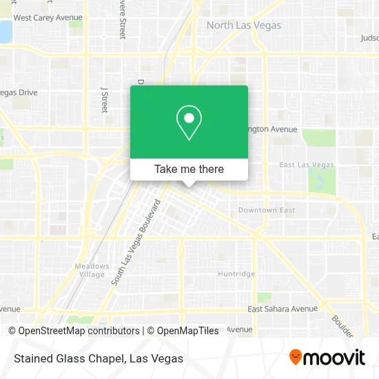
See Stained Glass Chapel, Las Vegas, on the map
Public Transit to Stained Glass Chapel in Las Vegas
Wondering how to get to Stained Glass Chapel in Las Vegas? Moovit helps you find the best way to get to Stained Glass Chapel with step-by-step directions from the nearest public transit station.
Moovit provides free maps and live directions to help you navigate through your city. View schedules, routes, timetables, and find out how long does it take to get to Stained Glass Chapel in real time.
Looking for the nearest stop or station to Stained Glass Chapel? Check out this list of stops closest to your destination: Wb Stewart After 6th; Nb Las Vegas After Stewart; Wb Carson After 9th; Sb Lv Blvd at Fremont St Experience; Sb Maryland Before Carson; Fremont East; Sls Station.
Bus: 207, 208, BHX, DEUCE, 113.Monorail: LVM.
Want to see if there’s another route that gets you there at an earlier time? Moovit helps you find alternative routes or times. Get directions from and directions to Stained Glass Chapel easily from the Moovit App or Website.
We make riding to Stained Glass Chapel easy, which is why over 1.7 million users, including users in Las Vegas, trust Moovit as the best app for public transit. You don’t need to download an individual bus app or train app, Moovit is your all-in-one transit app that helps you find the best bus time or train time available.
For information on prices of bus, costs and ride fares to Stained Glass Chapel, please check the Moovit app.
Use the app to navigate to popular places including to the airport, hospital, stadium, grocery store, mall, coffee shop, school, college, and university.
Stained Glass Chapel Address: 901 E Ogden Ave street in Las Vegas
- Alamo,
- Hotel & Casino LOTUS,
- Atomic,
- Bonnie & Clyde Death Car,
- Southern Nevada Regional Housing Authority,
- Southern Nevada Regional Housing Authority (Section 8 Housing Authority),
- El Cortez Casino,
- Downtown Container Park (The Container Park),
- Las Vegas Chocolate Bar,
- Downtown Container Park,
- El Cortez Hotel Casino Las Vegas,
- Stewart Avenue & North Maryland Parkway,
- El Cortez Hotel & Casino,
- EDC Downtown Shuttle Station,
- The Laundry Room,
- corner of 4th & Fremont Street,
- Aubrey Oiler,
- Downtown,
- The Deuce Bus Stop at Fremont St,
- Stewart Ave / Las Vegas Blvd N
Places Near Stained Glass Chapel (Las Vegas)
- The Neon Museum, Las Vegas,
- Zak Bagans Haunted Museum, Las Vegas,
- Town Square, Enterprise,
- Welcome To Fabulous Las Vegas Sign, Paradise,
- Walmart Supercenter, Las Vegas,
- Walmart, Las Vegas,
- Gold & Silver Pawn Shop, Las Vegas,
- Trump International Hotel Las Vegas, Paradise,
- Las Vegas South Premium Outlets, Enterprise,
- Allegiant Stadium, Paradise,
- Meow Wolf - Las Vegas (Meow Wolf's Omega Mart), Las Vegas,
- Lee Canyon, Las Vegas,
- Arte Museum Las Vegas, Paradise,
- Area15, Las Vegas,
- Las Vegas North Premium Outlets, Las Vegas,
- The Palms Casino Resort, Paradise,
- Koolsville Tattoos, Las Vegas,
- Las Vegas Premium Outlets-North, Enterprise,
- Omega Mart, Las Vegas,
- The Deuce Bus Stop at Fremont St, Las Vegas
How to get to popular places in Las Vegas with public transit
Get around Las Vegas by public transit!
Traveling around Las Vegas has never been so easy. See step by step directions as you travel to any attraction, street or major public transit station. View bus and train schedules, arrival times, service alerts and detailed routes on a map, so you know exactly how to get to anywhere in Las Vegas.
When traveling to any destination around Las Vegas use Moovit's Live Directions with Get Off Notifications to know exactly where and how far to walk, how long to wait for your line, and how many stops are left. Moovit will alert you when it's time to get off — no need to constantly re-check whether yours is the next stop.
Wondering how to use public transit in Las Vegas or how to pay for public transit in Las Vegas? Moovit public transit app can help you navigate your way with public transit easily, and at minimum cost. It includes public transit fees, ticket prices, and costs. Looking for a map of Las Vegas public transit lines? Moovit public transit app shows all public transit maps in Las Vegas with all Bus and Monorail routes and stops on an interactive map.
Las Vegas has 2 transit type(s), including: Bus and Monorail, operated by several transit agencies, including RTCSNV, City of Las Vegas, Alvand Transportation, Vegas Airporter, Las Vegas Monorail, FlixBus-us and Greyhound-us