How to get to Staley Park Playground by bus?
Click on the bus route to see step by step directions with maps, line arrival times and updated time schedules.
From Walmart Supercenter, Montgomery County
184 minFrom Kentlands, Montgomery County
135 minFrom Montgomery Village, Maryland, Montgomery County
142 minFrom Leesburg Corner Premium Outlet, Loudoun County
137 minFrom Clarksburg Premium Outlets, Montgomery County
313 minFrom Clarksburg Premium Outlets, Montgomery County
356 minFrom Kaiser Permanente - Gaithersburg Medical Center, Montgomery County
162 minFrom Montgomery County Fairgrounds, Montgomery County
160 minFrom Astrazeneca HQ, Montgomery County
138 min
How to get to Staley Park Playground by train?
Click on the train route to see step by step directions with maps, line arrival times and updated time schedules.
Bus stops near Staley Park Playground in Frederick
Train station near Staley Park Playground in Frederick
- Frederick Marc Eb, 52 min walk,VIEW
Bus lines to Staley Park Playground in Frederick
What are the closest stations to Staley Park Playground?
The closest stations to Staley Park Playground are:
- East Street at Delaware Road (Monocacy Village Shopping Center) is 142 yards away, 3 min walk.
- 9th Street at Toll House Avenue is 143 yards away, 2 min walk.
- East Street Across From Delaware Road is 168 yards away, 3 min walk.
- Motter Avenue at West 9th Street is 187 yards away, 3 min walk.
- West 7th Street at Motter Avenue/Bentz Street is 585 yards away, 7 min walk.
- Frederick Marc Eb is 4404 yards away, 52 min walk.
Which bus lines stop near Staley Park Playground?
These bus lines stop near Staley Park Playground: 20, 581.
Which train line stops near Staley Park Playground?
MARC (Inbound - Brunswick)
What’s the nearest bus station to Staley Park Playground in Frederick?
The nearest bus stations to Staley Park Playground in Frederick are East Street at Delaware Road (Monocacy Village Shopping Center), East Street Across From Delaware Road and Motter Avenue at West 9th Street. The closest one is a 3 min walk away.
What time is the first train to Staley Park Playground in Frederick?
The MARC is the first train that goes to Staley Park Playground in Frederick. It stops nearby at 5:00 AM.
What time is the last train to Staley Park Playground in Frederick?
The MARC is the last train that goes to Staley Park Playground in Frederick. It stops nearby at 8:21 PM.
What time is the first bus to Staley Park Playground in Frederick?
The WALKERSVILLE MEET-THE-MARC SHUTTLE is the first bus that goes to Staley Park Playground in Frederick. It stops nearby at 5:50 AM.
What time is the last bus to Staley Park Playground in Frederick?
The 65 is the last bus that goes to Staley Park Playground in Frederick. It stops nearby at 10:05 PM.
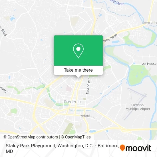
See Staley Park Playground, Frederick, on the map
Public Transit to Staley Park Playground in Frederick
Wondering how to get to Staley Park Playground in Frederick? Moovit helps you find the best way to get to Staley Park Playground with step-by-step directions from the nearest public transit station.
Moovit provides free maps and live directions to help you navigate through your city. View schedules, routes, timetables, and find out how long does it take to get to Staley Park Playground in real time.
Looking for the nearest stop or station to Staley Park Playground? Check out this list of stops closest to your destination: East Street at Delaware Road (Monocacy Village Shopping Center); 9th Street at Toll House Avenue; East Street Across From Delaware Road; Motter Avenue at West 9th Street; West 7th Street at Motter Avenue/Bentz Street; Frederick Marc Eb.
Bus: 20, 581, 60, NORTH FREDERICK SHUTTLE, 65, EMMITSBURG THURMONT SHUTTLE, WALKERSVILLE MEET-THE-MARC SHUTTLE, 61, 51.Train: MARC.
Want to see if there’s another route that gets you there at an earlier time? Moovit helps you find alternative routes or times. Get directions from and directions to Staley Park Playground easily from the Moovit App or Website.
We make riding to Staley Park Playground easy, which is why over 1.7 million users, including users in Frederick, trust Moovit as the best app for public transit. You don’t need to download an individual bus app or train app, Moovit is your all-in-one transit app that helps you find the best bus time or train time available.
For information on prices of bus and train, costs and ride fares to Staley Park Playground, please check the Moovit app.
Get to Staley Park Playground with public transit and pay for the ride in the Moovit app. In addition to all info you may need for your trip to Staley Park Playground, including live directions, real-time arrivals and fare prices, you can also buy public transit passes for your rides. No need for cash or paper tickets to get to Staley Park Playground - everything you need is accessible in the app with a click of the button.
Use the app to navigate to popular places including to the airport, hospital, stadium, grocery store, mall, coffee shop, school, college, and university.
Staley Park Playground Address: 1005 Motter Ave street in Frederick
- Downtown Y,
- Meritus Health,
- Bargain Bin,
- YMCA,
- Gov Thomas Johnson High School ,
- Blink Charging,
- Four Branches Therapy & Wellness-Katie Marsh Lyburn, LCSW-C,
- 7-Eleven,
- ChargePoint,
- Frederick Memorial Hospital,
- Department of Social Services,
- Hood College,
- Thomas Johnson Dr Suite,
- Weinberg Center for the Arts,
- Fort Detrick,
- Blink Charging,
- The Maryland Motor Vehicle Administration,
- Carroll Creek Park (Carrol Creek Linear Park),
- Irish Meadows,
- Blink Charging
Places Near Staley Park Playground (Frederick)
- PG Mall, Prince George's County,
- Westfield Montgomery Mall, Montgomery County,
- Amazon Hq2, Arlington County,
- Basilica of the National Shrine, Washington,
- Camden Yards, Baltimore,
- National Zoo, Washington,
- Sibley Memorial Hospital, Washington,
- Pennsylvania Ave NW (3rd st and pennsylvania), Washington,
- M&T Bank Stadium, Baltimore,
- Capital One Arena, Washington,
- Washington DC VA Medical Center, Washington,
- Rock Creek Tennis Center, Washington,
- National Theatre, Washington,
- Georgetown, Washington,
- National Museum of African American History and Culture, Washington,
- The Anthem, Washington,
- Marriott Marquis Washington, DC, Washington,
- Museum Of The Bible, Washington,
- Warner Theatre, Washington,
- Washington National Cathedral, Washington
How to get to popular places in Washington, D.C. - Baltimore, MD with public transit
Get around Frederick by public transit!
Traveling around Frederick has never been so easy. See step by step directions as you travel to any attraction, street or major public transit station. View bus and train schedules, arrival times, service alerts and detailed routes on a map, so you know exactly how to get to anywhere in Frederick.
When traveling to any destination around Frederick use Moovit's Live Directions with Get Off Notifications to know exactly where and how far to walk, how long to wait for your line, and how many stops are left. Moovit will alert you when it's time to get off — no need to constantly re-check whether yours is the next stop.
Wondering how to use public transit in Frederick or how to pay for public transit in Frederick? Moovit public transit app can help you navigate your way with public transit easily, and at minimum cost. It includes public transit fees, ticket prices, and costs. Looking for a map of Frederick public transit lines? Moovit public transit app shows all public transit maps in Frederick with all Bus, Train, Metro, Light Rail and Ferry routes and stops on an interactive map.
Washington, D.C. - Baltimore, MD has 5 transit type(s), including: Bus, Train, Metro, Light Rail and Ferry, operated by several transit agencies, including WMATA, Montgomery County Ride On, Fairfax Connector, TheBus, PRTC, DASH - Alexandria, Arlington Transit (ART), RTA of Central Maryland, MDOT MTA, MDOT MTA Light RailLink, MDOT MTA Commuter Bus, MDOT MTA Local Bus, FXBGO!, Virginia Railway Express (VRE) and MARC