How to get to Stallwarth Community Support Services by bus?
Click on the bus route to see step by step directions with maps, line arrival times and updated time schedules.
From Baptist homestead hospital, Homestead
59 minFrom Baptist Health South Florida Homestead Hospital, Homestead
70 minFrom Falls (Mall), Kendall-Palmetto Bay
40 minFrom Coral Reef Senior High School, Kendall-Palmetto Bay
47 minFrom Miami Palmetto Senior High School, Kendall-Palmetto Bay
63 minFrom SW 144th Street & US1, Kendall-Palmetto Bay
38 minFrom Miami Killian Senior High School, Kendall-Palmetto Bay
89 minFrom Palmetto High School, Kendall-Palmetto Bay
66 minFrom South Dade Senior High School, Homestead
63 minFrom Martinez Distributors, Kendale Lakes-Tamiami
70 min
Bus stops near Stallwarth Community Support Services in Princeton-Goulds
Bus lines to Stallwarth Community Support Services in Princeton-Goulds
- 35, 35 - Cutler Bay SW 112 Av/211 St,VIEW
- 52, 52 - Caribbean Blvd Station SW 200 St & Transitway,VIEW
- 70, 70 - FL City SW 344 St Park & Ride,VIEW
- 287, 287 Max - Richmond Dr Station SW 168 St & Transitway,VIEW
- 97, 97 - Quail Roost Dr/114 Av,VIEW
- 107, 107 - Dolphin Mall Terminal,VIEW
- 137, 137 - Dolphin Mall Terminal,VIEW
- 500, 500 - Cutler Bay Circulator,VIEW
What are the closest stations to Stallwarth Community Support Services?
The closest stations to Stallwarth Community Support Services are:
- Sw 216 St @ # 10711 is 109 yards away, 2 min walk.
- S Dade Health Ctr @ 10300 Sw 216 St is 1027 yards away, 13 min walk.
- Sw 211 St @ Sw 107 Av is 1059 yards away, 13 min walk.
- Sw 211 St @ Op S Dade Govt Ctr is 1177 yards away, 15 min walk.
Which bus line stops near Stallwarth Community Support Services?
35 (35 - Cutler Bay SW 112 Av/211 St)
What’s the nearest bus station to Stallwarth Community Support Services in Princeton-Goulds?
The nearest bus station to Stallwarth Community Support Services in Princeton-Goulds is Sw 216 St @ # 10711. It’s a 2 min walk away.
What time is the first bus to Stallwarth Community Support Services in Princeton-Goulds?
The 52 is the first bus that goes to Stallwarth Community Support Services in Princeton-Goulds. It stops nearby at 4:25 AM.
What time is the last bus to Stallwarth Community Support Services in Princeton-Goulds?
The 107 is the last bus that goes to Stallwarth Community Support Services in Princeton-Goulds. It stops nearby at 1:17 AM.
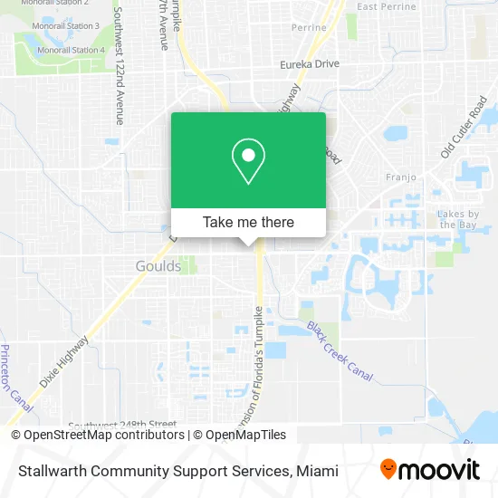
See Stallwarth Community Support Services, Princeton-Goulds, on the map
Public Transit to Stallwarth Community Support Services in Princeton-Goulds
Wondering how to get to Stallwarth Community Support Services in Princeton-Goulds? Moovit helps you find the best way to get to Stallwarth Community Support Services with step-by-step directions from the nearest public transit station.
Moovit provides free maps and live directions to help you navigate through your city. View schedules, routes, timetables, and find out how long does it take to get to Stallwarth Community Support Services in real time.
Looking for the nearest stop or station to Stallwarth Community Support Services? Check out this list of stops closest to your destination: Sw 216 St @ # 10711; S Dade Health Ctr @ 10300 Sw 216 St; Sw 211 St @ Sw 107 Av; Sw 211 St @ Op S Dade Govt Ctr.
Bus: 35, 52, 70, 287, 97, 107, 137, 500.
Want to see if there’s another route that gets you there at an earlier time? Moovit helps you find alternative routes or times. Get directions from and directions to Stallwarth Community Support Services easily from the Moovit App or Website.
We make riding to Stallwarth Community Support Services easy, which is why over 1.5 million users, including users in Princeton-Goulds, trust Moovit as the best app for public transit. You don’t need to download an individual bus app or train app, Moovit is your all-in-one transit app that helps you find the best bus time or train time available.
For information on prices of bus, costs and ride fares to Stallwarth Community Support Services, please check the Moovit app.
Use the app to navigate to popular places including to the airport, hospital, stadium, grocery store, mall, coffee shop, school, college, and university.
Stallwarth Community Support Services Address: 10711 SW 216th St Miami, FL 33170 street in Princeton-Goulds
- Union Locksmith,
- Manantial de Vida,
- Happy Sunflowers Childcare,
- House of God Pntcstl CH of the Living,
- Miami-Dade County Police Department,
- Pitts Tasty Food Spot,
- McIntyre & Sons,
- Cutler Riverside in Miami, Fl,
- South Dade Regional Library - Miami-Dade Public Library System,
- Cutler Ridge skate park,
- Covid-19 Testing Site: South Dade Government Center,
- South Dade Justice Center (Miami Dade County South Dade Government Center),
- Homestead Florida Turnpike South,
- Southern Baptist Convention,
- 10710 Southwest 211 Street,
- Water's Edge Apartments,
- Firehouse 34,
- Miami-Dade Water And Sewer,
- Fredy Fonseca - Intuit Turbotax Verified Pro,
- Braids by Kelly
Places Near Stallwarth Community Support Services (Princeton-Goulds)
- Aventura Mall, Miami,
- Richard E. Gerstein Justice Building, Miami,
- Marlins Park, Miami,
- Zoo Miami, Miami,
- Bayside Marketplace, Miami,
- Miami Design District, Miami,
- Hard Rock Stadium, Miami Gardens,
- Dolphin Mall Bus, Miami,
- Miami-Dade County Courthouse, Miami,
- Miami Freedom Park, Miami,
- Miami VA Hospital, Miami,
- Sawgrass Mall, Miami,
- Wynwood, Miami,
- Dolphin Mall, Miami,
- Keiser University Flagship Campus, West Palm Beach,
- Brickell City Centre, Miami,
- Sawgrass mall ( FL ), Miami Beach,
- Port of Miami Cruise Terminal, Miami,
- Little Havana, Miami,
- Aventura Mall, Miami Beach
How to get to popular places in Miami with public transit
Get around Princeton-Goulds by public transit!
Traveling around Princeton-Goulds has never been so easy. See step by step directions as you travel to any attraction, street or major public transit station. View bus and train schedules, arrival times, service alerts and detailed routes on a map, so you know exactly how to get to anywhere in Princeton-Goulds.
When traveling to any destination around Princeton-Goulds use Moovit's Live Directions with Get Off Notifications to know exactly where and how far to walk, how long to wait for your line, and how many stops are left. Moovit will alert you when it's time to get off — no need to constantly re-check whether yours is the next stop.
Wondering how to use public transit in Princeton-Goulds or how to pay for public transit in Princeton-Goulds? Moovit public transit app can help you navigate your way with public transit easily, and at minimum cost. It includes public transit fees, ticket prices, and costs. Looking for a map of Princeton-Goulds public transit lines? Moovit public transit app shows all public transit maps in Princeton-Goulds with all Bus, Train, Light Rail and Ferry routes and stops on an interactive map.
Miami has 4 transit type(s), including: Bus, Train, Light Rail and Ferry, operated by several transit agencies, including Broward County Transit, Miami-Dade Transit, Metrorail, Palm Tran, Tri-Rail, Brightline, MARTY, City of Homestead Trolley, Key West Transit, Treasure Coast Connector, GoLine IRT, Amtrak, Greyhound-us, FlixBus-us and Aventura Express Shuttle Bus