How to get to Standard Express by bus?
Click on the bus route to see step by step directions with maps, line arrival times and updated time schedules.
From Aaaaa Aaaa, Bronx
103 minFrom Foley Square, Manhattan
81 minFrom 10th Avenue, Manhattan
77 minFrom QwQw, Manhattan
74 minFrom Flushing Chinatown, Queens
34 minFrom 1 Police Plaza Path, Manhattan
78 minFrom 34th Street–Herald Square, Manhattan
61 minFrom 1 Police Plaza, Manhattan
80 minFrom 1 Police Plaza (Nypd Headquarters), Manhattan
78 minFrom East 90th Street Ferry Terminal, Manhattan
69 min
How to get to Standard Express by train?
Click on the train route to see step by step directions with maps, line arrival times and updated time schedules.
From Foley Square, Manhattan
81 minFrom 10th Avenue, Manhattan
44 minFrom QwQw, Manhattan
53 minFrom Flushing Chinatown, Queens
30 minFrom 1 Police Plaza Path, Manhattan
82 minFrom 34th Street–Herald Square, Manhattan
34 minFrom 1 Police Plaza, Manhattan
81 minFrom 1 Police Plaza (Nypd Headquarters), Manhattan
81 min
How to get to Standard Express by subway?
Click on the subway route to see step by step directions with maps, line arrival times and updated time schedules.
From Aaaaa Aaaa, Bronx
55 minFrom Foley Square, Manhattan
40 minFrom 10th Avenue, Manhattan
34 minFrom QwQw, Manhattan
41 minFrom Flushing Chinatown, Queens
16 minFrom 1 Police Plaza Path, Manhattan
43 minFrom 34th Street–Herald Square, Manhattan
22 minFrom 1 Police Plaza, Manhattan
43 minFrom 1 Police Plaza (Nypd Headquarters), Manhattan
43 minFrom East 90th Street Ferry Terminal, Manhattan
51 min
Subway station near Standard Express in Queens
- 74 St-Broadway, 3 min walk,VIEW
Bus stops near Standard Express in Queens
Bus lines to Standard Express in Queens
What are the closest stations to Standard Express?
The closest stations to Standard Express are:
- 74 St-Broadway is 182 yards away, 3 min walk.
- 74 St/37 Av is 197 yards away, 3 min walk.
- Roosevelt Av/74 St is 269 yards away, 4 min walk.
- 74 St/Roosevelt Av Station is 335 yards away, 5 min walk.
- Broadway/75 St is 388 yards away, 5 min walk.
Which bus lines stop near Standard Express?
These bus lines stop near Standard Express: Q32, Q63.
Which train lines stop near Standard Express?
These train lines stop near Standard Express: PORT WASHINGTON BRANCH, RONKONKOMA BRANCH.
Which subway lines stop near Standard Express?
These subway lines stop near Standard Express: 7X, E, F, M, R.
What’s the nearest subway station to Standard Express in Queens?
The nearest subway station to Standard Express in Queens is 74 St-Broadway. It’s a 3 min walk away.
What’s the nearest bus station to Standard Express in Queens?
The nearest bus station to Standard Express in Queens is 74 St/37 Av. It’s a 3 min walk away.
What time is the first subway to Standard Express in Queens?
The E is the first subway that goes to Standard Express in Queens. It stops nearby at 3:01 AM.
What time is the last subway to Standard Express in Queens?
The F is the last subway that goes to Standard Express in Queens. It stops nearby at 3:53 AM.
What time is the first bus to Standard Express in Queens?
The Q33 is the first bus that goes to Standard Express in Queens. It stops nearby at 3:00 AM.
What time is the last bus to Standard Express in Queens?
The Q70-SBS is the last bus that goes to Standard Express in Queens. It stops nearby at 3:08 AM.
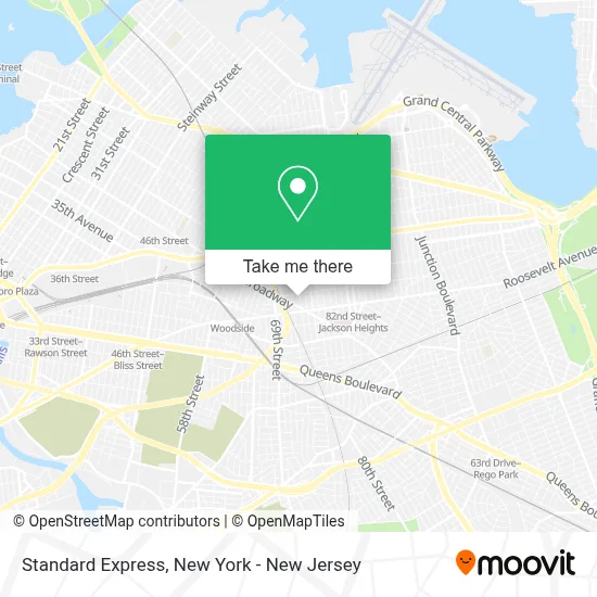
See Standard Express, Queens, on the map
Public Transit to Standard Express in Queens
Wondering how to get to Standard Express in Queens? Moovit helps you find the best way to get to Standard Express with step-by-step directions from the nearest public transit station.
Moovit provides free maps and live directions to help you navigate through your city. View schedules, routes, timetables, and find out how long does it take to get to Standard Express in real time.
Looking for the nearest stop or station to Standard Express? Check out this list of stops closest to your destination: 74 St-Broadway; 74 St/37 Av; Roosevelt Av/74 St; 74 St/Roosevelt Av Station; Broadway/75 St.
Bus: Q32, Q63, Q47, Q49, Q70-SBS, Q33, Q53-SBS.Train: PORT WASHINGTON BRANCH, RONKONKOMA BRANCH.Subway: 7X, E, F, M, R, FX.
Want to see if there’s another route that gets you there at an earlier time? Moovit helps you find alternative routes or times. Get directions from and directions to Standard Express easily from the Moovit App or Website.
We make riding to Standard Express easy, which is why over 1.5 million users, including users in Queens, trust Moovit as the best app for public transit. You don’t need to download an individual bus app or train app, Moovit is your all-in-one transit app that helps you find the best bus time or train time available.
For information on prices of subway, bus and train, costs and ride fares to Standard Express, please check the Moovit app.
Use the app to navigate to popular places including to the airport, hospital, stadium, grocery store, mall, coffee shop, school, college, and university.
Standard Express Address: 37-22 73rd St street in Queens
- Kaiser Preservation,
- Usbd Group,
- Oxford Learning Center,
- Premier Tax and Accounting,
- Bd Mela,
- United Travels Inc,
- Cruise Travel Agency,
- Eastland Travel and Tours,
- Bd Tax and Accounting Llc,
- Kaiser Construction,
- Kaiser Tech Inc.,
- Fauma Innovative Inc,
- Alma Tour,
- Trendy Sharee Usa,
- Neel Dorea,
- NY Home Care Service Inc,
- Khaamar Baari Discount Store,
- Darul Hidayah,
- Impressive Day Care,
- Ultra Credit Solutions
Places Near Standard Express (Queens)
- 1 Police Plaza, Manhattan,
- 66 John Street, Manhattan,
- qqqq, Manhattan,
- Queens Center Mall, Queens,
- Katz's Deli, Manhattan,
- 911 Memorial, Manhattan,
- 111 Centre New York City Supreme Court, Manhattan,
- SoHo, Manhattan,
- Bellevue Hospital, Manhattan,
- Times Square, Manhattan,
- 26 Federal Plaza, Manhattan,
- 3 Stone St, Manhattan,
- Chinatown, Manhattan,
- Mountainside Hospital, Glen Ridge,
- Pier 83, Manhattan,
- 376 Hudson Street, Manhattan,
- Rockefeller Center, Manhattan,
- Wall Street, Manhattan,
- San Gennaro Feast, Manhattan,
- Hudson Yards, Manhattan
How to get to popular places in New York - New Jersey with public transit
Get around Queens by public transit!
Traveling around Queens has never been so easy. See step by step directions as you travel to any attraction, street or major public transit station. View bus and train schedules, arrival times, service alerts and detailed routes on a map, so you know exactly how to get to anywhere in Queens.
When traveling to any destination around Queens use Moovit's Live Directions with Get Off Notifications to know exactly where and how far to walk, how long to wait for your line, and how many stops are left. Moovit will alert you when it's time to get off — no need to constantly re-check whether yours is the next stop.
Wondering how to use public transit in Queens or how to pay for public transit in Queens? Moovit public transit app can help you navigate your way with public transit easily, and at minimum cost. It includes public transit fees, ticket prices, and costs. Looking for a map of Queens public transit lines? Moovit public transit app shows all public transit maps in Queens with all Bus, Train, Subway, Light Rail, Ferry and Cable Car routes and stops on an interactive map.
New York - New Jersey has 6 transit type(s), including: Bus, Train, Subway, Light Rail, Ferry and Cable Car, operated by several transit agencies, including MTA Subway, Metro-North Railroad, LIRR, PATH, MTA New York City Transit - Express routes, MTA Bus, NJ Transit, NYC Ferry, NICE bus, Bee-Line Bus, NJ Transit Rail, Norwalk Transit District, Hartford Line, River Valley Transit and HART