How to get to Standex Engraving by bus?
Click on the bus route to see step by step directions with maps, line arrival times and updated time schedules.
From Lorton, VA - Amtrak Auto Train Station (LOR), Fairfax County
284 minFrom Busch Gardens Williamsburg (Employee Parking Lot), James City County
186 minFrom Rose Gaming Resort, Prince William County
294 minFrom Potomac Mills Mall, Prince William County
269 minFrom Lorton, VA, Fairfax County
278 minFrom Woodbridge, VA, Prince William County
213 minFrom UVA Hospital Medical Center, Charlottesville
358 minFrom Amazon Fulfillment Center-Ric3, Richmond
139 min
Bus stops near Standex Engraving in Henrico County
Bus lines to Standex Engraving in Henrico County
What are the closest stations to Standex Engraving?
The closest stations to Standex Engraving are:
- Charles City + Laburnum is 1344 yards away, 16 min walk.
- Ric Airport is 1528 yards away, 18 min walk.
Which bus lines stop near Standex Engraving?
These bus lines stop near Standex Engraving: 7A, 7B.
What time is the first bus to Standex Engraving in Henrico County?
The 7B is the first bus that goes to Standex Engraving in Henrico County. It stops nearby at 5:00 AM.
What time is the last bus to Standex Engraving in Henrico County?
The 7B is the last bus that goes to Standex Engraving in Henrico County. It stops nearby at 12:00 AM.
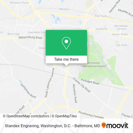
See Standex Engraving, Henrico County, on the map
Public Transit to Standex Engraving in Henrico County
Wondering how to get to Standex Engraving in Henrico County? Moovit helps you find the best way to get to Standex Engraving with step-by-step directions from the nearest public transit station.
Moovit provides free maps and live directions to help you navigate through your city. View schedules, routes, timetables, and find out how long does it take to get to Standex Engraving in real time.
Looking for the nearest stop or station to Standex Engraving? Check out this list of stops closest to your destination: Charles City + Laburnum; Ric Airport.
Bus: 7A, 7B, 56.
Want to see if there’s another route that gets you there at an earlier time? Moovit helps you find alternative routes or times. Get directions from and directions to Standex Engraving easily from the Moovit App or Website.
We make riding to Standex Engraving easy, which is why over 1.5 million users, including users in Henrico County, trust Moovit as the best app for public transit. You don’t need to download an individual bus app or train app, Moovit is your all-in-one transit app that helps you find the best bus time or train time available.
For information on prices of bus and train, costs and ride fares to Standex Engraving, please check the Moovit app.
Use the app to navigate to popular places including to the airport, hospital, stadium, grocery store, mall, coffee shop, school, college, and university.
Standex Engraving Address: 5901 Lewis Rd Sandston, VA 23150 street in Henrico County
- Martin Metalfab,
- Economy Parking C,
- The Expedting Co.,
- Schenker,
- Davis Autosports,
- Swift Air Delivery,
- Bax Global Transportation & Logistics Worldwide,
- Quantum Aviation Services,
- Delta Airlines LLC,
- Golden Sands General Contractor,
- Japanese Classics,
- Japan Parts Service,
- FedEx,
- Quantem Aviation,
- United Parcel Services,
- Amazing Car Rental Richmond,
- Commonwealth Cargo,
- Airport Taxi Service,
- Hauni Richmond,
- Blakemore Construction
Places Near Standex Engraving (Henrico County)
- Camden Yards, Baltimore,
- Capital One Arena, Washington,
- Warner Theatre, Washington,
- PG Mall, Prince George's County,
- Rock Creek Tennis Center, Washington,
- Washington National Cathedral, Washington,
- Washington DC VA Medical Center, Washington,
- National Zoo, Washington,
- Museum Of The Bible, Washington,
- Pennsylvania Ave NW (3rd st and pennsylvania), Washington,
- Sibley Memorial Hospital, Washington,
- National Theatre, Washington,
- Basilica of the National Shrine, Washington,
- Amazon Hq2, Arlington County,
- The Anthem, Washington,
- M&T Bank Stadium, Baltimore,
- National Museum of African American History and Culture, Washington,
- Marriott Marquis Washington, DC, Washington,
- Westfield Montgomery Mall, Montgomery County,
- Georgetown, Washington
How to get to popular places in Washington, D.C. - Baltimore, MD with public transit
Get around Henrico County by public transit!
Traveling around Henrico County has never been so easy. See step by step directions as you travel to any attraction, street or major public transit station. View bus and train schedules, arrival times, service alerts and detailed routes on a map, so you know exactly how to get to anywhere in Henrico County.
When traveling to any destination around Henrico County use Moovit's Live Directions with Get Off Notifications to know exactly where and how far to walk, how long to wait for your line, and how many stops are left. Moovit will alert you when it's time to get off — no need to constantly re-check whether yours is the next stop.
Wondering how to use public transit in Henrico County or how to pay for public transit in Henrico County? Moovit public transit app can help you navigate your way with public transit easily, and at minimum cost. It includes public transit fees, ticket prices, and costs. Looking for a map of Henrico County public transit lines? Moovit public transit app shows all public transit maps in Henrico County with all Bus, Train, Metro, Light Rail and Ferry routes and stops on an interactive map.
Washington, D.C. - Baltimore, MD has 5 transit type(s), including: Bus, Train, Metro, Light Rail and Ferry, operated by several transit agencies, including WMATA, Montgomery County Ride On, Fairfax Connector, TheBus, PRTC, DASH - Alexandria, Arlington Transit (ART), RTA of Central Maryland, MDOT MTA, MDOT MTA Light RailLink, MDOT MTA Commuter Bus, MDOT MTA Local Bus, FXBGO!, Virginia Railway Express (VRE) and MARC