How to get to Stang Insurance Group by bus?
Click on the bus route to see step by step directions with maps, line arrival times and updated time schedules.
From HJF, Montgomery County
42 minFrom Astrazeneca HQ, Montgomery County
25 minFrom Wheaton High School, Montgomery County
66 minFrom Olney MD USA, Montgomery County
47 minFrom Pike & Rose (Pike and Rose), Montgomery County
47 minFrom Montgomery Village, Maryland, Montgomery County
43 minFrom Kaiser Permanente - Kensington Medical Center, Montgomery County
69 minFrom Georgia Ave & Icc Park & Ride Lot, Montgomery County
46 minFrom Germantown, Maryland, Montgomery County
54 minFrom The Music Center At Strathmore, Montgomery County
49 min
How to get to Stang Insurance Group by metro?
Click on the metro route to see step by step directions with maps, line arrival times and updated time schedules.
Bus stops near Stang Insurance Group in Montgomery County
Metro station near Stang Insurance Group in Montgomery County
- Shady Grove, 12 min walk,VIEW
Bus lines to Stang Insurance Group in Montgomery County
What are the closest stations to Stang Insurance Group?
The closest stations to Stang Insurance Group are:
- Research Blvd & @2275 is 166 yards away, 3 min walk.
- Research Blvd & Gude Dr is 362 yards away, 5 min walk.
- Shady Grove is 977 yards away, 12 min walk.
- Carnation Dr & Woodley Dr is 1149 yards away, 14 min walk.
Which bus lines stop near Stang Insurance Group?
These bus lines stop near Stang Insurance Group: 54, 63, 66.
Which metro line stops near Stang Insurance Group?
RED (Shady Grove)
What’s the nearest metro station to Stang Insurance Group in Montgomery County?
The nearest metro station to Stang Insurance Group in Montgomery County is Shady Grove. It’s a 12 min walk away.
What’s the nearest bus station to Stang Insurance Group in Montgomery County?
The nearest bus station to Stang Insurance Group in Montgomery County is Research Blvd & @2275. It’s a 3 min walk away.
What time is the first metro to Stang Insurance Group in Montgomery County?
The RED is the first metro that goes to Stang Insurance Group in Montgomery County. It stops nearby at 5:00 AM.
What time is the last metro to Stang Insurance Group in Montgomery County?
The RED is the last metro that goes to Stang Insurance Group in Montgomery County. It stops nearby at 12:42 AM.
What time is the first train to Stang Insurance Group in Montgomery County?
The MARC is the first train that goes to Stang Insurance Group in Montgomery County. It stops nearby at 5:39 AM.
What time is the last train to Stang Insurance Group in Montgomery County?
The MARC is the last train that goes to Stang Insurance Group in Montgomery County. It stops nearby at 7:50 PM.
What time is the first bus to Stang Insurance Group in Montgomery County?
The 54 is the first bus that goes to Stang Insurance Group in Montgomery County. It stops nearby at 5:17 AM.
What time is the last bus to Stang Insurance Group in Montgomery County?
The 54 is the last bus that goes to Stang Insurance Group in Montgomery County. It stops nearby at 12:11 AM.
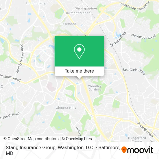
See Stang Insurance Group, Montgomery County, on the map
Public Transit to Stang Insurance Group in Montgomery County
Wondering how to get to Stang Insurance Group in Montgomery County? Moovit helps you find the best way to get to Stang Insurance Group with step-by-step directions from the nearest public transit station.
Moovit provides free maps and live directions to help you navigate through your city. View schedules, routes, timetables, and find out how long does it take to get to Stang Insurance Group in real time.
Looking for the nearest stop or station to Stang Insurance Group? Check out this list of stops closest to your destination: Research Blvd & @2275; Research Blvd & Gude Dr; Shady Grove; Carnation Dr & Woodley Dr.
Bus: 54, 63, 66, 45.Metro: RED.
Want to see if there’s another route that gets you there at an earlier time? Moovit helps you find alternative routes or times. Get directions from and directions to Stang Insurance Group easily from the Moovit App or Website.
We make riding to Stang Insurance Group easy, which is why over 1.5 million users, including users in Montgomery County, trust Moovit as the best app for public transit. You don’t need to download an individual bus app or train app, Moovit is your all-in-one transit app that helps you find the best bus time or train time available.
For information on prices of bus and metro, costs and ride fares to Stang Insurance Group, please check the Moovit app.
Use the app to navigate to popular places including to the airport, hospital, stadium, grocery store, mall, coffee shop, school, college, and university.
Stang Insurance Group Address: 2275 Research Blvd Rockville, MD 20850 street in Montgomery County
- Safety & Security,
- Brightview Acquisition Holdings,
- Tellenger,
- Practical Alternatives, LLC,
- Window Replacement DC,
- Bioplan Associates,
- Chevo Consulting, LLC,
- Encompass Health,
- Atlantis Pool Management,
- Law Offices of Mindy F,
- Wellfleet Inc,
- Calistoga Construction,
- Reliable CPM Schedule,
- Belta Medical Devices Inc.,
- Glendale Dining Services,
- The Brickman Group,
- Cnsi,
- Biopharmaceutical Company,
- Department of Transportation,
- Karp Ronald - Karp Frosh Law Firm
Places Near Stang Insurance Group (Montgomery County)
- PG Mall, Prince George's County,
- National Zoo, Washington,
- Sibley Memorial Hospital, Washington,
- Washington DC VA Medical Center, Washington,
- Marriott Marquis Washington, DC, Washington,
- National Museum of African American History and Culture, Washington,
- Pennsylvania Ave NW (3rd st and pennsylvania), Washington,
- Westfield Montgomery Mall, Montgomery County,
- National Mall, Washington,
- Basilica of the National Shrine, Washington,
- Camden Yards, Baltimore,
- Capital One Arena, Washington,
- Washington National Cathedral, Washington,
- M&T Bank Stadium, Baltimore,
- Amazon Hq2, Arlington County,
- The Anthem, Washington,
- Warner Theatre, Washington,
- Georgetown, Washington,
- Museum Of The Bible, Washington,
- Rock Creek Tennis Center, Washington
How to get to popular places in Washington, D.C. - Baltimore, MD with public transit
Get around Montgomery County by public transit!
Traveling around Montgomery County has never been so easy. See step by step directions as you travel to any attraction, street or major public transit station. View bus and train schedules, arrival times, service alerts and detailed routes on a map, so you know exactly how to get to anywhere in Montgomery County.
When traveling to any destination around Montgomery County use Moovit's Live Directions with Get Off Notifications to know exactly where and how far to walk, how long to wait for your line, and how many stops are left. Moovit will alert you when it's time to get off — no need to constantly re-check whether yours is the next stop.
Wondering how to use public transit in Montgomery County or how to pay for public transit in Montgomery County? Moovit public transit app can help you navigate your way with public transit easily, and at minimum cost. It includes public transit fees, ticket prices, and costs. Looking for a map of Montgomery County public transit lines? Moovit public transit app shows all public transit maps in Montgomery County with all Bus, Train, Metro, Light Rail and Ferry routes and stops on an interactive map.
Washington, D.C. - Baltimore, MD has 5 transit type(s), including: Bus, Train, Metro, Light Rail and Ferry, operated by several transit agencies, including WMATA, Montgomery County Ride On, Fairfax Connector, TheBus, PRTC, DASH - Alexandria, Arlington Transit (ART), RTA of Central Maryland, MDOT MTA, MDOT MTA Light RailLink, MDOT MTA Commuter Bus, MDOT MTA Local Bus, FXBGO!, Virginia Railway Express (VRE) and MARC