How to get to Stapleton Anchorage by bus?
Click on the bus route to see step by step directions with maps, line arrival times and updated time schedules.
From DoubleTree by Hilton New York Downtown, Manhattan
58 minFrom Four Points by Sheraton New York Downtown, Manhattan
65 minFrom City Hall 141 Worth Street, Manhattan
63 minFrom The Beekman, Manhattan
64 minFrom 911 Memorial, Manhattan
64 minFrom 1 Pace plaza, Manhattan
66 minFrom Ikea, Elizabeth
237 minFrom Hudson Mall, Jersey City
126 minFrom Newport Mall Bus, Jersey City
115 min
Ferry station near Stapleton Anchorage in Staten Island
- St. George Ferry Terminal, 32 min walk,VIEW
Subway station near Stapleton Anchorage in Staten Island
- Stapleton, 33 min walk,VIEW
What are the closest stations to Stapleton Anchorage?
The closest stations to Stapleton Anchorage are:
- St. George Ferry Terminal is 2708 yards away, 32 min walk.
- Stapleton is 2776 yards away, 33 min walk.
Which bus lines stop near Stapleton Anchorage?
These bus lines stop near Stapleton Anchorage: S46, S51, S76, SIM33C.
Which ferry line stops near Stapleton Anchorage?
SG (Wall St./Pier 11)
What time is the first subway to Stapleton Anchorage in Staten Island?
The SIR is the first subway that goes to Stapleton Anchorage in Staten Island. It stops nearby at 3:06 AM.
What time is the last subway to Stapleton Anchorage in Staten Island?
The SIR is the last subway that goes to Stapleton Anchorage in Staten Island. It stops nearby at 3:13 AM.
What time is the first ferry to Stapleton Anchorage in Staten Island?
The STATEN ISLAND FERRY is the first ferry that goes to Stapleton Anchorage in Staten Island. It stops nearby at 3:00 AM.
What time is the last ferry to Stapleton Anchorage in Staten Island?
The STATEN ISLAND FERRY is the last ferry that goes to Stapleton Anchorage in Staten Island. It stops nearby at 2:55 AM.
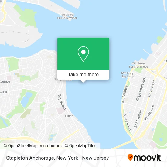
See Stapleton Anchorage, Staten Island, on the map
Public Transit to Stapleton Anchorage in Staten Island
Wondering how to get to Stapleton Anchorage in Staten Island? Moovit helps you find the best way to get to Stapleton Anchorage with step-by-step directions from the nearest public transit station.
Moovit provides free maps and live directions to help you navigate through your city. View schedules, routes, timetables, and find out how long does it take to get to Stapleton Anchorage in real time.
Looking for the nearest stop or station to Stapleton Anchorage? Check out this list of stops closest to your destination: St. George Ferry Terminal; Stapleton.
Bus: S46, S51, S76, SIM33C.Subway: SIR.Ferry: SG, STATEN ISLAND FERRY.
Want to see if there’s another route that gets you there at an earlier time? Moovit helps you find alternative routes or times. Get directions from and directions to Stapleton Anchorage easily from the Moovit App or Website.
We make riding to Stapleton Anchorage easy, which is why over 1.5 million users, including users in Staten Island, trust Moovit as the best app for public transit. You don’t need to download an individual bus app or train app, Moovit is your all-in-one transit app that helps you find the best bus time or train time available.
For information on prices of bus, ferry, subway and train, costs and ride fares to Stapleton Anchorage, please check the Moovit app.
Use the app to navigate to popular places including to the airport, hospital, stadium, grocery store, mall, coffee shop, school, college, and university.
Location: Staten Island, New York - New Jersey
- Staten Island Fleet Week,
- U S Navy,
- Uss the Sullivans Homeport Pier,
- Miller's Tug and Barge,
- Naval Station New York,
- Victory Blvd (victory boulevard and Bay Street Lndg),
- Littay - Home,
- Homeport Pier,
- Lyons Pool Recreation Center,
- Sp+ Parking,
- Keyme Locksmiths,
- USS the Sullivans Homeport Pier,
- New York City Department Of Probation,
- Blue Pearl,
- Navy Pier,
- Enterprise Rent-A-Car,
- Stapleton Waterfront Park,
- Domino's Pizza,
- Us Marine Corps Recruiting Station Staten Island,
- Crunch Fitness - Staten Island
Places Near Stapleton Anchorage (Staten Island)
- Times Square, Manhattan,
- San Gennaro Feast, Manhattan,
- Mountainside Hospital, Glen Ridge,
- Rockefeller Center, Manhattan,
- 1 Police Plaza, Manhattan,
- Pier 83, Manhattan,
- Queens Center Mall, Queens,
- qqqq, Manhattan,
- 26 Federal Plaza, Manhattan,
- Bellevue Hospital, Manhattan,
- Chinatown, Manhattan,
- 111 Centre New York City Supreme Court, Manhattan,
- 66 John Street, Manhattan,
- Wall Street, Manhattan,
- Hudson Yards, Manhattan,
- 376 Hudson Street, Manhattan,
- SoHo, Manhattan,
- 3 Stone St, Manhattan,
- Katz's Deli, Manhattan,
- 911 Memorial, Manhattan
How to get to popular places in New York - New Jersey with public transit
Get around Staten Island by public transit!
Traveling around Staten Island has never been so easy. See step by step directions as you travel to any attraction, street or major public transit station. View bus and train schedules, arrival times, service alerts and detailed routes on a map, so you know exactly how to get to anywhere in Staten Island.
When traveling to any destination around Staten Island use Moovit's Live Directions with Get Off Notifications to know exactly where and how far to walk, how long to wait for your line, and how many stops are left. Moovit will alert you when it's time to get off — no need to constantly re-check whether yours is the next stop.
Wondering how to use public transit in Staten Island or how to pay for public transit in Staten Island? Moovit public transit app can help you navigate your way with public transit easily, and at minimum cost. It includes public transit fees, ticket prices, and costs. Looking for a map of Staten Island public transit lines? Moovit public transit app shows all public transit maps in Staten Island with all Bus, Train, Subway, Light Rail, Ferry and Cable Car routes and stops on an interactive map.
New York - New Jersey has 6 transit type(s), including: Bus, Train, Subway, Light Rail, Ferry and Cable Car, operated by several transit agencies, including MTA Subway, Metro-North Railroad, LIRR, PATH, MTA New York City Transit - Express routes, MTA Bus, NJ Transit, NYC Ferry, NICE bus, Bee-Line Bus, NJ Transit Rail, Norwalk Transit District, Hartford Line, River Valley Transit and HART