How to get to Start by bus?
Click on the bus route to see step by step directions with maps, line arrival times and updated time schedules.
Bus stop near Start in Sulzburg
- Sulzburg Marktplatz, 3 min walk,VIEW
Train station near Start in Sulzburg
- Staufen (Brsg) Süd Bahnhof, 19 min walk,VIEW
Bus lines to Start in Sulzburg
What are the closest stations to Start?
The closest stations to Start are:
- Sulzburg Marktplatz is 140 meters away, 3 min walk.
- Staufen (Brsg) Süd Bahnhof is 1442 meters away, 19 min walk.
Which bus lines stop near Start?
These bus lines stop near Start: 113, 261.
What’s the nearest train station to Start in Sulzburg?
The nearest train station to Start in Sulzburg is Staufen (Brsg) Süd Bahnhof. It’s a 19 min walk away.
What’s the nearest bus station to Start in Sulzburg?
The nearest bus station to Start in Sulzburg is Sulzburg Marktplatz. It’s a 3 min walk away.
What time is the first train to Start in Sulzburg?
The S3 is the first train that goes to Start in Sulzburg. It stops nearby at 5:13 AM.
What time is the last train to Start in Sulzburg?
The S3 is the last train that goes to Start in Sulzburg. It stops nearby at 12:18 AM.
What time is the first bus to Start in Sulzburg?
The 113 is the first bus that goes to Start in Sulzburg. It stops nearby at 5:35 AM.
What time is the last bus to Start in Sulzburg?
The 261 is the last bus that goes to Start in Sulzburg. It stops nearby at 1:06 AM.
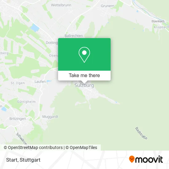
See Start, Sulzburg, on the map
Public Transit to Start in Sulzburg
Wondering how to get to Start in Sulzburg? Moovit helps you find the best way to get to Start with step-by-step directions from the nearest public transit station.
Moovit provides free maps and live directions to help you navigate through your city. View schedules, routes, timetables, and find out how long does it take to get to Start in real time.
Looking for the nearest stop or station to Start? Check out this list of stops closest to your destination: Sulzburg Marktplatz; Staufen (Brsg) Süd Bahnhof.
Train: S3.Bus: 113, 261.
Want to see if there’s another route that gets you there at an earlier time? Moovit helps you find alternative routes or times. Get directions from and directions to Start easily from the Moovit App or Website.
We make riding to Start easy, which is why over 1.5 million users, including users in Sulzburg, trust Moovit as the best app for public transit. You don’t need to download an individual bus app or train app, Moovit is your all-in-one transit app that helps you find the best bus time or train time available.
For information on prices of bus, train and light rail, costs and ride fares to Start, please check the Moovit app.
Use the app to navigate to popular places including to the airport, hospital, stadium, grocery store, mall, coffee shop, school, college, and university.
Start Address: Gustav-Weil-Straße 24 79295 Sulzburg street in Sulzburg
- Günter Engler,
- Ehemalige Synagoge Sulzburg,
- Pizza Taxi,
- Zum Wilden Mann,
- Die Brillenfabrik,
- Zähringer Arno Zahntechnik,
- Sparkasse,
- Zum Weinheiligen,
- Postfiliale,
- Der Weinladen,
- Hairvisions by Kevin,
- Friseur und Blond,
- Torstüble,
- Gaststätte Torstüble,
- Yoga im Eck,
- Stadttor,
- Ellen Baumbusch,
- Tessera-Kunst,
- Hilde Burgert Hebamme,
- Gaststätte Altes Stadttor
Places Near Start (Sulzburg)
- Hanns-Martin-Schleyer-Halle, Bad Cannstatt,
- Wilhelma (U-Bahn Wilhelma), Bad Cannstatt,
- Gasometer Pforzheim, Pforzheim,
- Schleyerhalle, Bad Cannstatt,
- Im Wizemann (Halle), Bad Cannstatt,
- Hanns-Martin-Schleyer-Halle (Stuttgart Hans-Martin-Schleyerhalle), Bad Cannstatt,
- Hauptbahnhof Stuttgart, Stuttgart-Mitte,
- Pariser Platz Stuttgart, Stuttgart-Mitte,
- Mercedes-Benz Museum, Bad Cannstatt,
- Mercedes-Benz Museum (Mercedes Museum Stuttgart), Bad Cannstatt,
- Geilhaus Haus 33a, Reutlingen-Betzingen,
- Porsche-Arena, Bad Cannstatt,
- Waldfriedhof, Degerloch,
- SI-Centrum, Möhringen,
- Gleis 101/102 (tief), Stuttgart-Mitte,
- Porsche Museum, Zuffenhausen,
- FlixBus Haltestelle, Stuttgart,
- Marmorsaal Im Weissenburgpark, Stuttgart-Süd,
- Mettingen Eros-Center Puff Laufhaus, Esslingen Am Neckar,
- Klinikum Stuttgart - Katharinenhospital, Stuttgart-Mitte
How to get to popular places in Stuttgart with public transit
Get around Sulzburg by public transit!
Traveling around Sulzburg has never been so easy. See step by step directions as you travel to any attraction, street or major public transit station. View bus and train schedules, arrival times, service alerts and detailed routes on a map, so you know exactly how to get to anywhere in Sulzburg.
When traveling to any destination around Sulzburg use Moovit's Live Directions with Get Off Notifications to know exactly where and how far to walk, how long to wait for your line, and how many stops are left. Moovit will alert you when it's time to get off — no need to constantly re-check whether yours is the next stop.
Wondering how to use public transit in Sulzburg or how to pay for public transit in Sulzburg? Moovit public transit app can help you navigate your way with public transit easily, and at minimum cost. It includes public transit fees, ticket prices, and costs. Looking for a map of Sulzburg public transit lines? Moovit public transit app shows all public transit maps in Sulzburg with all Bus, Train, Subway, Light Rail, Ferry, S-Bahn and Funicular routes and stops on an interactive map.
Stuttgart has 7 transit type(s), including: Bus, Train, Subway, Light Rail, Ferry, S-Bahn and Funicular, operated by several transit agencies, including SSB - Stadtbahn, SSB, SSB - Seilbahn / Zacke, S-Bahn Stuttgart, Rhein-Neckar-Verkehr GmbH (rnv), Karlsruher Verkehrsverbund, DB AG, DB Regiobus BW, Arverio Baden-Württemberg GmbH, DB RegioNetz Verkehrs GmbH Westfrankenbahn, DB Regio AG Baden-Württemberg, Südwestdeutsche Verkehrs-AG, DB Regio AG Mitte Region Hessen, DB and Bodensee-Oberschwaben-Bahn