How to get to State Auto Salvage by bus?
Click on the bus route to see step by step directions with maps, line arrival times and updated time schedules.
From Baptist homestead hospital, Homestead
51 minFrom Cutler Bay, FL, Princeton-Goulds
113 minFrom SW 137th Ave / US-1, Princeton-Goulds
46 minFrom Robert Morgan Educational Center, Kendale Lakes-Tamiami
88 minFrom US 1@SW 248 St, Princeton-Goulds
60 minFrom Herbert Ammons Middle School, Kendale Lakes-Tamiami
100 minFrom Eureka Drive & U.S. 1, Kendall-Palmetto Bay
76 minFrom Baptist Health South Florida Homestead Hospital, Homestead
31 minFrom Zoo Miami, Kendale Lakes-Tamiami
126 minFrom SW 184 St & US 1, Kendall-Palmetto Bay
74 min
Bus stops near State Auto Salvage in Homestead
Bus lines to State Auto Salvage in Homestead
What are the closest stations to State Auto Salvage?
The closest stations to State Auto Salvage are:
- W Mowry Dr & Sw 187 Av is 106 yards away, 2 min walk.
- Sw 14 Av @ W Mowry Dr is 225 yards away, 3 min walk.
Which bus lines stop near State Auto Salvage?
These bus lines stop near State Auto Salvage: 35, 70, DOWNTOWN.
What’s the nearest bus station to State Auto Salvage in Homestead?
The nearest bus station to State Auto Salvage in Homestead is W Mowry Dr & Sw 187 Av. It’s a 2 min walk away.
What time is the first bus to State Auto Salvage in Homestead?
The 70 is the first bus that goes to State Auto Salvage in Homestead. It stops nearby at 6:07 AM.
What time is the last bus to State Auto Salvage in Homestead?
The 70 is the last bus that goes to State Auto Salvage in Homestead. It stops nearby at 9:25 PM.
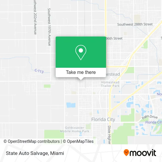
See State Auto Salvage, Homestead, on the map
Public Transit to State Auto Salvage in Homestead
Wondering how to get to State Auto Salvage in Homestead? Moovit helps you find the best way to get to State Auto Salvage with step-by-step directions from the nearest public transit station.
Moovit provides free maps and live directions to help you navigate through your city. View schedules, routes, timetables, and find out how long does it take to get to State Auto Salvage in real time.
Looking for the nearest stop or station to State Auto Salvage? Check out this list of stops closest to your destination: W Mowry Dr & Sw 187 Av; Sw 14 Av @ W Mowry Dr.
Bus: 35, 70, DOWNTOWN, HOMEDT.
Want to see if there’s another route that gets you there at an earlier time? Moovit helps you find alternative routes or times. Get directions from and directions to State Auto Salvage easily from the Moovit App or Website.
We make riding to State Auto Salvage easy, which is why over 1.5 million users, including users in Homestead, trust Moovit as the best app for public transit. You don’t need to download an individual bus app or train app, Moovit is your all-in-one transit app that helps you find the best bus time or train time available.
For information on prices of bus, costs and ride fares to State Auto Salvage, please check the Moovit app.
Use the app to navigate to popular places including to the airport, hospital, stadium, grocery store, mall, coffee shop, school, college, and university.
State Auto Salvage Address: 1250 W Mowry Dr Homestead, FL 33030 street in Homestead
- Flamingo Auto Salvage,
- Keys Food Market,
- MNS Junkyard Used Auto Parts,
- Krispy Krunchy Chicken,
- Chevron,
- ABC Supply Co,
- Calvary Chapel Homestead,
- Taqueria las Tarascas,
- ATM,
- Shell,
- Accursio Well Drilling,
- New Life Christian Fellowship of Miami,
- Fl National Auto Sales,
- American Ice,
- Dayton Electric,
- J A Electronics,
- FB Tire Service,
- Auto Mechanic RX,
- Trinity Sda Church,
- Lorenzos Bodyshop
Places Near State Auto Salvage (Homestead)
- Wynwood, Miami,
- Hard Rock Stadium, Miami Gardens,
- Dolphin Mall, Miami,
- Miami Design District, Miami,
- Aventura Mall, Miami,
- Miami VA Hospital, Miami,
- Little Havana, Miami,
- Dolphin Mall Bus, Miami,
- Richard E. Gerstein Justice Building, Miami,
- Zoo Miami, Miami,
- Aventura Mall, Miami Beach,
- Marlins Park, Miami,
- Sawgrass mall ( FL ), Miami Beach,
- Brickell City Centre, Miami,
- Port of Miami Cruise Terminal, Miami,
- Miami Freedom Park, Miami,
- Keiser University Flagship Campus, West Palm Beach,
- Sawgrass Mall, Miami,
- Miami-Dade County Courthouse, Miami,
- Bayside Marketplace, Miami
How to get to popular places in Miami with public transit
Get around Homestead by public transit!
Traveling around Homestead has never been so easy. See step by step directions as you travel to any attraction, street or major public transit station. View bus and train schedules, arrival times, service alerts and detailed routes on a map, so you know exactly how to get to anywhere in Homestead.
When traveling to any destination around Homestead use Moovit's Live Directions with Get Off Notifications to know exactly where and how far to walk, how long to wait for your line, and how many stops are left. Moovit will alert you when it's time to get off — no need to constantly re-check whether yours is the next stop.
Wondering how to use public transit in Homestead or how to pay for public transit in Homestead? Moovit public transit app can help you navigate your way with public transit easily, and at minimum cost. It includes public transit fees, ticket prices, and costs. Looking for a map of Homestead public transit lines? Moovit public transit app shows all public transit maps in Homestead with all Bus, Train, Light Rail and Ferry routes and stops on an interactive map.
Miami has 4 transit type(s), including: Bus, Train, Light Rail and Ferry, operated by several transit agencies, including Broward County Transit, Miami-Dade Transit, Metrorail, Palm Tran, Tri-Rail, Brightline, MARTY, City of Homestead Trolley, Key West Transit, Treasure Coast Connector, GoLine IRT, Amtrak, Greyhound-us, FlixBus-us and Aventura Express Shuttle Bus