How to get to State Farm by bus?
Click on the bus route to see step by step directions with maps, line arrival times and updated time schedules.
From Oakland Park Boulevard & State Road 7, Fort Lauderdale
57 minFrom Butterfly World, Pompano Beach
79 minFrom Tri-Rail-Deerfield Beach Station, Deerfield Beach
61 minFrom Ross, Fort Lauderdale
46 minFrom Walmart, Fort Lauderdale
60 minFrom Galleria at Fort Lauderdale (Galleria Mall At Fort Lauderdale), Fort Lauderdale
50 minFrom Galleria Mall, Fort Lauderdale
52 minFrom Wilton Manors, Fort Lauderdale
39 minFrom Trapeze Swing Club, Fort Lauderdale
52 minFrom Mai-Kai Restaurant And Polynesian Show, Fort Lauderdale
30 min
Bus stops near State Farm in Pompano Beach
Train station near State Farm in Pompano Beach
- Cypress Creek Station, 55 min walk,VIEW
Bus lines to State Farm in Pompano Beach
What are the closest stations to State Farm?
The closest stations to State Farm are:
- Southwest 3rd Street/Southwest 4th Avenue is 221 yards away, 3 min walk.
- Dixie Highway/Southwest 2nd Street is 406 yards away, 5 min walk.
- Atlantic Boulevard/Dixie Highway is 861 yards away, 11 min walk.
- Atlantic Boulevard/Northwest 6th Avenue is 1262 yards away, 15 min walk.
- Cypress Creek Station is 4629 yards away, 55 min walk.
Which bus lines stop near State Farm?
These bus lines stop near State Farm: 20, 50, 60.
What’s the nearest bus station to State Farm in Pompano Beach?
The nearest bus station to State Farm in Pompano Beach is Southwest 3rd Street/Southwest 4th Avenue. It’s a 3 min walk away.
What time is the first train to State Farm in Pompano Beach?
The TRIRAIL is the first train that goes to State Farm in Pompano Beach. It stops nearby at 4:38 AM.
What time is the last train to State Farm in Pompano Beach?
The TRIRAIL is the last train that goes to State Farm in Pompano Beach. It stops nearby at 10:43 PM.
What time is the first bus to State Farm in Pompano Beach?
The 60 is the first bus that goes to State Farm in Pompano Beach. It stops nearby at 5:34 AM.
What time is the last bus to State Farm in Pompano Beach?
The 50 is the last bus that goes to State Farm in Pompano Beach. It stops nearby at 11:43 PM.
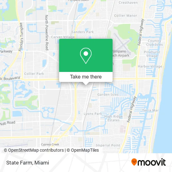
See State Farm, Pompano Beach, on the map
Public Transit to State Farm in Pompano Beach
Wondering how to get to State Farm in Pompano Beach? Moovit helps you find the best way to get to State Farm with step-by-step directions from the nearest public transit station.
Moovit provides free maps and live directions to help you navigate through your city. View schedules, routes, timetables, and find out how long does it take to get to State Farm in real time.
Looking for the nearest stop or station to State Farm? Check out this list of stops closest to your destination: Southwest 3rd Street/Southwest 4th Avenue; Dixie Highway/Southwest 2nd Street; Atlantic Boulevard/Dixie Highway; Atlantic Boulevard/Northwest 6th Avenue; Cypress Creek Station.
Bus: 20, 50, 60, 42.Train: TRIRAIL.
Want to see if there’s another route that gets you there at an earlier time? Moovit helps you find alternative routes or times. Get directions from and directions to State Farm easily from the Moovit App or Website.
We make riding to State Farm easy, which is why over 1.5 million users, including users in Pompano Beach, trust Moovit as the best app for public transit. You don’t need to download an individual bus app or train app, Moovit is your all-in-one transit app that helps you find the best bus time or train time available.
For information on prices of bus and train, costs and ride fares to State Farm, please check the Moovit app.
Use the app to navigate to popular places including to the airport, hospital, stadium, grocery store, mall, coffee shop, school, college, and university.
State Farm Address: 201 SW 4th Ave Pompano Beach, FL 33060 street in Pompano Beach
- Turning Point Bridge Work Release Center,
- Travel Etc of las Olas,
- VFW Post 8182,
- Depew Commercial AC Contractors,
- Maid for You,
- Youth under Construction Youth Center,
- Western Union,
- Latin Flyer,
- RM&B Auto Sales,
- Ip4 Garage,
- Mexican Supermarket,
- Ja Custom Designs (Gun Metal Custom Productions),
- T-N-T Auto & Marine Center, Inc.,
- Top Cars Motors,
- Fleetworx Truck and Auto Repair, LLC.,
- Mydream Auto Sales,
- Dent Be Gone,
- CJ Properties,
- Avondale Park,
- Rubber Mulch
Places Near State Farm (Pompano Beach)
- Miami Freedom Park, Miami,
- Aventura Mall, Miami,
- Aventura Mall, Miami Beach,
- Port of Miami Cruise Terminal, Miami,
- Marlins Park, Miami,
- Wynwood, Miami,
- Dolphin Mall Bus, Miami,
- Miami Design District, Miami,
- Dolphin Mall, Miami,
- 1351 NW 12th St, Miami,
- Hard Rock Stadium, Miami Gardens,
- Sawgrass Mall, Miami,
- Zoo Miami, Miami,
- Keiser University Flagship Campus, West Palm Beach,
- Miami-Dade County Courthouse, Miami,
- Richard E. Gerstein Justice Building, Miami,
- Sawgrass mall ( FL ), Miami Beach,
- Brickell City Centre, Miami,
- Bayside Marketplace, Miami,
- Little Havana, Miami
How to get to popular places in Miami with public transit
Get around Pompano Beach by public transit!
Traveling around Pompano Beach has never been so easy. See step by step directions as you travel to any attraction, street or major public transit station. View bus and train schedules, arrival times, service alerts and detailed routes on a map, so you know exactly how to get to anywhere in Pompano Beach.
When traveling to any destination around Pompano Beach use Moovit's Live Directions with Get Off Notifications to know exactly where and how far to walk, how long to wait for your line, and how many stops are left. Moovit will alert you when it's time to get off — no need to constantly re-check whether yours is the next stop.
Wondering how to use public transit in Pompano Beach or how to pay for public transit in Pompano Beach? Moovit public transit app can help you navigate your way with public transit easily, and at minimum cost. It includes public transit fees, ticket prices, and costs. Looking for a map of Pompano Beach public transit lines? Moovit public transit app shows all public transit maps in Pompano Beach with all Bus, Train, Light Rail and Ferry routes and stops on an interactive map.
Miami has 4 transit type(s), including: Bus, Train, Light Rail and Ferry, operated by several transit agencies, including Broward County Transit, Miami-Dade Transit, Metrorail, Palm Tran, Tri-Rail, Brightline, MARTY, City of Homestead Trolley, Key West Transit, Treasure Coast Connector, GoLine IRT, Amtrak, Greyhound-us, FlixBus-us and Aventura Express Shuttle Bus