Directions to State Farm (Baltimore) with public transportation
The following transit lines have routes that pass near State Farm
 Bus: 71, 94, CHERRY ROUTE, CITYLINK SILVER, BANNER ROUTE.
- Metro: METRO.
- Ferry: HC3.
How to get to State Farm by bus?
Click on the bus route to see step by step directions with maps, line arrival times and updated time schedules.
From Glen Burnie, MD, Anne Arundel County
47 minFrom Giant Food Stores, Baltimore
41 minFrom Mva, Baltimore
72 minFrom I-70 at Security Blvd Baltimore City Lot Park & Ride, Baltimore
67 minFrom Johns Hopkins University, Baltimore
38 minFrom Sinai Hospital, Baltimore
67 minFrom Coppin State University, Baltimore
58 minFrom NSA Friendship Annex (FANX), Anne Arundel County
71 minFrom Pimlico Race Course, Baltimore
87 minFrom Morgan State University, Baltimore
55 min
How to get to State Farm by metro?
Click on the metro route to see step by step directions with maps, line arrival times and updated time schedules.
Bus stops near State Farm in Baltimore
Ferry stations near State Farm in Baltimore
Light Rail stations near State Farm in Baltimore
- Hamburg Street, 21 min walk,VIEW
Bus lines to State Farm in Baltimore
- 94, Fort Mchenry,VIEW
- CHERRY ROUTE, Baltimore Peninsula (Sb),VIEW
- 71, Patapsco Station,VIEW
- BANNER ROUTE, Lee St.,VIEW
- CITYLINK BLUE, Westgate,VIEW
- CITYLINK BROWN, Overlea,VIEW
- CITYLINK GREEN, Towson Town Center,VIEW
- CITYLINK ORANGE, Highlandtown,VIEW
- CITYLINK SILVER, Station North,VIEW
- 67, Brandon Woods,VIEW
What are the closest stations to State Farm?
The closest stations to State Farm are:
- Fort Ave & Riverside Ave is 294 yards away, 4 min walk.
- Riverside Park (Eb) is 294 yards away, 4 min walk.
- Key Hwy & Harborview Wb FS is 302 yards away, 4 min walk.
- Harborview (Nb) is 400 yards away, 5 min walk.
- Due Covington is 451 yards away, 6 min walk.
- Light St & Fort Ave Sb is 524 yards away, 7 min walk.
- Federal Hill is 1362 yards away, 17 min walk.
- Locust Point is 1500 yards away, 18 min walk.
- Hamburg Street is 1756 yards away, 21 min walk.
Which bus lines stop near State Farm?
These bus lines stop near State Farm: 71, 94, CHERRY ROUTE, CITYLINK SILVER.
Which metro line stops near State Farm?
METRO (Towards John Hopkins)
What’s the nearest light rail station to State Farm in Baltimore?
The nearest light rail station to State Farm in Baltimore is Hamburg Street. It’s a 21 min walk away.
What’s the nearest bus station to State Farm in Baltimore?
The nearest bus stations to State Farm in Baltimore are Fort Ave & Riverside Ave, Riverside Park (Eb) and Key Hwy & Harborview Wb FS. The closest one is a 4 min walk away.
What’s the nearest ferry station to State Farm in Baltimore?
The nearest ferry station to State Farm in Baltimore is Federal Hill. It’s a 17 min walk away.
What time is the first light rail to State Farm in Baltimore?
The LIGHT RAILLINK is the first light rail that goes to State Farm in Baltimore. It stops nearby at 4:20 AM.
What time is the last light rail to State Farm in Baltimore?
The LIGHT RAILLINK is the last light rail that goes to State Farm in Baltimore. It stops nearby at 1:04 AM.
What time is the first bus to State Farm in Baltimore?
The 94 is the first bus that goes to State Farm in Baltimore. It stops nearby at 3:59 AM.
What time is the last bus to State Farm in Baltimore?
The CITYLINK SILVER is the last bus that goes to State Farm in Baltimore. It stops nearby at 3:28 AM.
What time is the first ferry to State Farm in Baltimore?
The HC3 is the first ferry that goes to State Farm in Baltimore. It stops nearby at 6:00 AM.
What time is the last ferry to State Farm in Baltimore?
The HC1 is the last ferry that goes to State Farm in Baltimore. It stops nearby at 8:07 PM.
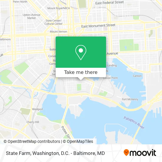
See State Farm, Baltimore, on the map
Public Transit to State Farm in Baltimore
Wondering how to get to State Farm in Baltimore? Moovit helps you find the best way to get to State Farm with step-by-step directions from the nearest public transit station.
Moovit provides free maps and live directions to help you navigate through your city. View schedules, routes, timetables, and find out how long does it take to get to State Farm in real time.
Looking for the nearest stop or station to State Farm? Check out this list of stops closest to your destination: Fort Ave & Riverside Ave; Riverside Park (Eb); Key Hwy & Harborview Wb FS; Harborview (Nb); Due Covington; Light St & Fort Ave Sb; Federal Hill; Locust Point; Hamburg Street.
Bus: 71, 94, CHERRY ROUTE, CITYLINK SILVER, BANNER ROUTE, CITYLINK BLUE, CITYLINK BROWN, CITYLINK GREEN, CITYLINK ORANGE.Metro: METRO.Ferry: HC3.
Want to see if there’s another route that gets you there at an earlier time? Moovit helps you find alternative routes or times. Get directions from and directions to State Farm easily from the Moovit App or Website.
We make riding to State Farm easy, which is why over 1.5 million users, including users in Baltimore, trust Moovit as the best app for public transit. You don’t need to download an individual bus app or train app, Moovit is your all-in-one transit app that helps you find the best bus time or train time available.
For information on prices of bus, metro and light rail, costs and ride fares to State Farm, please check the Moovit app.
Use the app to navigate to popular places including to the airport, hospital, stadium, grocery store, mall, coffee shop, school, college, and university.
State Farm Address: 454 E Fort Ave Baltimore, MD 21230 street in Baltimore
- Sherbow David,
- World Changers,
- Your Financial Pharmacist,
- Top Secret Salsa,
- Au Sud Bistrot,
- 611 Hyson St,
- Foster Real Estate,
- Taylor Properties,
- Baltimore Title Group,
- The Baltimore Academy of Defence,
- Hardwood Floor Cleaning Carpet Cleaning,
- Charles Shettle - Aflac,
- Port City Properties,
- Ullmann & Wakefield Pa,
- The Fort Ave Bridge,
- Leave It To Jamie,
- Boss Steaks,
- Art Exposure,
- La Cosette,
- Little Havana
Places Near State Farm (Baltimore)
- Sibley Memorial Hospital, Washington,
- Camden Yards, Baltimore,
- Amazon Hq2, Arlington County,
- M&T Bank Stadium, Baltimore,
- Marriott Marquis Washington, DC, Washington,
- Museum Of The Bible, Washington,
- Warner Theatre, Washington,
- Washington DC VA Medical Center, Washington,
- Westfield Montgomery Mall, Montgomery County,
- Pennsylvania Ave NW (3rd st and pennsylvania), Washington,
- Basilica of the National Shrine, Washington,
- National Zoo, Washington,
- PG Mall, Prince George's County,
- Washington National Cathedral, Washington,
- Capital One Arena, Washington,
- National Mall, Washington,
- National Museum of African American History and Culture, Washington,
- The Anthem, Washington,
- Rock Creek Tennis Center, Washington,
- Georgetown, Washington
How to get to popular places in Washington, D.C. - Baltimore, MD with public transit
Get around Baltimore by public transit!
Traveling around Baltimore has never been so easy. See step by step directions as you travel to any attraction, street or major public transit station. View bus and train schedules, arrival times, service alerts and detailed routes on a map, so you know exactly how to get to anywhere in Baltimore.
When traveling to any destination around Baltimore use Moovit's Live Directions with Get Off Notifications to know exactly where and how far to walk, how long to wait for your line, and how many stops are left. Moovit will alert you when it's time to get off — no need to constantly re-check whether yours is the next stop.
Wondering how to use public transit in Baltimore or how to pay for public transit in Baltimore? Moovit public transit app can help you navigate your way with public transit easily, and at minimum cost. It includes public transit fees, ticket prices, and costs. Looking for a map of Baltimore public transit lines? Moovit public transit app shows all public transit maps in Baltimore with all Bus, Train, Metro, Light Rail and Ferry routes and stops on an interactive map.
Washington, D.C. - Baltimore, MD has 5 transit type(s), including: Bus, Train, Metro, Light Rail and Ferry, operated by several transit agencies, including WMATA, Montgomery County Ride On, Fairfax Connector, TheBus, PRTC, DASH - Alexandria, Arlington Transit (ART), RTA of Central Maryland, MDOT MTA, MDOT MTA Light RailLink, MDOT MTA Commuter Bus, MDOT MTA Local Bus, FXBGO!, Virginia Railway Express (VRE) and MARC