Directions to State Farm (Henrico County) with public transportation
The following transit lines have routes that pass near State Farm
 Bus: 18, BRT, 19, 76, 50.
- Train: CAROLINIAN, NORTHEAST REGIONAL, PALMETTO, FLORIDIAN, SILVER METEOR.
How to get to State Farm by bus?
Click on the bus route to see step by step directions with maps, line arrival times and updated time schedules.
From Rose Gaming Resort, Prince William County
256 minFrom Lorton, VA, Fairfax County
241 minFrom Potomac Mills Mall, Prince William County
231 minFrom Busch Gardens Williamsburg (Employee Parking Lot), James City County
172 minFrom Lorton, VA - Amtrak Auto Train Station (LOR), Fairfax County
246 minFrom Woodbridge, VA, Prince William County
176 minFrom UVA Hospital Medical Center, Charlottesville
321 minFrom Amazon Fulfillment Center-Ric3, Richmond
86 min
How to get to State Farm by train?
Click on the train route to see step by step directions with maps, line arrival times and updated time schedules.
Bus stops near State Farm in Henrico County
Train station near State Farm in Henrico County
- Richmond Staples Mill Road Amtrak Station, 36 min walk,VIEW
Bus lines to State Farm in Henrico County
What are the closest stations to State Farm?
The closest stations to State Farm are:
- Staples Mill & Libbie Mill East is 20 yards away, 1 min walk.
- Broad & 50th is 243 yards away, 4 min walk.
- Willow Lawn Station is 247 yards away, 4 min walk.
- Willow Lawn + Markel is 358 yards away, 5 min walk.
- Broad + Willow Lawn Shopping Center is 483 yards away, 6 min walk.
- Richmond Staples Mill Road Amtrak Station is 3025 yards away, 36 min walk.
Which bus lines stop near State Farm?
These bus lines stop near State Farm: 18, BRT.
Which train lines stop near State Farm?
These train lines stop near State Farm: CAROLINIAN, NORTHEAST REGIONAL, PALMETTO.
What’s the nearest bus station to State Farm in Henrico County?
The nearest bus station to State Farm in Henrico County is Staples Mill & Libbie Mill East. It’s a 1 min walk away.
What time is the first train to State Farm in Henrico County?
The SILVER METEOR is the first train that goes to State Farm in Henrico County. It stops nearby at 3:52 AM.
What time is the last train to State Farm in Henrico County?
The SILVER METEOR is the last train that goes to State Farm in Henrico County. It stops nearby at 3:52 AM.
What time is the first bus to State Farm in Henrico County?
The BRT is the first bus that goes to State Farm in Henrico County. It stops nearby at 5:00 AM.
What time is the last bus to State Farm in Henrico County?
The BRT is the last bus that goes to State Farm in Henrico County. It stops nearby at 1:37 AM.
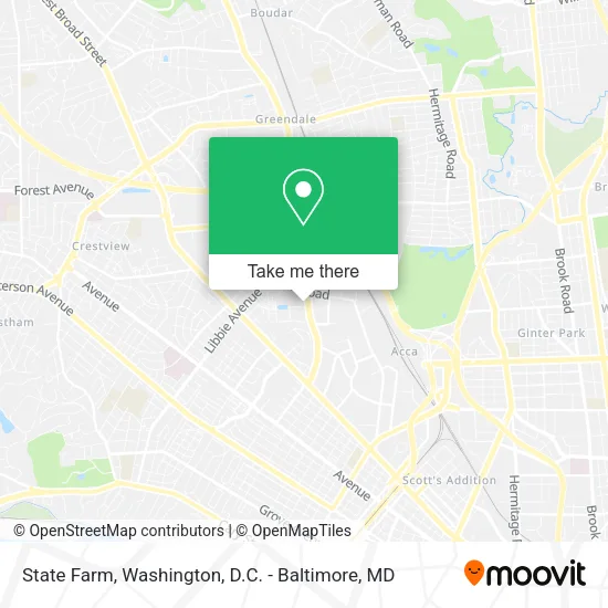
See State Farm, Henrico County, on the map
Public Transit to State Farm in Henrico County
Wondering how to get to State Farm in Henrico County? Moovit helps you find the best way to get to State Farm with step-by-step directions from the nearest public transit station.
Moovit provides free maps and live directions to help you navigate through your city. View schedules, routes, timetables, and find out how long does it take to get to State Farm in real time.
Looking for the nearest stop or station to State Farm? Check out this list of stops closest to your destination: Staples Mill & Libbie Mill East; Broad & 50th; Willow Lawn Station; Willow Lawn + Markel; Broad + Willow Lawn Shopping Center; Richmond Staples Mill Road Amtrak Station.
Bus: 18, BRT, 19, 76, 50, 91, 79.Train: CAROLINIAN, NORTHEAST REGIONAL, PALMETTO, FLORIDIAN, SILVER METEOR.
Want to see if there’s another route that gets you there at an earlier time? Moovit helps you find alternative routes or times. Get directions from and directions to State Farm easily from the Moovit App or Website.
We make riding to State Farm easy, which is why over 1.5 million users, including users in Henrico County, trust Moovit as the best app for public transit. You don’t need to download an individual bus app or train app, Moovit is your all-in-one transit app that helps you find the best bus time or train time available.
For information on prices of bus and train, costs and ride fares to State Farm, please check the Moovit app.
Use the app to navigate to popular places including to the airport, hospital, stadium, grocery store, mall, coffee shop, school, college, and university.
State Farm Address: 4900 Libbie Mill East Blvd Richmond, VA 23230 street in Henrico County
- Airrosti Libbie Mill,
- Nationwide Insurance,
- Crafted,
- All Star Orthodontics,
- Marsh & McLennan Companies,
- Seasons Mill,
- Richmond Therapeutic Health Services,
- Cavalier Moving,
- Burn Boot Camp - Libbie Mill,
- River Run Dental,
- Stephanie Daniel Aveda Artist,
- Radiant Nail and Spa,
- The Brass Tap,
- Salon Thirty Three,
- Habit Modern Massage,
- Gateway Homes,
- Amanda Lee,
- Libbie Mill - Midtown,
- Richmond Memorial Health Foundation,
- PCMH Collaborative
Places Near State Farm (Henrico County)
- Washington DC VA Medical Center, Washington,
- M&T Bank Stadium, Baltimore,
- National Mall, Washington,
- National Museum of African American History and Culture, Washington,
- Marriott Marquis Washington, DC, Washington,
- Camden Yards, Baltimore,
- Sibley Memorial Hospital, Washington,
- Museum Of The Bible, Washington,
- The Anthem, Washington,
- Warner Theatre, Washington,
- Washington National Cathedral, Washington,
- Georgetown, Washington,
- Capital One Arena, Washington,
- Basilica of the National Shrine, Washington,
- Westfield Montgomery Mall, Montgomery County,
- National Zoo, Washington,
- Amazon Hq2, Arlington County,
- PG Mall, Prince George's County,
- Rock Creek Tennis Center, Washington,
- Pennsylvania Ave NW (3rd st and pennsylvania), Washington
How to get to popular places in Washington, D.C. - Baltimore, MD with public transit
Get around Henrico County by public transit!
Traveling around Henrico County has never been so easy. See step by step directions as you travel to any attraction, street or major public transit station. View bus and train schedules, arrival times, service alerts and detailed routes on a map, so you know exactly how to get to anywhere in Henrico County.
When traveling to any destination around Henrico County use Moovit's Live Directions with Get Off Notifications to know exactly where and how far to walk, how long to wait for your line, and how many stops are left. Moovit will alert you when it's time to get off — no need to constantly re-check whether yours is the next stop.
Wondering how to use public transit in Henrico County or how to pay for public transit in Henrico County? Moovit public transit app can help you navigate your way with public transit easily, and at minimum cost. It includes public transit fees, ticket prices, and costs. Looking for a map of Henrico County public transit lines? Moovit public transit app shows all public transit maps in Henrico County with all Bus, Train, Metro, Light Rail and Ferry routes and stops on an interactive map.
Washington, D.C. - Baltimore, MD has 5 transit type(s), including: Bus, Train, Metro, Light Rail and Ferry, operated by several transit agencies, including WMATA, Montgomery County Ride On, Fairfax Connector, TheBus, PRTC, DASH - Alexandria, Arlington Transit (ART), RTA of Central Maryland, MDOT MTA, MDOT MTA Light RailLink, MDOT MTA Commuter Bus, MDOT MTA Local Bus, FXBGO!, Virginia Railway Express (VRE) and MARC