Directions to State Farm Insurance (Henrico County) with public transportation
The following transit lines have routes that pass near State Farm Insurance
 Bus: 18, BRT, 19, 50, 76.
- Train: CAROLINIAN, FLORIDIAN, NORTHEAST REGIONAL, PALMETTO, SILVER METEOR.
How to get to State Farm Insurance by bus?
Click on the bus route to see step by step directions with maps, line arrival times and updated time schedules.
From Lorton, VA - Amtrak Auto Train Station (LOR), Fairfax County
240 minFrom Lorton, VA, Fairfax County
234 minFrom Potomac Mills Mall, Prince William County
225 minFrom Rose Gaming Resort, Prince William County
250 minFrom Busch Gardens Williamsburg (Employee Parking Lot), James City County
165 minFrom Amazon Fulfillment Center-Ric3, Richmond
79 minFrom Woodbridge, VA, Prince William County
169 minFrom UVA Hospital Medical Center, Charlottesville
314 min
Bus stops near State Farm Insurance in Henrico County
Train station near State Farm Insurance in Henrico County
- Richmond Staples Mill Road Amtrak Station, 58 min walk,VIEW
Bus lines to State Farm Insurance in Henrico County
What are the closest stations to State Farm Insurance?
The closest stations to State Farm Insurance are:
- Willow Lawn + Shelter is 175 yards away, 3 min walk.
- Staples Mill Eastbound Station is 624 yards away, 8 min walk.
- Richmond Staples Mill Road Amtrak Station is 4930 yards away, 58 min walk.
Which bus lines stop near State Farm Insurance?
These bus lines stop near State Farm Insurance: 18, BRT.
What’s the nearest bus station to State Farm Insurance in Henrico County?
The nearest bus station to State Farm Insurance in Henrico County is Willow Lawn + Shelter. It’s a 3 min walk away.
What time is the first train to State Farm Insurance in Henrico County?
The SILVER METEOR is the first train that goes to State Farm Insurance in Henrico County. It stops nearby at 3:52 AM.
What time is the last train to State Farm Insurance in Henrico County?
The SILVER METEOR is the last train that goes to State Farm Insurance in Henrico County. It stops nearby at 3:52 AM.
What time is the first bus to State Farm Insurance in Henrico County?
The BRT is the first bus that goes to State Farm Insurance in Henrico County. It stops nearby at 5:02 AM.
What time is the last bus to State Farm Insurance in Henrico County?
The BRT is the last bus that goes to State Farm Insurance in Henrico County. It stops nearby at 1:33 AM.
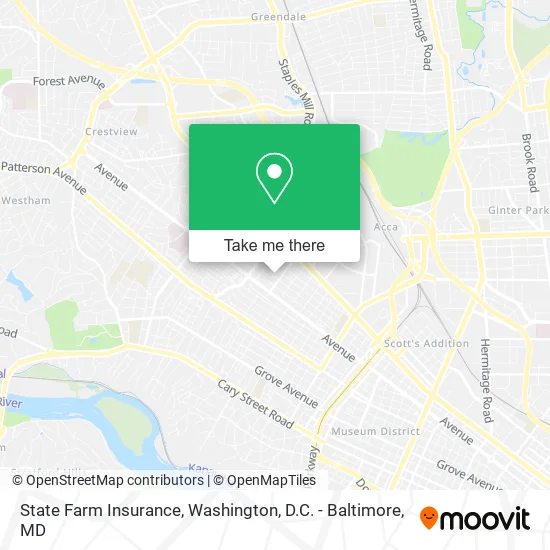
See State Farm Insurance, Henrico County, on the map
Public Transit to State Farm Insurance in Henrico County
Wondering how to get to State Farm Insurance in Henrico County? Moovit helps you find the best way to get to State Farm Insurance with step-by-step directions from the nearest public transit station.
Moovit provides free maps and live directions to help you navigate through your city. View schedules, routes, timetables, and find out how long does it take to get to State Farm Insurance in real time.
Looking for the nearest stop or station to State Farm Insurance? Check out this list of stops closest to your destination: Willow Lawn + Shelter; Staples Mill Eastbound Station; Richmond Staples Mill Road Amtrak Station.
Bus: 18, BRT, 19, 50, 76, 79.Train: CAROLINIAN, FLORIDIAN, NORTHEAST REGIONAL, PALMETTO, SILVER METEOR.
Want to see if there’s another route that gets you there at an earlier time? Moovit helps you find alternative routes or times. Get directions from and directions to State Farm Insurance easily from the Moovit App or Website.
We make riding to State Farm Insurance easy, which is why over 1.5 million users, including users in Henrico County, trust Moovit as the best app for public transit. You don’t need to download an individual bus app or train app, Moovit is your all-in-one transit app that helps you find the best bus time or train time available.
For information on prices of bus and train, costs and ride fares to State Farm Insurance, please check the Moovit app.
Use the app to navigate to popular places including to the airport, hospital, stadium, grocery store, mall, coffee shop, school, college, and university.
State Farm Insurance Address: 4906 Cutshaw Ave Richmond, VA 23230 street in Henrico County
- Mental Wellness Center,
- Global & Alternative Solutions LLC,
- Community Intervention Associates,
- Circle of Wellness,
- Commonwealth Physicians,
- Capital Area Alcohol,
- 310 Marketing,
- Virginia Association of Secondary School Principals,
- Virginia Wholesale & Distributors Association,
- YWCA,
- Stuart Simon Law Firm,
- Tuffy Properties,
- Networks Commercial Real Estate,
- Christina Pendleton & Associates,
- Grants Supermarket,
- Landin Companies,
- Landininc,
- Financial Asset Securities,
- USPS Collection Box - Blue Box,
- Lantz and Robins, P.C.
Places Near State Farm Insurance (Henrico County)
- Marriott Marquis Washington, DC, Washington,
- Georgetown, Washington,
- Westfield Montgomery Mall, Montgomery County,
- Camden Yards, Baltimore,
- National Zoo, Washington,
- Rock Creek Tennis Center, Washington,
- Pennsylvania Ave NW (3rd st and pennsylvania), Washington,
- Amazon Hq2, Arlington County,
- National Museum of African American History and Culture, Washington,
- Museum Of The Bible, Washington,
- M&T Bank Stadium, Baltimore,
- National Theatre, Washington,
- Washington National Cathedral, Washington,
- The Anthem, Washington,
- Basilica of the National Shrine, Washington,
- Warner Theatre, Washington,
- Washington DC VA Medical Center, Washington,
- PG Mall, Prince George's County,
- Sibley Memorial Hospital, Washington,
- Capital One Arena, Washington
How to get to popular places in Washington, D.C. - Baltimore, MD with public transit
Get around Henrico County by public transit!
Traveling around Henrico County has never been so easy. See step by step directions as you travel to any attraction, street or major public transit station. View bus and train schedules, arrival times, service alerts and detailed routes on a map, so you know exactly how to get to anywhere in Henrico County.
When traveling to any destination around Henrico County use Moovit's Live Directions with Get Off Notifications to know exactly where and how far to walk, how long to wait for your line, and how many stops are left. Moovit will alert you when it's time to get off — no need to constantly re-check whether yours is the next stop.
Wondering how to use public transit in Henrico County or how to pay for public transit in Henrico County? Moovit public transit app can help you navigate your way with public transit easily, and at minimum cost. It includes public transit fees, ticket prices, and costs. Looking for a map of Henrico County public transit lines? Moovit public transit app shows all public transit maps in Henrico County with all Bus, Train, Metro, Light Rail and Ferry routes and stops on an interactive map.
Washington, D.C. - Baltimore, MD has 5 transit type(s), including: Bus, Train, Metro, Light Rail and Ferry, operated by several transit agencies, including WMATA, Montgomery County Ride On, Fairfax Connector, TheBus, PRTC, DASH - Alexandria, Arlington Transit (ART), RTA of Central Maryland, MDOT MTA, MDOT MTA Light RailLink, MDOT MTA Commuter Bus, MDOT MTA Local Bus, FXBGO!, Virginia Railway Express (VRE) and MARC