How to get to State Farm Insurance by bus?
Click on the bus route to see step by step directions with maps, line arrival times and updated time schedules.
From Penn Quarter, Washington DC, Washington
97 minFrom The Bullpen, Washington
104 minFrom Martin Luther King Jr Ave SE, Washington
69 minFrom Washington Nationals Youth Baseball Academy, Washington
107 minFrom Eastern High School, Washington
105 minFrom I-295 Exit 1 - Naval Research Lab, Washington
69 minFrom U.S. Naval Research Laboratory - NRL, Washington
87 minFrom Lincoln Park, Washington
116 minFrom Congressional Cemetery, Washington
86 min
Bus stop near State Farm Insurance in Prince George's County
- Auth Rd & Oakland Way, 65 min walk,VIEW
Bus lines to State Farm Insurance in Prince George's County
What are the closest stations to State Farm Insurance?
The closest stations to State Farm Insurance are:
- Auth Rd & Oakland Way is 5393 yards away, 65 min walk.
Which bus lines stop near State Farm Insurance?
These bus lines stop near State Farm Insurance: P84, P85, P86, P87, P88.
What time is the first bus to State Farm Insurance in Prince George's County?
The P62 is the first bus that goes to State Farm Insurance in Prince George's County. It stops nearby at 5:11 AM.
What time is the last bus to State Farm Insurance in Prince George's County?
The P62 is the last bus that goes to State Farm Insurance in Prince George's County. It stops nearby at 12:21 AM.
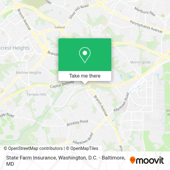
See State Farm Insurance, Prince George's County, on the map
Public Transit to State Farm Insurance in Prince George's County
Wondering how to get to State Farm Insurance in Prince George's County? Moovit helps you find the best way to get to State Farm Insurance with step-by-step directions from the nearest public transit station.
Moovit provides free maps and live directions to help you navigate through your city. View schedules, routes, timetables, and find out how long does it take to get to State Farm Insurance in real time.
Looking for the nearest stop or station to State Farm Insurance? Check out this list of stops closest to your destination: Auth Rd & Oakland Way.
Bus: P84, P85, P86, P87, P88, P62.
Want to see if there’s another route that gets you there at an earlier time? Moovit helps you find alternative routes or times. Get directions from and directions to State Farm Insurance easily from the Moovit App or Website.
We make riding to State Farm Insurance easy, which is why over 1.7 million users, including users in Prince George's County, trust Moovit as the best app for public transit. You don’t need to download an individual bus app or train app, Moovit is your all-in-one transit app that helps you find the best bus time or train time available.
For information on prices of bus and metro, costs and ride fares to State Farm Insurance, please check the Moovit app.
Use the app to navigate to popular places including to the airport, hospital, stadium, grocery store, mall, coffee shop, school, college, and university.
State Farm Insurance Address: 5121 Henderson Rd street in Prince George's County
- I-95 / 495 Exit 7 - Branch Avenue (MD 5),
- Holiday Inn Express-Andrews AFB (Holiday Inn Express Washington DC East-Andrews AFB),
- Central Baptist Church Camp Springs ,
- Car Solutions Automotive,
- U-Haul,
- Park & Ride Branch Ave,
- Branch Ave Kiss & Ride,
- Exit 9 - MD 337 (Allentown Rd) / Andrews AFB, Morningside,
- Kaiser Permanente - Marlow Heights Medical Center,
- Kaiser Permanente Health Care,
- Branch Avenue Station,
- Darcars KIA of Temple Hills,
- U.S. Citizenship and Immigration Services - Uscis,
- Wmata Branch Avenue Yard,
- Cheatham Heating - Air Conditioning,
- Kaiser Permanente,
- Camp Springs , MD,
- Heritage Signature Events,
- Ucr-8 Studios,
- Shan's Jumping Gymnasium
Places Near State Farm Insurance (Prince George's County)
- National Museum of African American History and Culture, Washington,
- Sibley Memorial Hospital, Washington,
- Camden Yards, Baltimore,
- Warner Theatre, Washington,
- Amazon Hq2, Arlington County,
- National Theatre, Washington,
- Washington National Cathedral, Washington,
- PG Mall, Prince George's County,
- The Anthem, Washington,
- Basilica of the National Shrine, Washington,
- Washington DC VA Medical Center, Washington,
- Georgetown, Washington,
- Marriott Marquis Washington, DC, Washington,
- Museum Of The Bible, Washington,
- National Zoo, Washington,
- Rock Creek Tennis Center, Washington,
- M&T Bank Stadium, Baltimore,
- Pennsylvania Ave NW (3rd st and pennsylvania), Washington,
- Capital One Arena, Washington,
- Westfield Montgomery Mall, Montgomery County
How to get to popular places in Washington, D.C. - Baltimore, MD with public transit
Get around Prince George's County by public transit!
Traveling around Prince George's County has never been so easy. See step by step directions as you travel to any attraction, street or major public transit station. View bus and train schedules, arrival times, service alerts and detailed routes on a map, so you know exactly how to get to anywhere in Prince George's County.
When traveling to any destination around Prince George's County use Moovit's Live Directions with Get Off Notifications to know exactly where and how far to walk, how long to wait for your line, and how many stops are left. Moovit will alert you when it's time to get off — no need to constantly re-check whether yours is the next stop.
Wondering how to use public transit in Prince George's County or how to pay for public transit in Prince George's County? Moovit public transit app can help you navigate your way with public transit easily, and at minimum cost. It includes public transit fees, ticket prices, and costs. Looking for a map of Prince George's County public transit lines? Moovit public transit app shows all public transit maps in Prince George's County with all Bus, Train, Metro, Light Rail and Ferry routes and stops on an interactive map.
Washington, D.C. - Baltimore, MD has 5 transit type(s), including: Bus, Train, Metro, Light Rail and Ferry, operated by several transit agencies, including WMATA, Montgomery County Ride On, Fairfax Connector, TheBus, PRTC, DASH - Alexandria, Arlington Transit (ART), RTA of Central Maryland, MDOT MTA, MDOT MTA Light RailLink, MDOT MTA Commuter Bus, MDOT MTA Local Bus, FXBGO!, Virginia Railway Express (VRE) and MARC