Directions to Station Arnhem Zuid with public transportation
The following transit lines have routes that pass near Station Arnhem Zuid
 Bus: 331, 5, 56, 11, 1.
- Train: SPR, IC, IC, IC, IC.
How to get to Station Arnhem Zuid by bus?
Click on the bus route to see step by step directions with maps, line arrival times and updated time schedules.
How to get to Station Arnhem Zuid by train?
Click on the train route to see step by step directions with maps, line arrival times and updated time schedules.
Bus stops near Station Arnhem Zuid
- Arnhem, Station Arnhem Zuid, 1 min walk,
- Arnhem, Hollandweg, 7 min walk,
Train stations near Station Arnhem Zuid
- Oosterbeek, 11 min walk,
- Arnhem Zuid, 53 min walk,
- Arnhem Centraal, 59 min walk,
Bus lines to Station Arnhem Zuid
- 5, Stadsdienst Arnhem | Schuytgraaf - Presikhaaf,
- 11, Stadsdienst Arnhem | Centraal Station - Station Zuid,
- 56, Heteren - Arnhem CS,
- 1, De Laar West,
What are the closest stations to Station Arnhem Zuid?
The closest stations to Station Arnhem Zuid are:
- Arnhem, Station Arnhem Zuid is 7 meters away, 1 min walk.
- Arnhem, Hollandweg is 481 meters away, 7 min walk.
- Oosterbeek is 831 meters away, 11 min walk.
- Arnhem Zuid is 4076 meters away, 53 min walk.
- Arnhem Centraal is 4638 meters away, 59 min walk.
Which bus lines stop near Station Arnhem Zuid?
These bus lines stop near Station Arnhem Zuid: 331, 5, 56.
Which train line stops near Station Arnhem Zuid?
SPR (Wijchen)
What’s the nearest train station to Station Arnhem Zuid?
The nearest train station to Station Arnhem Zuid is Oosterbeek. It’s a 11 min walk away.
What’s the nearest bus station to Station Arnhem Zuid?
The nearest bus station to Station Arnhem Zuid is Arnhem, Station Arnhem Zuid. It’s a 1 min walk away.
What time is the first train to Station Arnhem Zuid?
The STOPTREIN RE19 is the first train that goes to Station Arnhem Zuid. It stops nearby at 6:29 AM.
What time is the last train to Station Arnhem Zuid?
The IC is the last train that goes to Station Arnhem Zuid. It stops nearby at 1:44 AM.
What time is the first bus to Station Arnhem Zuid?
The 56 is the first bus that goes to Station Arnhem Zuid. It stops nearby at 8:34 AM.
What time is the last bus to Station Arnhem Zuid?
The 56 is the last bus that goes to Station Arnhem Zuid. It stops nearby at 1:11 AM.
See Station Arnhem Zuid on the map
Public Transportation to Station Arnhem Zuid
Wondering how to get to Station Arnhem Zuid? Moovit helps you find the best way to get to Station Arnhem Zuid with step-by-step directions from the nearest public transit station.
Moovit provides free maps and live directions to help you navigate through your city. View schedules, routes, timetables, and find out how long does it take to get to Station Arnhem Zuid in real time.
Looking for the nearest stop or station to Station Arnhem Zuid? Check out this list of stops closest to your destination: Arnhem, Station Arnhem Zuid; Arnhem, Hollandweg; Oosterbeek; Arnhem Zuid; Arnhem Centraal.
Bus: 331, 5, 56, 11, 1.Train: SPR, IC, IC, IC, IC, IC.
Want to see if there’s another route that gets you there at an earlier time? Moovit helps you find alternative routes or times. Get directions from and directions to Station Arnhem Zuid easily from the Moovit App or Website.
We make riding to Station Arnhem Zuid easy, which is why over 1.5 million users, including users in Arnhem, trust Moovit as the best app for public transit. You don’t need to download an individual bus app or train app, Moovit is your all-in-one transit app that helps you find the best bus time or train time available.
For information on prices of train and bus, costs and ride fares to Station Arnhem Zuid, please check the Moovit app.
Use the app to navigate to popular places including to the airport, hospital, stadium, grocery store, mall, coffee shop, school, college, and university.
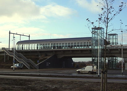
Station Arnhem Zuid Address: Metamorfosenallee street in Arnhem
- Omnibus,
- Rivers International School Arnhem,
- Arnhem Parnassusstraat,
- Winkelcentrum Schuytgraaf,
- Mr. E.N. van Kleffensstraat,
- Meles Jan en Ditsy Autorijschool,
- Praktijk voor Speyertherapie Martina Hoogerwerf,
- Produs Arnhem,
- Medisch Pedicure Bodycare Arnhem,
- Kortenhoefpad,
- uden Eindhovensingel,
- Uden Eindhoven,
- Schuytgraaf,
- Deckert Grafisch Ontwerp,
- Burgemeester Matsersingel 200,
- Jumbo,
- Winkelcentrum Elderhof,
- Coen te Beest Boringen,
- Elderveld,
- Elderveld / Hollandweg
Places Near Station Arnhem Zuid
- Ziggo Dome, Amsterdam,
- Maasstad Ziekenhuis, Rotterdam,
- Euromast, Rotterdam,
- 9 Straatjes, Amsterdam,
- Rijksmuseum, Amsterdam,
- Dappermarkt, Amsterdam,
- Mall of the Netherlands, Leidschendam-Voorburg,
- OLVG Oost, Amsterdam,
- Fenixloodsen, Rotterdam,
- Het Concertgebouw, Amsterdam,
- Erasmus MC, Rotterdam,
- Kralingse Bos, Rotterdam,
- Feyenoord Stadion (De Kuip), Rotterdam,
- IKEA, Amsterdam,
- Brabanthallen, 'S-Hertogenbosch,
- Diergaarde Blijdorp, Rotterdam,
- OLVG West, Amsterdam,
- Vlietland Ziekenhuis, Schiedam,
- St. Antonius Ziekenhuis, Nieuwegein,
- Johan Cruijff Arena, Amsterdam
How to get to popular places in Netherlands with public transit
Get around Arnhem by public transit!
Traveling around Arnhem has never been so easy. See step by step directions as you travel to any attraction, street or major public transit station. View bus and train schedules, arrival times, service alerts and detailed routes on a map, so you know exactly how to get to anywhere in Arnhem.
When traveling to any destination around Arnhem use Moovit's Live Directions with Get Off Notifications to know exactly where and how far to walk, how long to wait for your line, and how many stops are left. Moovit will alert you when it's time to get off — no need to constantly re-check whether yours is the next stop.
Wondering how to use public transit in Arnhem or how to pay for public transit in Arnhem? Moovit public transit app can help you navigate your way with public transit easily, and at minimum cost. It includes public transit fees, ticket prices, and costs. Looking for a map of Arnhem public transit lines? Moovit public transit app shows all public transit maps in Arnhem with all Bus, Train, Metro, Light Rail and Ferry routes and stops on an interactive map.
Netherlands has 5 transit type(s), including: Bus, Train, Metro, Light Rail and Ferry, operated by several transit agencies, including NS, GVB, U-OV, HTM, RET, De Lijn, Connexxion, Arriva, Breng, EBS, Bravo (Hermes), Hermes, Qbuzz, Bravo (Arriva) and allGo