Directions to Staypineapple (Manhattan) with public transportation
The following transit lines have routes that pass near Staypineapple
 Bus: M20, M34-SBS, M34A-SBS, Q32, QM12.
- Train: 2, BABYLON BRANCH, EMPIRE SERVICE, PORT WASHINGTON BRANCH, RONKONKOMA BRANCH.
- Subway: 3, A, C, E, S.
How to get to Staypineapple by bus?
Click on the bus route to see step by step directions with maps, line arrival times and updated time schedules.
How to get to Staypineapple by train?
Click on the train route to see step by step directions with maps, line arrival times and updated time schedules.
How to get to Staypineapple by subway?
Click on the subway route to see step by step directions with maps, line arrival times and updated time schedules.
Bus stops near Staypineapple in Manhattan
Subway stations near Staypineapple in Manhattan
Train station near Staypineapple in Manhattan
- 34 St-Penn Station, 5 min walk,VIEW
Bus lines to Staypineapple in Manhattan
- M11, 23 St,VIEW
- M34-SBS, Select Bus East Side Fdr Dr Crosstown,VIEW
- SIM23, Annadale Via Arden Av,VIEW
- SIM24, Midtown Via 34 St Via Madison Av,VIEW
- GREENWICH, Midtown / W 39th Street - Midtown / W 39th Street,VIEW
- 34TH ST, 34th St,VIEW
- M34A-SBS, Select Bus Pa Bus Trm Via 34 St Via 8 Av,VIEW
- M20, Lincoln Center 66 St Via 8 Av,VIEW
What are the closest stations to Staypineapple?
The closest stations to Staypineapple are:
- 9 Av/W 34 St is 120 yards away, 2 min walk.
- W 34 St/9 Av is 207 yards away, 3 min walk.
- W 34th St & 9th Ave (Westbound) is 212 yards away, 3 min walk.
- 34 St-Penn Station is 231 yards away, 3 min walk.
- 8 Av/W 37 St is 240 yards away, 3 min walk.
- 34 St-Hudson Yards is 460 yards away, 6 min walk.
Which bus lines stop near Staypineapple?
These bus lines stop near Staypineapple: M20, M34-SBS, M34A-SBS, Q32, QM12, QM24.
Which train lines stop near Staypineapple?
These train lines stop near Staypineapple: 2, BABYLON BRANCH, EMPIRE SERVICE, PORT WASHINGTON BRANCH, RONKONKOMA BRANCH, YEL.
Which subway lines stop near Staypineapple?
These subway lines stop near Staypineapple: 3, A, C, E, S.
What’s the nearest subway station to Staypineapple in Manhattan?
The nearest subway station to Staypineapple in Manhattan is 34 St-Penn Station. It’s a 3 min walk away.
What’s the nearest train station to Staypineapple in Manhattan?
The nearest train station to Staypineapple in Manhattan is 34 St-Penn Station. It’s a 5 min walk away.
What’s the nearest bus station to Staypineapple in Manhattan?
The nearest bus station to Staypineapple in Manhattan is 9 Av/W 34 St. It’s a 2 min walk away.
What time is the first subway to Staypineapple in Manhattan?
The E is the first subway that goes to Staypineapple in Manhattan. It stops nearby at 3:01 AM.
What time is the last subway to Staypineapple in Manhattan?
The A is the last subway that goes to Staypineapple in Manhattan. It stops nearby at 3:57 AM.
What time is the first train to Staypineapple in Manhattan?
The PORT JEFFERSON BRANCH is the first train that goes to Staypineapple in Manhattan. It stops nearby at 3:01 AM.
What time is the last train to Staypineapple in Manhattan?
The RONKONKOMA BRANCH is the last train that goes to Staypineapple in Manhattan. It stops nearby at 3:15 AM.
What time is the first bus to Staypineapple in Manhattan?
The M34A-SBS is the first bus that goes to Staypineapple in Manhattan. It stops nearby at 5:18 AM.
What time is the last bus to Staypineapple in Manhattan?
The M34-SBS is the last bus that goes to Staypineapple in Manhattan. It stops nearby at 1:26 AM.
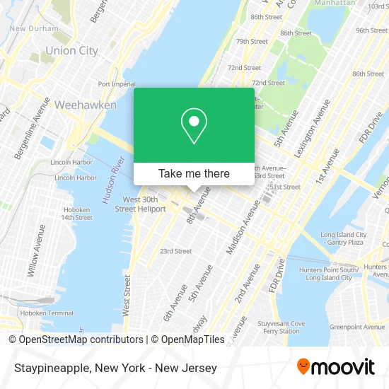
See Staypineapple, Manhattan, on the map
Public Transit to Staypineapple in Manhattan
Wondering how to get to Staypineapple in Manhattan? Moovit helps you find the best way to get to Staypineapple with step-by-step directions from the nearest public transit station.
Moovit provides free maps and live directions to help you navigate through your city. View schedules, routes, timetables, and find out how long does it take to get to Staypineapple in real time.
Looking for the nearest stop or station to Staypineapple? Check out this list of stops closest to your destination: 9 Av/W 34 St; W 34 St/9 Av; W 34th St & 9th Ave (Westbound); 34 St-Penn Station; 8 Av/W 37 St; 34 St-Hudson Yards.
Bus: M20, M34-SBS, M34A-SBS, Q32, QM12, QM24, M11, SIM23, SIM24.Train: 2, BABYLON BRANCH, EMPIRE SERVICE, PORT WASHINGTON BRANCH, RONKONKOMA BRANCH, YEL, ACELA, ADIRONDACK, BERKSHIRE FLYER, CARDINAL, CAROLINIAN.Subway: 3, A, C, E, S, 7, 7X.
Want to see if there’s another route that gets you there at an earlier time? Moovit helps you find alternative routes or times. Get directions from and directions to Staypineapple easily from the Moovit App or Website.
We make riding to Staypineapple easy, which is why over 1.5 million users, including users in Manhattan, trust Moovit as the best app for public transit. You don’t need to download an individual bus app or train app, Moovit is your all-in-one transit app that helps you find the best bus time or train time available.
For information on prices of subway, bus and train, costs and ride fares to Staypineapple, please check the Moovit app.
Use the app to navigate to popular places including to the airport, hospital, stadium, grocery store, mall, coffee shop, school, college, and university.
Staypineapple Address: West 36th Street street in Manhattan
- Yaisuri Salamanca & John Hernan Raigosa,
- Staypineapple - New York (Staypineapple, an Artful Hotel, Midtown),
- Staypineapple Midtown,
- Doubletree-Times Square South (DoubleTree by Hilton New York Times Square South),
- Wyndham Garden Hotel,
- Sam Fashion New York,
- Leader Thread Corporation,
- Sherry Accessories,
- Masjid Awliya Of Allah,
- Periche,
- Executive Sign Corporation,
- Lmp Group,
- Springhill Suites,
- Levy Lighting,
- Fairfield Inn & Suites by Marriott New York Manhattan / Times Square 36th St.,
- Fairfield Inn & Suites by Marriott New York Manhattan / Times Square South ,
- Ashbahian Design,
- Irishcentral.Com,
- Ane American Bar & Grill,
- Doyler's 37
Places Near Staypineapple (Manhattan)
- qqqq, Manhattan,
- 1 Police Plaza, Manhattan,
- 111 Centre New York City Supreme Court, Manhattan,
- Queens Center Mall, Queens,
- 911 Memorial, Manhattan,
- Chinatown, Manhattan,
- Rockefeller Center, Manhattan,
- 3 Stone St, Manhattan,
- Pier 83, Manhattan,
- Katz's Deli, Manhattan,
- San Gennaro Feast, Manhattan,
- Mountainside Hospital, Glen Ridge,
- 376 Hudson Street, Manhattan,
- Wall Street, Manhattan,
- Times Square, Manhattan,
- Bellevue Hospital, Manhattan,
- Hudson Yards, Manhattan,
- 66 John Street, Manhattan,
- 26 Federal Plaza, Manhattan,
- SoHo, Manhattan
How to get to popular places in New York - New Jersey with public transit
Get around Manhattan by public transit!
Traveling around Manhattan has never been so easy. See step by step directions as you travel to any attraction, street or major public transit station. View bus and train schedules, arrival times, service alerts and detailed routes on a map, so you know exactly how to get to anywhere in Manhattan.
When traveling to any destination around Manhattan use Moovit's Live Directions with Get Off Notifications to know exactly where and how far to walk, how long to wait for your line, and how many stops are left. Moovit will alert you when it's time to get off — no need to constantly re-check whether yours is the next stop.
Wondering how to use public transit in Manhattan or how to pay for public transit in Manhattan? Moovit public transit app can help you navigate your way with public transit easily, and at minimum cost. It includes public transit fees, ticket prices, and costs. Looking for a map of Manhattan public transit lines? Moovit public transit app shows all public transit maps in Manhattan with all Bus, Train, Subway, Light Rail, Ferry and Cable Car routes and stops on an interactive map.
New York - New Jersey has 6 transit type(s), including: Bus, Train, Subway, Light Rail, Ferry and Cable Car, operated by several transit agencies, including MTA Subway, Metro-North Railroad, LIRR, PATH, MTA New York City Transit - Express routes, MTA Bus, NJ Transit, NYC Ferry, NICE bus, Bee-Line Bus, NJ Transit Rail, Norwalk Transit District, Hartford Line, River Valley Transit and HART