How to get to Sterling Auto Repair by bus?
Click on the bus route to see step by step directions with maps, line arrival times and updated time schedules.
From Alligator Alley, Fort Lauderdale
74 minFrom Walmart, Fort Lauderdale
55 minFrom City of Oakland Park, Fort Lauderdale
83 minFrom Piper High School, Plantation
76 minFrom Northeast High School, Fort Lauderdale
81 minFrom Intersection : N Andrews Ave & Sample Rd., Pompano Beach
49 minFrom Tri-Rail-Deerfield Beach Station, Deerfield Beach
88 minFrom Tamarac, Coral Springs-Margate
74 minFrom Holy Cross Hospital, Fort Lauderdale
65 minFrom N Federal Hwy, Fort Lauderdale
76 min
Bus stops near Sterling Auto Repair in Coral Springs-Margate
Bus lines to Sterling Auto Repair in Coral Springs-Margate
What are the closest stations to Sterling Auto Repair?
The closest stations to Sterling Auto Repair are:
- Northwest 15th Street/Banks Road is 240 yards away, 4 min walk.
- US 441/Northwest 18th Street is 931 yards away, 11 min walk.
- Copans Road/Banks Road is 1123 yards away, 14 min walk.
- US 441/Coconut Creek Parkway is 1269 yards away, 16 min walk.
Which bus lines stop near Sterling Auto Repair?
These bus lines stop near Sterling Auto Repair: 19, 60, 83.
What’s the nearest bus station to Sterling Auto Repair in Coral Springs-Margate?
The nearest bus station to Sterling Auto Repair in Coral Springs-Margate is Northwest 15th Street/Banks Road. It’s a 4 min walk away.
What time is the first bus to Sterling Auto Repair in Coral Springs-Margate?
The 19 is the first bus that goes to Sterling Auto Repair in Coral Springs-Margate. It stops nearby at 4:35 AM.
What time is the last bus to Sterling Auto Repair in Coral Springs-Margate?
The 19 is the last bus that goes to Sterling Auto Repair in Coral Springs-Margate. It stops nearby at 1:15 AM.
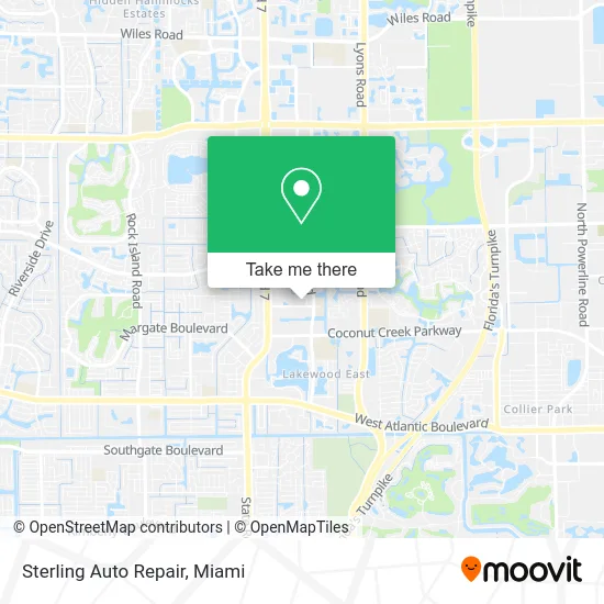
See Sterling Auto Repair, Coral Springs-Margate, on the map
Public Transit to Sterling Auto Repair in Coral Springs-Margate
Wondering how to get to Sterling Auto Repair in Coral Springs-Margate? Moovit helps you find the best way to get to Sterling Auto Repair with step-by-step directions from the nearest public transit station.
Moovit provides free maps and live directions to help you navigate through your city. View schedules, routes, timetables, and find out how long does it take to get to Sterling Auto Repair in real time.
Looking for the nearest stop or station to Sterling Auto Repair? Check out this list of stops closest to your destination: Northwest 15th Street/Banks Road; US 441/Northwest 18th Street; Copans Road/Banks Road; US 441/Coconut Creek Parkway.
Bus: 19, 60, 83, 441.
Want to see if there’s another route that gets you there at an earlier time? Moovit helps you find alternative routes or times. Get directions from and directions to Sterling Auto Repair easily from the Moovit App or Website.
We make riding to Sterling Auto Repair easy, which is why over 1.5 million users, including users in Coral Springs-Margate, trust Moovit as the best app for public transit. You don’t need to download an individual bus app or train app, Moovit is your all-in-one transit app that helps you find the best bus time or train time available.
For information on prices of bus and train, costs and ride fares to Sterling Auto Repair, please check the Moovit app.
Use the app to navigate to popular places including to the airport, hospital, stadium, grocery store, mall, coffee shop, school, college, and university.
Sterling Auto Repair Address: 4900 NW 15th St Pompano Beach, FL 33063 street in Coral Springs-Margate
- Higher Levels Auto Repair,
- SDF Dessert,
- Incanto Events,
- Vegveggie Vegetarian Cuisine,
- Affordable Price Point,
- NY Restoration Remodeling Services,
- Comeco Manufacturing,
- Y & F Auto Specialist Repair 2017,
- Miami Beach Leasing I,
- B.Print Fine Art Center,
- Oscar S Woodworks,
- Floor Coverings International of North Broward,
- RRK Properties,
- Roadrunner Vehicle Transport,
- Aka Motor Group,
- Bell Towing,
- Innovative Grounds MGT of Florida,
- C&H Auto Accessories Corp,
- JFJ Vehicle Repair,
- My Broward Mechanic
Places Near Sterling Auto Repair (Coral Springs-Margate)
- Aventura Mall, Miami Beach,
- Miami-Dade County Courthouse, Miami,
- Dolphin Mall Bus, Miami,
- Richard E. Gerstein Justice Building, Miami,
- Sawgrass mall ( FL ), Miami Beach,
- Miami Freedom Park, Miami,
- Miami Design District, Miami,
- Wynwood, Miami,
- Little Havana, Miami,
- Aventura Mall, Miami,
- Port of Miami Cruise Terminal, Miami,
- Bayside Marketplace, Miami,
- Hard Rock Stadium, Miami Gardens,
- Marlins Park, Miami,
- Sawgrass Mall, Miami,
- Dolphin Mall, Miami,
- Miami VA Hospital, Miami,
- Brickell City Centre, Miami,
- Keiser University Flagship Campus, West Palm Beach,
- Zoo Miami, Miami
How to get to popular places in Miami with public transit
Get around Coral Springs-Margate by public transit!
Traveling around Coral Springs-Margate has never been so easy. See step by step directions as you travel to any attraction, street or major public transit station. View bus and train schedules, arrival times, service alerts and detailed routes on a map, so you know exactly how to get to anywhere in Coral Springs-Margate.
When traveling to any destination around Coral Springs-Margate use Moovit's Live Directions with Get Off Notifications to know exactly where and how far to walk, how long to wait for your line, and how many stops are left. Moovit will alert you when it's time to get off — no need to constantly re-check whether yours is the next stop.
Wondering how to use public transit in Coral Springs-Margate or how to pay for public transit in Coral Springs-Margate? Moovit public transit app can help you navigate your way with public transit easily, and at minimum cost. It includes public transit fees, ticket prices, and costs. Looking for a map of Coral Springs-Margate public transit lines? Moovit public transit app shows all public transit maps in Coral Springs-Margate with all Bus, Train, Light Rail and Ferry routes and stops on an interactive map.
Miami has 4 transit type(s), including: Bus, Train, Light Rail and Ferry, operated by several transit agencies, including Broward County Transit, Miami-Dade Transit, Metrorail, Palm Tran, Tri-Rail, Brightline, MARTY, City of Homestead Trolley, Key West Transit, Treasure Coast Connector, GoLine IRT, Amtrak, Greyhound-us, FlixBus-us and Aventura Express Shuttle Bus