How to get to Steven S Snider by bus?
Click on the bus route to see step by step directions with maps, line arrival times and updated time schedules.
From Hilton Alexandria Mark Center, Alexandria
45 minFrom Prince George's Plaza Metro Station, Prince George's County
70 minFrom Hyatt Regency Crystal City at Reagan National Airport, Arlington County
61 minFrom FSI, Arlington County
61 minFrom Mwaa Fire Station 301, Arlington County
60 minFrom Shirlington, Arlington County
30 minFrom Consulado General de El Salvador en El Dmv, Montgomery County
57 minFrom Courtyard Alexandria Pentagon South, Alexandria
34 minFrom Alexandria, VA, Alexandria
37 minFrom Sheraton Suites Old Town Alexandria, Alexandria
32 min
How to get to Steven S Snider by train?
Click on the train route to see step by step directions with maps, line arrival times and updated time schedules.
From Prince George's Plaza Metro Station, Prince George's County
76 minFrom Hyatt Regency Crystal City at Reagan National Airport, Arlington County
120 minFrom Mwaa Fire Station 301, Arlington County
126 minFrom Consulado General de El Salvador en El Dmv, Montgomery County
75 minFrom Alexandria, VA, Alexandria
72 min
How to get to Steven S Snider by metro?
Click on the metro route to see step by step directions with maps, line arrival times and updated time schedules.
From Prince George's Plaza Metro Station, Prince George's County
33 minFrom Hyatt Regency Crystal City at Reagan National Airport, Arlington County
41 minFrom Mwaa Fire Station 301, Arlington County
26 minFrom Consulado General de El Salvador en El Dmv, Montgomery County
40 minFrom Alexandria, VA, Alexandria
45 minFrom Sheraton Suites Old Town Alexandria, Alexandria
45 min
Bus stops near Steven S Snider in Washington
Metro stations near Steven S Snider in Washington
Bus lines to Steven S Snider in Washington
- 230, 230/3 Washington Dc,VIEW
- 250, 250/2 Washington Dc,VIEW
- 541, 541 - Washington Dc / State Department,VIEW
- 611, State Department / Washington Dc,VIEW
- 611-FR, Front Royal - Gainesville,VIEW
- 943, 543 - L'Enfant Plaza - Washington, Dc,VIEW
- 953, 234 Lot / Montclair,VIEW
- 971, Horner / Telegraph / Dale City Lots Via Minnieville,VIEW
- 981, Pentagon / State Department / Washington Dc,VIEW
- 972-M, Eastern Lot Connector,VIEW
- F19, North To Potomac Park,VIEW
- A29, South To Van Dorn Street,VIEW
- D50, North To 14+Colorado Av,VIEW
- D10, East To Southern Av,VIEW
- DC, Front Royal,VIEW
What are the closest stations to Steven S Snider?
The closest stations to Steven S Snider are:
- 14 Th St & F St NW is 122 yards away, 2 min walk.
- 14th St @ F St Nw is 127 yards away, 2 min walk.
- 14 St Nw+Pennsylvania Av NW is 184 yards away, 3 min walk.
- 13 St Nw+F St NW is 341 yards away, 5 min walk.
- Metro Center is 388 yards away, 5 min walk.
- Federal Triangle Metro Station is 453 yards away, 6 min walk.
Which bus lines stop near Steven S Snider?
These bus lines stop near Steven S Snider: 981, A29, D32, D60, F19.
Which train lines stop near Steven S Snider?
These train lines stop near Steven S Snider: MARC, NORTHEAST REGIONAL.
Which metro lines stop near Steven S Snider?
These metro lines stop near Steven S Snider: BLUE, ORANGE, RED.
What’s the nearest metro station to Steven S Snider in Washington?
The nearest metro station to Steven S Snider in Washington is Federal Triangle Metro Station. It’s a 6 min walk away.
What’s the nearest bus station to Steven S Snider in Washington?
The nearest bus stations to Steven S Snider in Washington are 14 Th St & F St NW and 14th St @ F St Nw. The closest one is a 2 min walk away.
What time is the first metro to Steven S Snider in Washington?
The BLUE is the first metro that goes to Steven S Snider in Washington. It stops nearby at 5:20 AM.
What time is the last metro to Steven S Snider in Washington?
The RED is the last metro that goes to Steven S Snider in Washington. It stops nearby at 12:08 AM.
What time is the first bus to Steven S Snider in Washington?
The D50 is the first bus that goes to Steven S Snider in Washington. It stops nearby at 3:02 AM.
What time is the last bus to Steven S Snider in Washington?
The D50 is the last bus that goes to Steven S Snider in Washington. It stops nearby at 3:23 AM.
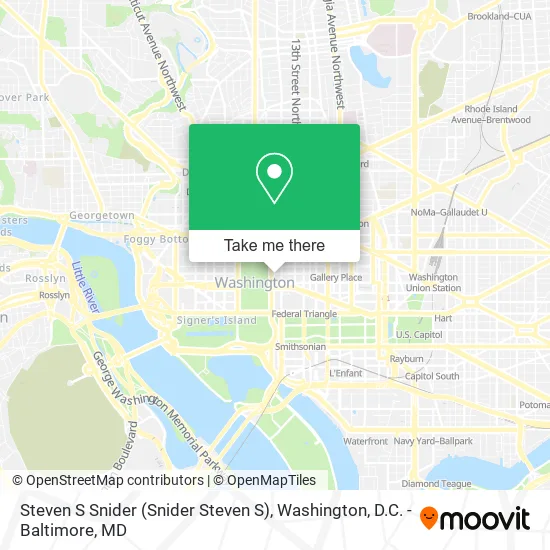
See Steven S Snider, Washington, on the map
Public Transit to Steven S Snider in Washington
Wondering how to get to Steven S Snider in Washington? Moovit helps you find the best way to get to Steven S Snider with step-by-step directions from the nearest public transit station.
Moovit provides free maps and live directions to help you navigate through your city. View schedules, routes, timetables, and find out how long does it take to get to Steven S Snider in real time.
Looking for the nearest stop or station to Steven S Snider? Check out this list of stops closest to your destination: 14 Th St & F St NW; 14th St @ F St Nw; 14 St Nw+Pennsylvania Av NW; 13 St Nw+F St NW; Metro Center; Federal Triangle Metro Station.
Bus: 981, A29, D32, D60, F19, 541, 611, 611-FR, 943, 953, 230, 250, 972-M, D50.Train: MARC, NORTHEAST REGIONAL.Metro: BLUE, ORANGE, RED, SILVER.
Want to see if there’s another route that gets you there at an earlier time? Moovit helps you find alternative routes or times. Get directions from and directions to Steven S Snider easily from the Moovit App or Website.
We make riding to Steven S Snider easy, which is why over 1.5 million users, including users in Washington, trust Moovit as the best app for public transit. You don’t need to download an individual bus app or train app, Moovit is your all-in-one transit app that helps you find the best bus time or train time available.
For information on prices of bus, metro and train, costs and ride fares to Steven S Snider, please check the Moovit app.
Use the app to navigate to popular places including to the airport, hospital, stadium, grocery store, mall, coffee shop, school, college, and university.
Steven S Snider Address: 1455 Pennsylvania Ave NW street in Washington
- Maria Bates Law PLLC,
- Clark Hill,
- Treasure Trove Foreign Currency Exchange,
- W Washington D.C.,
- W Washington D.C. (W HOTELS),
- Vue Rooftop,
- W Staff Green Room,
- The Hamilton,
- Thayer Capital Partners (Thayer-Blum Funding III),
- All Green Electronics Recycling (The Green Bar),
- National Press Club Library,
- Freedom Plaza,
- W Hotel Washington,
- Koch Industries (Koch Companies Public Sector),
- Hamilton Live (Pepper Hamilton),
- White Ford Bronco,
- Lipton Childcare Center - Temp Closed,
- Alvarez & Marsal,
- Café du Parc,
- F NW 14th
Places Near Steven S Snider (Washington)
- PG Mall, Prince George's County,
- Washington National Cathedral, Washington,
- Basilica of the National Shrine, Washington,
- National Museum of African American History and Culture, Washington,
- The Anthem, Washington,
- National Zoo, Washington,
- Georgetown, Washington,
- Sibley Memorial Hospital, Washington,
- National Theatre, Washington,
- Capital One Arena, Washington,
- Museum Of The Bible, Washington,
- Washington DC VA Medical Center, Washington,
- Amazon Hq2, Arlington County,
- Westfield Montgomery Mall, Montgomery County,
- Warner Theatre, Washington,
- Pennsylvania Ave NW (3rd st and pennsylvania), Washington,
- Rock Creek Tennis Center, Washington,
- M&T Bank Stadium, Baltimore,
- Marriott Marquis Washington, DC, Washington,
- Camden Yards, Baltimore
How to get to popular places in Washington, D.C. - Baltimore, MD with public transit
Get around Washington by public transit!
Traveling around Washington has never been so easy. See step by step directions as you travel to any attraction, street or major public transit station. View bus and train schedules, arrival times, service alerts and detailed routes on a map, so you know exactly how to get to anywhere in Washington.
When traveling to any destination around Washington use Moovit's Live Directions with Get Off Notifications to know exactly where and how far to walk, how long to wait for your line, and how many stops are left. Moovit will alert you when it's time to get off — no need to constantly re-check whether yours is the next stop.
Wondering how to use public transit in Washington or how to pay for public transit in Washington? Moovit public transit app can help you navigate your way with public transit easily, and at minimum cost. It includes public transit fees, ticket prices, and costs. Looking for a map of Washington public transit lines? Moovit public transit app shows all public transit maps in Washington with all Bus, Train, Metro, Light Rail and Ferry routes and stops on an interactive map.
Washington, D.C. - Baltimore, MD has 5 transit type(s), including: Bus, Train, Metro, Light Rail and Ferry, operated by several transit agencies, including WMATA, Montgomery County Ride On, Fairfax Connector, TheBus, PRTC, DASH - Alexandria, Arlington Transit (ART), RTA of Central Maryland, MDOT MTA, MDOT MTA Light RailLink, MDOT MTA Commuter Bus, MDOT MTA Local Bus, FXBGO!, Virginia Railway Express (VRE) and MARC