How to get to Stiegele by bus?
Click on the bus route to see step by step directions with maps, line arrival times and updated time schedules.
From Lago Bowlingcenter Karlsruhe, Pforzheim
42 minFrom Schloss Neuenbürg, Verwaltungsgemeinschaft Neuenbürg
39 minFrom Klinik Öschelbronn, Niefern-Öschelbronn
131 minFrom Waldbronn Eistreff, Waldbronn
329 minFrom Möbelzentrum Pforzheim, Eutingen
34 minFrom Kibungu, Verwaltungsverband Heckengäu
48 minFrom Amazon Fulfillment Center - STR1, Eutingen
38 minFrom Monbachtal, Liebenzell
87 minFrom Cts-Klinik Schloßberg, Liebenzell
52 minFrom Enzkreisklinik Mühlacker, Vvg Der Stadt Mühlacker
105 min
How to get to Stiegele by train?
Click on the train route to see step by step directions with maps, line arrival times and updated time schedules.
Bus stops near Stiegele in Pforzheim
Train stations near Stiegele in Pforzheim
- Brötzingen Mitte, 4 min walk,VIEW
Bus lines to Stiegele in Pforzheim
- 10, Pforzheim Stadtmuseum,VIEW
- 11, Pforzheim Wasserturm - Pforzheim Arcus Klinik,VIEW
- 712, Birkenfeld Kirchplatz - Pforzheim ZOB Bstg 8,VIEW
- 715, Pforzheim ZOB Bstg 8 - Ittersbach Descostraße,VIEW
- 716, Bad Herrenalb - Pforzheim ZOB Bstg 8,VIEW
- 717, Ittersbach Descostraße - Pforzheim ZOB Bstg 8,VIEW
- 718, Conweiler Schule - Pforzheim ZOB Bstg 8,VIEW
- 720, Ittersbach Becker-Göring-Str. - Pforzheim ZOB Bstg 5,VIEW
- 721, Pforzheim ZOB Bstg 5 - Langensteinbach Klinikum,VIEW
- 916, Neuenbürg Gymnasium - Bad Herrenalb,VIEW
- 1, Eutingen Gartenstadt,VIEW
- 9, Mäurach am Waldrand,VIEW
- 20, Brötzingen Bahnhof,VIEW
- 923, Ittersbach Rathaus,VIEW
- SEV S6, Bad Wildbad Bahnhof,VIEW
- 2, Pforzheim Unterer Wingertweg,VIEW
- 43, Büchenbronn Panoramastraße,VIEW
- 743, Pforzheim Zob,VIEW
- 744, Salmbach Rathaus,VIEW
- 917, Neuenbürg Gymnasium,VIEW
What are the closest stations to Stiegele?
The closest stations to Stiegele are:
- Pforzheim am Mühlkanal is 156 meters away, 3 min walk.
- Pforzheim Burgstraße is 184 meters away, 3 min walk.
- Brötzingen Mitte is 261 meters away, 4 min walk.
- Brötzingen Marktplatz is 307 meters away, 5 min walk.
- Arlinger Dietlinger Straße is 362 meters away, 6 min walk.
- Brötzingen Bahnhof is 378 meters away, 6 min walk.
- Pforzheim Brötzinger Brücke is 392 meters away, 6 min walk.
Which train lines stop near Stiegele?
These train lines stop near Stiegele: MEX 17A, RB 74, RB74, S6.
Which light rail line stops near Stiegele?
S6 (Pforzheim Hauptbahnhof)
Which bus lines stop near Stiegele?
These bus lines stop near Stiegele: 712, 715, 716, 717, 720, 721, 743, 744, 763, 916.
What’s the nearest train station to Stiegele in Pforzheim?
The nearest train station to Stiegele in Pforzheim is Brötzingen Mitte. It’s a 4 min walk away.
What’s the nearest bus station to Stiegele in Pforzheim?
The nearest bus stations to Stiegele in Pforzheim are Pforzheim am Mühlkanal and Pforzheim Burgstraße. The closest one is a 3 min walk away.
What time is the first light rail to Stiegele in Pforzheim?
The S6 is the first light rail that goes to Stiegele in Pforzheim. It stops nearby at 5:11 AM.
What time is the last light rail to Stiegele in Pforzheim?
The S6 is the last light rail that goes to Stiegele in Pforzheim. It stops nearby at 12:45 AM.
What time is the first train to Stiegele in Pforzheim?
The RB74 is the first train that goes to Stiegele in Pforzheim. It stops nearby at 4:43 AM.
What time is the last train to Stiegele in Pforzheim?
The S6 is the last train that goes to Stiegele in Pforzheim. It stops nearby at 12:45 AM.
What time is the first bus to Stiegele in Pforzheim?
The 20 is the first bus that goes to Stiegele in Pforzheim. It stops nearby at 4:45 AM.
What time is the last bus to Stiegele in Pforzheim?
The 717 is the last bus that goes to Stiegele in Pforzheim. It stops nearby at 12:10 AM.
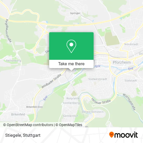
See Stiegele, Pforzheim, on the map
Public Transit to Stiegele in Pforzheim
Wondering how to get to Stiegele in Pforzheim? Moovit helps you find the best way to get to Stiegele with step-by-step directions from the nearest public transit station.
Moovit provides free maps and live directions to help you navigate through your city. View schedules, routes, timetables, and find out how long does it take to get to Stiegele in real time.
Looking for the nearest stop or station to Stiegele? Check out this list of stops closest to your destination: Pforzheim am Mühlkanal; Pforzheim Burgstraße; Brötzingen Mitte; Brötzingen Marktplatz; Arlinger Dietlinger Straße; Brötzingen Bahnhof; Pforzheim Brötzinger Brücke.
Train: MEX 17A, RB 74, RB74, S6.Light Rail: S6.Bus: 712, 715, 716, 717, 720, 721, 743, 744, 763, 916, 10, 11, 1, 9.
Want to see if there’s another route that gets you there at an earlier time? Moovit helps you find alternative routes or times. Get directions from and directions to Stiegele easily from the Moovit App or Website.
We make riding to Stiegele easy, which is why over 1.5 million users, including users in Pforzheim, trust Moovit as the best app for public transit. You don’t need to download an individual bus app or train app, Moovit is your all-in-one transit app that helps you find the best bus time or train time available.
For information on prices of bus, train and light rail, costs and ride fares to Stiegele, please check the Moovit app.
Use the app to navigate to popular places including to the airport, hospital, stadium, grocery store, mall, coffee shop, school, college, and university.
Stiegele Address: Kirchenstraße 60 75172 Pforzheim street in Pforzheim
- Wahlefeld Beteiligungs-und Verwaltungs,
- AOK - die Gesundheitskasse Kundencenter Pforzheim West,
- IBC,
- Orsuliak Petr Schwimmakademie,
- Bike Sport Höhn,
- Köstlichfein,
- Farruggio Meisterbetrieb,
- C-Vitale,
- Insurance Versicherungsmakler,
- Schaefer,
- Klavierunterricht Pforzheim,
- Peter Kuch,
- Peiter Ak,
- Fehling Gmbh,
- Heinrich Fakler Inhaber Reiner,
- Penny-markt,
- Am Mühlkanal,
- Hws Converso,
- Hwa Solar GmbH & Co.,
- Centrocura
Places Near Stiegele (Pforzheim)
- Gasometer Pforzheim, Pforzheim,
- Mercedes-Benz Museum, Bad Cannstatt,
- Wilhelma (U-Bahn Wilhelma), Bad Cannstatt,
- Geilhaus Haus 33a, Reutlingen-Betzingen,
- FlixBus Haltestelle, Stuttgart,
- Gleis 101/102 (tief), Stuttgart-Mitte,
- Pariser Platz Stuttgart, Stuttgart-Mitte,
- Mercedes-Benz Museum (Mercedes Museum Stuttgart), Bad Cannstatt,
- Hanns-Martin-Schleyer-Halle, Bad Cannstatt,
- SI-Centrum, Möhringen,
- Waldfriedhof, Degerloch,
- Mettingen Eros-Center Puff Laufhaus, Esslingen Am Neckar,
- Porsche-Arena, Bad Cannstatt,
- Schleyerhalle, Bad Cannstatt,
- Hanns-Martin-Schleyer-Halle (Stuttgart Hans-Martin-Schleyerhalle), Bad Cannstatt,
- Marmorsaal Im Weissenburgpark, Stuttgart-Süd,
- Klinikum Stuttgart - Katharinenhospital, Stuttgart-Mitte,
- Im Wizemann (Halle), Bad Cannstatt,
- Hauptbahnhof Stuttgart, Stuttgart-Mitte,
- Porsche Museum, Zuffenhausen
How to get to popular places in Stuttgart with public transit
Get around Pforzheim by public transit!
Traveling around Pforzheim has never been so easy. See step by step directions as you travel to any attraction, street or major public transit station. View bus and train schedules, arrival times, service alerts and detailed routes on a map, so you know exactly how to get to anywhere in Pforzheim.
When traveling to any destination around Pforzheim use Moovit's Live Directions with Get Off Notifications to know exactly where and how far to walk, how long to wait for your line, and how many stops are left. Moovit will alert you when it's time to get off — no need to constantly re-check whether yours is the next stop.
Wondering how to use public transit in Pforzheim or how to pay for public transit in Pforzheim? Moovit public transit app can help you navigate your way with public transit easily, and at minimum cost. It includes public transit fees, ticket prices, and costs. Looking for a map of Pforzheim public transit lines? Moovit public transit app shows all public transit maps in Pforzheim with all Bus, Train, Subway, Light Rail, Ferry, S-Bahn and Funicular routes and stops on an interactive map.
Stuttgart has 7 transit type(s), including: Bus, Train, Subway, Light Rail, Ferry, S-Bahn and Funicular, operated by several transit agencies, including SSB - Stadtbahn, SSB, SSB - Seilbahn / Zacke, S-Bahn Stuttgart, Rhein-Neckar-Verkehr GmbH (rnv), Karlsruher Verkehrsverbund, DB AG, DB Regiobus BW, Arverio Baden-Württemberg GmbH, DB RegioNetz Verkehrs GmbH Westfrankenbahn, DB Regio AG Baden-Württemberg, Südwestdeutsche Verkehrs-AG, DB Regio AG Mitte Region Hessen, DB and Bodensee-Oberschwaben-Bahn