Directions to Stips Store (Sítio Cercado) with public transportation
The following transit lines have routes that pass near Stips Store
How to get to Stips Store by bus?
Click on the bus route to see step by step directions with maps, line arrival times and updated time schedules.
From Copel - Santa Quitéria, Santa Quitéria
56 minFrom Rua Veríssimo Marques, São José Dos Pinhais
39 minFrom Jardim Botânico, Jardim Botânico
57 minFrom Estação Tubo Rebouças - Templo Maior, Rebouças
59 minFrom Avenida Iguaçu, Rebouças
56 minFrom Estação Tubo Coronel Dulcídio, Água Verde
53 minFrom Arujá, São José Dos Pinhais
98 minFrom Hospital Novo Mundo, Novo Mundo
37 minFrom Seminário, Seminário
61 minFrom Terminal Central de São José dos Pinhais, São José Dos Pinhais
30 min
Bus stops near Stips Store in Sítio Cercado
Bus lines to Stips Store in Sítio Cercado
- 534 PARIGOT DE SOUZA, Terminal Sítio Cercado → Terminal Boqueirão,VIEW
- 545 TRABALHADOR, Terminal Boqueirão → Terminal Fazendinha,VIEW
- 549 MAD. BAIRRO NOVO, Terminal Boqueirão → Bairro Novo,VIEW
- X12 ESPECIAL BOQUEIRÃO, Terminal Boqueirão → Terminal Sítio Cercado,VIEW
- 502 CIRCULAR SUL (HORÁRIO), Sentido Horário,VIEW
- 524 BAIRRO NOVO B / C, BAIRRO NOVO B / C,VIEW
- 547 BAIRRO NOVO C, BAIRRO NOVO C,VIEW
- 689 MAD. SÃO PEDRO / RIO NEGRO, Praça Rui Barbosa ↺ São Pedro / Rio Negro (Circular),VIEW
- 602 CIRCULAR SUL (ANTI-HORÁRIO), Terminal Sítio Cercado → Terminal Boqueirão,VIEW
- 519 MAD. SÃO FRANCISCO / IGUAPE, Terminal Hauer ↺ São Francisco / Iguape (Circular),VIEW
- 625 GRAMADOS, Terminal Capão Raso → Terminal Sítio Cercado,VIEW
What are the closest stations to Stips Store?
The closest stations to Stips Store are:
- R. Izaac Ferreira Da Cruz, 725 is 16 meters away, 1 min walk.
- Érico Veríssimo is 303 meters away, 5 min walk.
- Rua Cidade De Ouro, 514-610 is 347 meters away, 5 min walk.
- R. David Tows, 1833 is 384 meters away, 6 min walk.
- Coqueiros is 408 meters away, 6 min walk.
- R. Dos Pioneiros, 2500 is 502 meters away, 7 min walk.
- R. Marte, 130 is 531 meters away, 8 min walk.
Which bus lines stop near Stips Store?
These bus lines stop near Stips Store: 534 PARIGOT DE SOUZA, 545 TRABALHADOR, 625 GRAMADOS.
What’s the nearest bus station to Stips Store in Sítio Cercado?
The nearest bus station to Stips Store in Sítio Cercado is R. Izaac Ferreira Da Cruz, 725. It’s a 1 min walk away.
What time is the first bus to Stips Store in Sítio Cercado?
The 549 MAD. BAIRRO NOVO is the first bus that goes to Stips Store in Sítio Cercado. It stops nearby at 3:01 AM.
What time is the last bus to Stips Store in Sítio Cercado?
The 689 MAD. SÃO PEDRO / RIO NEGRO is the last bus that goes to Stips Store in Sítio Cercado. It stops nearby at 3:11 AM.
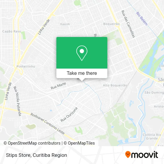
See Stips Store, Sítio Cercado, on the map
Public Transit to Stips Store in Sítio Cercado
Wondering how to get to Stips Store in Sítio Cercado? Moovit helps you find the best way to get to Stips Store with step-by-step directions from the nearest public transit station.
Moovit provides free maps and live directions to help you navigate through your city. View schedules, routes, timetables, and find out how long does it take to get to Stips Store in real time.
Looking for the nearest stop or station to Stips Store? Check out this list of stops closest to your destination: R. Izaac Ferreira Da Cruz; Érico Veríssimo; Rua Cidade De Ouro; R. David Tows; Coqueiros; R. Dos Pioneiros; R. Marte.
Bus: 534 PARIGOT DE SOUZA, 545 TRABALHADOR, 625 GRAMADOS, 549 MAD. BAIRRO NOVO, X12 ESPECIAL BOQUEIRÃO, 502 CIRCULAR SUL (HORÁRIO), 524 BAIRRO NOVO B / C, 547 BAIRRO NOVO C, 689 MAD. SÃO PEDRO / RIO NEGRO, 602 CIRCULAR SUL (ANTI-HORÁRIO), 519 MAD. SÃO FRANCISCO / IGUAPE.
Want to see if there’s another route that gets you there at an earlier time? Moovit helps you find alternative routes or times. Get directions from and directions to Stips Store easily from the Moovit App or Website.
We make riding to Stips Store easy, which is why over 1.5 million users, including users in Sítio Cercado, trust Moovit as the best app for public transit. You don’t need to download an individual bus app or train app, Moovit is your all-in-one transit app that helps you find the best bus time or train time available.
For information on prices of bus, costs and ride fares to Stips Store, please check the Moovit app.
Use the app to navigate to popular places including to the airport, hospital, stadium, grocery store, mall, coffee shop, school, college, and university.
Stips Store Address: Rua Izaac Ferreira da Cruz, 4731 Sítio Cercado Curitiba-PR 81910-000 street in Sítio Cercado
- Af Costa Esportes,
- Consultório Odontológico - Dra. Dayane Balbinot,
- Construtora Project,
- Hungry Bear Burger,
- Hot-Lee Couro e Reforma,
- Atlanta Produções e Eventos,
- Pjt Construções,
- Ds Treinamentos,
- Dr Conveniências,
- B2b Tec,
- Hot-Leecouro,
- Conth Contabilidade,
- Casa das Utilidades,
- R-Closs,
- Vitorino Indústria e Comercio de Plasticos,
- Swag Tattoo,
- Ak Segurança e Inovacoes Tecnologicas,
- Boa Fase Indústria e Comercio,
- Rua Isaac Ferreira da Cruz, 726 - Sítio Cercado,
- Ponto Musical
Places Near Stips Store (Sítio Cercado)
- Hospital do Rocio, Campo,
- Pontifícia Universidade Católica do Paraná (PUCPR), Prado Velho,
- Hospital Da Cruz Vermelha, Batel,
- Hospital Angelina Caron, Campina Grande Do Sul,
- Hospital Erasto Gaertner, Jardim Das Américas,
- Arena Da Baixada - Curitiba,
- Shopping Estação, Rebouças,
- Campo Largo, Campo,
- Rua Martim Afonso 558, Mercês,
- Parque Barigui, Mercês,
- Hospital Nossa Senhora Das Graças, Mercês,
- Hospital Universitário Evangélico de Curitiba, Bigorrilho,
- Jardim Botânico de Curitiba PR, Centro,
- Park Shopping Barigüi, Mossunguê,
- Jockey Plaza Shopping Center, Tarumã,
- Hhhhh, Fazendinha,
- Rua General Mário Tourinho, Campina Do Siqueira,
- Hospital de Clínicas (HC - UFPR), Centro,
- Shopping Palladium, Portão,
- Hospital Madalena Sofia, Bairro Alto
How to get to popular places in Curitiba Region with public transit
Get around Sítio Cercado by public transit!
Traveling around Sítio Cercado has never been so easy. See step by step directions as you travel to any attraction, street or major public transit station. View bus and train schedules, arrival times, service alerts and detailed routes on a map, so you know exactly how to get to anywhere in Sítio Cercado.
When traveling to any destination around Sítio Cercado use Moovit's Live Directions with Get Off Notifications to know exactly where and how far to walk, how long to wait for your line, and how many stops are left. Moovit will alert you when it's time to get off — no need to constantly re-check whether yours is the next stop.
Wondering how to use public transit in Sítio Cercado or how to pay for public transit in Sítio Cercado? Moovit public transit app can help you navigate your way with public transit easily, and at minimum cost. It includes public transit fees, ticket prices, and costs. Looking for a map of Sítio Cercado public transit lines? Moovit public transit app shows all public transit maps in Sítio Cercado with all Bus and Cable Car routes and stops on an interactive map.
Curitiba Region has 2 transit type(s), including: Bus and Cable Car, operated by several transit agencies, including Sistema Integrado de Mobilidade (URBS), Sistema Integrado de Mobilidade (AMEP), URBS (Cartões bancários e Dinheiro), URBS (Cartões bancários / Cartão URBS), AMEP (Cartões bancários / Cartão MetroCard), AMEP (Cartões bancários / Cartão MetroCard / Dinheiro), Viação Colombo (Dinheiro), TRIAR (Cartão TRIAR / Dinheiro), Empresa Curitiba Cerro Azul (Dinheiro), Expresso Nossa Senhora da Penha (Dinheiro), Empresa Campo Alto Tijucas (Dinheiro), Auto Viação São José (Cartão VEM / Dinheiro), BRT S/A (Cartão VEM / Dinheiro), TransPiedade (Cartão Cidadão / Dinheiro) and Oceânica Sul (Cartão Transporte / Dinheiro)