How to get to Stony Run Park by bus?
Click on the bus route to see step by step directions with maps, line arrival times and updated time schedules.
From Hilton Baltimore, Baltimore
53 minFrom Light Rail-Timonium Fairgrounds, Baltimore County
62 minFrom The Johns Hopkins Hospital, Baltimore
55 minFrom I-695 @ Exit 17 (Security Blvd/MD 122), Baltimore County
82 minFrom Medstar Harbor Hospital, Baltimore
64 minFrom Baltimore City Circuit Court, Baltimore
47 minFrom I-695 @ Exit 18 (Liberty Rd/MD 26), Baltimore County
66 minFrom Eastern Ave (eastern avenue and dundalk av), Baltimore
87 minFrom Federal Hill, Baltimore
52 minFrom I-83 Exit 5 (Maryland Ave/Charles St), Baltimore
29 min
Bus stops near Stony Run Park in Baltimore
Light Rail stations near Stony Run Park in Baltimore
- Mt. Washington, 20 min walk,VIEW
Bus lines to Stony Run Park in Baltimore
What are the closest stations to Stony Run Park?
The closest stations to Stony Run Park are:
- Roland Ave & Oakdale Rd Sb is 405 yards away, 5 min walk.
- Cold Spring Ln& Atwick Rd Eb is 527 yards away, 7 min walk.
- Charles St & Coldspring Ln Sb is 542 yards away, 7 min walk.
- Mt. Washington is 1656 yards away, 20 min walk.
Which bus lines stop near Stony Run Park?
These bus lines stop near Stony Run Park: 28, 51, 95.
What’s the nearest light rail station to Stony Run Park in Baltimore?
The nearest light rail station to Stony Run Park in Baltimore is Mt. Washington. It’s a 20 min walk away.
What’s the nearest bus station to Stony Run Park in Baltimore?
The nearest bus station to Stony Run Park in Baltimore is Roland Ave & Oakdale Rd Sb. It’s a 5 min walk away.
What time is the first light rail to Stony Run Park in Baltimore?
The LIGHT RAILLINK is the first light rail that goes to Stony Run Park in Baltimore. It stops nearby at 4:26 AM.
What time is the last light rail to Stony Run Park in Baltimore?
The LIGHT RAILLINK is the last light rail that goes to Stony Run Park in Baltimore. It stops nearby at 1:09 AM.
What time is the first bus to Stony Run Park in Baltimore?
The 28 is the first bus that goes to Stony Run Park in Baltimore. It stops nearby at 5:00 AM.
What time is the last bus to Stony Run Park in Baltimore?
The 28 is the last bus that goes to Stony Run Park in Baltimore. It stops nearby at 12:54 AM.
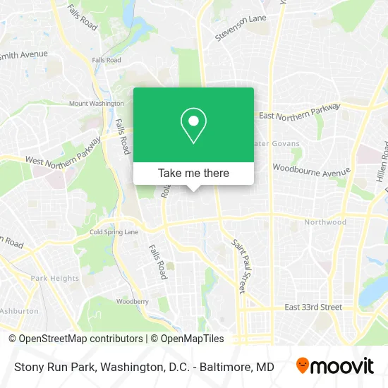
See Stony Run Park, Baltimore, on the map
Public Transit to Stony Run Park in Baltimore
Wondering how to get to Stony Run Park in Baltimore? Moovit helps you find the best way to get to Stony Run Park with step-by-step directions from the nearest public transit station.
Moovit provides free maps and live directions to help you navigate through your city. View schedules, routes, timetables, and find out how long does it take to get to Stony Run Park in real time.
Looking for the nearest stop or station to Stony Run Park? Check out this list of stops closest to your destination: Roland Ave & Oakdale Rd Sb; Cold Spring Ln& Atwick Rd Eb; Charles St & Coldspring Ln Sb; Mt. Washington.
Bus: 28, 51, 95.
Want to see if there’s another route that gets you there at an earlier time? Moovit helps you find alternative routes or times. Get directions from and directions to Stony Run Park easily from the Moovit App or Website.
We make riding to Stony Run Park easy, which is why over 1.7 million users, including users in Baltimore, trust Moovit as the best app for public transit. You don’t need to download an individual bus app or train app, Moovit is your all-in-one transit app that helps you find the best bus time or train time available.
For information on prices of bus and light rail, costs and ride fares to Stony Run Park, please check the Moovit app.
Use the app to navigate to popular places including to the airport, hospital, stadium, grocery store, mall, coffee shop, school, college, and university.
Stony Run Park Address: 1 Oakdale Rd street in Baltimore
- City Church Baltimore,
- Notre Dame Of Maryland University,
- Roland Park,
- Roland Park, Maryland,
- Loyola University Maryland,
- 10 West Eager Street,
- Roland Park Elementary / Middle School,
- Loyola University Maryland - Undergraduate Admission,
- Cathedral of Mary Our Queen,
- Woodlawn High School,
- Gilman School,
- W. Cold Spring Ln And Falls Rd Intersection,
- Western High School,
- Centennial Park,
- 700,W 40th St W 40th St,
- Keswick Multi-Care Center,
- Giant Food Stores,
- Roland Park Place,
- Guilford,
- Baltimore Poly Tech High School
Places Near Stony Run Park (Baltimore)
- National Theatre, Washington,
- The Anthem, Washington,
- Marriott Marquis Washington, DC, Washington,
- Warner Theatre, Washington,
- Basilica of the National Shrine, Washington,
- Washington DC VA Medical Center, Washington,
- PG Mall, Prince George's County,
- National Zoo, Washington,
- Amazon Hq2, Arlington County,
- National Museum of African American History and Culture, Washington,
- M&T Bank Stadium, Baltimore,
- Camden Yards, Baltimore,
- Rock Creek Tennis Center, Washington,
- Washington National Cathedral, Washington,
- Capital One Arena, Washington,
- Georgetown, Washington,
- Museum Of The Bible, Washington,
- Westfield Montgomery Mall, Montgomery County,
- Pennsylvania Ave NW (3rd st and pennsylvania), Washington,
- Sibley Memorial Hospital, Washington
How to get to popular places in Washington, D.C. - Baltimore, MD with public transit
Get around Baltimore by public transit!
Traveling around Baltimore has never been so easy. See step by step directions as you travel to any attraction, street or major public transit station. View bus and train schedules, arrival times, service alerts and detailed routes on a map, so you know exactly how to get to anywhere in Baltimore.
When traveling to any destination around Baltimore use Moovit's Live Directions with Get Off Notifications to know exactly where and how far to walk, how long to wait for your line, and how many stops are left. Moovit will alert you when it's time to get off — no need to constantly re-check whether yours is the next stop.
Wondering how to use public transit in Baltimore or how to pay for public transit in Baltimore? Moovit public transit app can help you navigate your way with public transit easily, and at minimum cost. It includes public transit fees, ticket prices, and costs. Looking for a map of Baltimore public transit lines? Moovit public transit app shows all public transit maps in Baltimore with all Bus, Train, Metro, Light Rail and Ferry routes and stops on an interactive map.
Washington, D.C. - Baltimore, MD has 5 transit type(s), including: Bus, Train, Metro, Light Rail and Ferry, operated by several transit agencies, including WMATA, Montgomery County Ride On, Fairfax Connector, TheBus, PRTC, DASH - Alexandria, Arlington Transit (ART), RTA of Central Maryland, MDOT MTA, MDOT MTA Light RailLink, MDOT MTA Commuter Bus, MDOT MTA Local Bus, FXBGO!, Virginia Railway Express (VRE) and MARC