How to get to Storchen by bus?
Click on the bus route to see step by step directions with maps, line arrival times and updated time schedules.
From D 78333 Stockach, Verwaltungsgemeinschaft Stockach
88 minFrom Stadtwerke Villingen-Schwenningen GmbH, Villingen-Schwenningen
71 minFrom Antiquariat Trenkle, Aach
170 minFrom Waldeck Spa, Bad Dürrheim
61 minFrom Bauhaus Villingen-Schwenningen, Villingen-Schwenningen
95 minFrom Aachbad Singen, Verwaltungsgemeinschaft Singen (Hohentwiel)
211 minFrom Helios Klinik Rottweil-Notaufnahme, Rottweil
120 min
How to get to Storchen by train?
Click on the train route to see step by step directions with maps, line arrival times and updated time schedules.
Bus stops near Storchen in Verwaltungsgemeinschaft Trossingen
Train stations near Storchen in Verwaltungsgemeinschaft Trossingen
- Trossingen Stadtbahnhof, 4 min walk,VIEW
Bus lines to Storchen in Verwaltungsgemeinschaft Trossingen
What are the closest stations to Storchen?
The closest stations to Storchen are:
- Trossingen Im Tal is 80 meters away, 2 min walk.
- Trossingen Ernst-Haller-Straße is 114 meters away, 2 min walk.
- Trossingen Stadtbahnhof is 225 meters away, 4 min walk.
- Trossingen Hauptstraße is 670 meters away, 9 min walk.
Which train line stops near Storchen?
RB 42A (Trossingen Stadtbahnhof)
Which bus lines stop near Storchen?
These bus lines stop near Storchen: 115, 117, 120, 122, 140.
What’s the nearest train station to Storchen in Verwaltungsgemeinschaft Trossingen?
The nearest train station to Storchen in Verwaltungsgemeinschaft Trossingen is Trossingen Stadtbahnhof. It’s a 4 min walk away.
What’s the nearest bus station to Storchen in Verwaltungsgemeinschaft Trossingen?
The nearest bus stations to Storchen in Verwaltungsgemeinschaft Trossingen are Trossingen Im Tal and Trossingen Ernst-Haller-Straße. The closest one is a 2 min walk away.
What time is the first train to Storchen in Verwaltungsgemeinschaft Trossingen?
The RB42A is the first train that goes to Storchen in Verwaltungsgemeinschaft Trossingen. It stops nearby at 5:09 AM.
What time is the last train to Storchen in Verwaltungsgemeinschaft Trossingen?
The RB42A is the last train that goes to Storchen in Verwaltungsgemeinschaft Trossingen. It stops nearby at 12:19 AM.
What time is the first bus to Storchen in Verwaltungsgemeinschaft Trossingen?
The 115 is the first bus that goes to Storchen in Verwaltungsgemeinschaft Trossingen. It stops nearby at 4:51 AM.
What time is the last bus to Storchen in Verwaltungsgemeinschaft Trossingen?
The 115 is the last bus that goes to Storchen in Verwaltungsgemeinschaft Trossingen. It stops nearby at 8:51 PM.
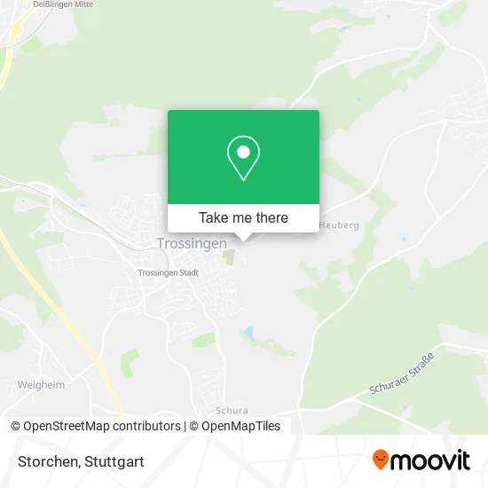
See Storchen, Verwaltungsgemeinschaft Trossingen, on the map
Public Transit to Storchen in Verwaltungsgemeinschaft Trossingen
Wondering how to get to Storchen in Verwaltungsgemeinschaft Trossingen? Moovit helps you find the best way to get to Storchen with step-by-step directions from the nearest public transit station.
Moovit provides free maps and live directions to help you navigate through your city. View schedules, routes, timetables, and find out how long does it take to get to Storchen in real time.
Looking for the nearest stop or station to Storchen? Check out this list of stops closest to your destination: Trossingen Im Tal; Trossingen Ernst-Haller-Straße; Trossingen Stadtbahnhof; Trossingen Hauptstraße.
Train: RB 42A, SEV, RB42A.Bus: 115, 117, 120, 122, 140, 142, 147, 160.
Want to see if there’s another route that gets you there at an earlier time? Moovit helps you find alternative routes or times. Get directions from and directions to Storchen easily from the Moovit App or Website.
We make riding to Storchen easy, which is why over 1.5 million users, including users in Verwaltungsgemeinschaft Trossingen, trust Moovit as the best app for public transit. You don’t need to download an individual bus app or train app, Moovit is your all-in-one transit app that helps you find the best bus time or train time available.
For information on prices of bus and train, costs and ride fares to Storchen, please check the Moovit app.
Use the app to navigate to popular places including to the airport, hospital, stadium, grocery store, mall, coffee shop, school, college, and university.
Storchen Address: Im Tal 42 78647 Trossingen street in Verwaltungsgemeinschaft Trossingen
- Traumfüsse-VS Gudrun Heimrath,
- F.b. Bau-Elite,
- Raunacht,
- Dlrg,
- Beauty- & Gesundheitsservices,
- Ute Müller - Kleiderschrankcheck,
- Monika Kirschning Ingenieurbüro für Baustatik,
- Förderverein Schwimmsport Trossingen,
- Kerzenhaus Mok,
- Trossingen,
- A.Maier Gerüstverleih,
- Reitstall und Hobbygeflügelzucht am Trosselbach,
- Eichkorn,
- Altes Rat- und Schulhaus,
- Bernhard Dudyk Plasmatec,
- City Kino Werner Martin,
- Angelone-Wellness,
- Lebenshaus Trossingen,
- Tomas Montage Dienst,
- Kolpingsfamilie Trossingen
Places Near Storchen (Verwaltungsgemeinschaft Trossingen)
- Klinikum Stuttgart - Katharinenhospital, Stuttgart-Mitte,
- FlixBus Haltestelle, Stuttgart,
- Marmorsaal Im Weissenburgpark, Stuttgart-Süd,
- Mettingen Eros-Center Puff Laufhaus, Esslingen Am Neckar,
- Mercedes-Benz Museum (Mercedes Museum Stuttgart), Bad Cannstatt,
- Im Wizemann (Halle), Bad Cannstatt,
- Hanns-Martin-Schleyer-Halle, Bad Cannstatt,
- Schleyerhalle, Bad Cannstatt,
- Gasometer Pforzheim, Pforzheim,
- Geilhaus Haus 33a, Reutlingen-Betzingen,
- SI-Centrum, Möhringen,
- Gleis 101/102 (tief), Stuttgart-Mitte,
- Mercedes-Benz Museum, Bad Cannstatt,
- Hauptbahnhof Stuttgart, Stuttgart-Mitte,
- Hanns-Martin-Schleyer-Halle (Stuttgart Hans-Martin-Schleyerhalle), Bad Cannstatt,
- Wilhelma (U-Bahn Wilhelma), Bad Cannstatt,
- Waldfriedhof, Degerloch,
- Porsche-Arena, Bad Cannstatt,
- Pariser Platz Stuttgart, Stuttgart-Mitte,
- Porsche Museum, Zuffenhausen
How to get to popular places in Stuttgart with public transit
Get around Verwaltungsgemeinschaft Trossingen by public transit!
Traveling around Verwaltungsgemeinschaft Trossingen has never been so easy. See step by step directions as you travel to any attraction, street or major public transit station. View bus and train schedules, arrival times, service alerts and detailed routes on a map, so you know exactly how to get to anywhere in Verwaltungsgemeinschaft Trossingen.
When traveling to any destination around Verwaltungsgemeinschaft Trossingen use Moovit's Live Directions with Get Off Notifications to know exactly where and how far to walk, how long to wait for your line, and how many stops are left. Moovit will alert you when it's time to get off — no need to constantly re-check whether yours is the next stop.
Wondering how to use public transit in Verwaltungsgemeinschaft Trossingen or how to pay for public transit in Verwaltungsgemeinschaft Trossingen? Moovit public transit app can help you navigate your way with public transit easily, and at minimum cost. It includes public transit fees, ticket prices, and costs. Looking for a map of Verwaltungsgemeinschaft Trossingen public transit lines? Moovit public transit app shows all public transit maps in Verwaltungsgemeinschaft Trossingen with all Bus, Train, Subway, Light Rail, Ferry, S-Bahn and Funicular routes and stops on an interactive map.
Stuttgart has 7 transit type(s), including: Bus, Train, Subway, Light Rail, Ferry, S-Bahn and Funicular, operated by several transit agencies, including SSB - Stadtbahn, SSB, SSB - Seilbahn / Zacke, S-Bahn Stuttgart, Rhein-Neckar-Verkehr GmbH (rnv), Karlsruher Verkehrsverbund, DB AG, DB Regiobus BW, Arverio Baden-Württemberg GmbH, DB RegioNetz Verkehrs GmbH Westfrankenbahn, DB Regio AG Baden-Württemberg, Südwestdeutsche Verkehrs-AG, DB Regio AG Mitte Region Hessen, DB and Bodensee-Oberschwaben-Bahn