How to get to Store by bus?
Click on the bus route to see step by step directions with maps, line arrival times and updated time schedules.
Train station near Store in Aulla
- Aulla Lunigiana, 23 min walk,VIEW
Bus lines to Store in Aulla
- L16, Aulla-Villafranca-Pontremoli,VIEW
- L22, Bagnone-Villafranca-Aulla,VIEW
- L26, Aulla-Castello Di Comano,VIEW
- L27, Aulla-Barbarasco-Villecchia,VIEW
- L28, Aulla-Barbarasco-Novegigola-Aulla,VIEW
- L30, Aulla-Moncigoli-Fivizzano-Sassalbo,VIEW
- L34, Aulla-Quercia-Olivola-Aulla,VIEW
- L37, Aulla-Gorasco,VIEW
- L100, School Service Licciana,VIEW
- L105, Tresana School Service,VIEW
- L17, Aulla-Sarzana-Carrara-Massa,VIEW
- L23, Aulla-Cerreto Laghi,VIEW
- L33, Aulla-Fivizzano-Equi Terme,VIEW
- L106, Aulla-La Spezia Muggiano,VIEW
- L18, Aulla-Caprigliola-Ceparana Industrial Zone,VIEW
- L19, Pontremoli-Aulla-Highway-Noa,VIEW
- L29, Aulla-Metti-Loppiedo,VIEW
- L31, Aulla-Serricciolo-Agnino-Fivizzano,VIEW
- L32, Aulla-Passo Dei Carpinelli,VIEW
- L36, Aulla-Vecchietto,VIEW
What are the closest stations to Store?
The closest stations to Store are:
- Resistance Street Pharmacy is 70 meters away, 1 min walk.
- Aulla is 152 meters away, 2 min walk.
- Aulla Lunigiana is 1748 meters away, 23 min walk.
Which bus lines stop near Store?
These bus lines stop near Store: L17, L34.
Which train line stops near Store?
R (Parma/Piacenza/Milano)
What’s the nearest train station to Store in Aulla?
The nearest train station to Store in Aulla is Aulla Lunigiana. It’s a 23 min walk away.
What’s the nearest bus station to Store in Aulla?
The nearest bus station to Store in Aulla is Resistance Street Pharmacy. It’s a 1 min walk away.
What time is the first train to Store in Aulla?
The R is the first train that goes to Store in Aulla. It stops nearby at 5:57 AM.
What time is the last train to Store in Aulla?
The R is the last train that goes to Store in Aulla. It stops nearby at 10:32 PM.
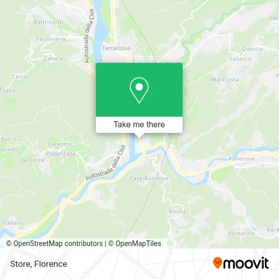
See Store, Aulla, on the map
Public Transit to Store in Aulla
Wondering how to get to Store in Aulla? Moovit helps you find the best way to get to Store with step-by-step directions from the nearest public transit station.
Moovit provides free maps and live directions to help you navigate through your city. View schedules, routes, timetables, and find out how long does it take to get to Store in real time.
Looking for the nearest stop or station to Store? Check out this list of stops closest to your destination: Resistance Street Pharmacy; Aulla; Aulla Lunigiana.
Bus: L17, L34, L16, L22, L26, L27, L28, L16, L23, L26, L33, L18, L19, L23, L29.Train: R.
Want to see if there’s another route that gets you there at an earlier time? Moovit helps you find alternative routes or times. Get directions from and directions to Store easily from the Moovit App or Website.
We make riding to Store easy, which is why over 1.5 million users, including users in Aulla, trust Moovit as the best app for public transit. You don’t need to download an individual bus app or train app, Moovit is your all-in-one transit app that helps you find the best bus time or train time available.
For information on prices of train and bus, costs and ride fares to Store, please check the Moovit app.
Use the app to navigate to popular places including to the airport, hospital, stadium, grocery store, mall, coffee shop, school, college, and university.
Store Address: Piazza Bettino Craxi, 54011 Aulla street in Aulla
- Frattini Antonio,
- Franco Hairdresser,
- Valettini & Associates Legal Studio,
- I.C.E.S.,
- Adorni Avv. Enrico,
- Bersanelli Enrico Engineering Studio,
- Eliane Footwear,
- Vannini Maurizio Ottavio,
- GM Punto Casa,
- Qiu Yixiao,
- Trocadero Bar,
- Hu Yongyin,
- Silvana Musetti Psychologist,
- Green Shop Aulla,
- Associated Studio of Dr. Gianluigi Lungo and Dr. Ugo Gabrielli Accountants,
- Intimiimi Woman/Man,
- Albatros,
- Gelomare by Giuseppe Mazzanti & Co.,
- March Gardens,
- Bianchi Stefano
Places Near Store (Aulla)
- Visarno Arena, Florence,
- Michelangelo Square, Florence,
- Campi Bisenzio, Campi Bisenzio,
- Santa Maria Novella Station, Florence,
- Mandela Forum (Nelson Mandela Forum), Florence,
- Field of Mars, Florence,
- Cascine Park, Florence,
- Santa Maria Nuova Hospital, Florence,
- Torregalli Hospital Scandicci *, Scandicci,
- Visarno Hippodrome, Florence,
- OOO, Florence,
- Piero Palagi Hospital Facility-Florence, Florence,
- Nelson Mandela Forum, Florence,
- Verdi Theater, Florence,
- Tobacco Manufacture, Florence,
- I Gigli, Campi Bisenzio,
- Asmana, Campi Bisenzio,
- Michelangelo Square, Florence,
- Artemio Franchi Municipal Stadium, Florence,
- IKEA Florence, Sesto Fiorentino
How to get to popular places in Florence with public transit
Get around Aulla by public transit!
Traveling around Aulla has never been so easy. See step by step directions as you travel to any attraction, street or major public transit station. View bus and train schedules, arrival times, service alerts and detailed routes on a map, so you know exactly how to get to anywhere in Aulla.
When traveling to any destination around Aulla use Moovit's Live Directions with Get Off Notifications to know exactly where and how far to walk, how long to wait for your line, and how many stops are left. Moovit will alert you when it's time to get off — no need to constantly re-check whether yours is the next stop.
Wondering how to use public transit in Aulla or how to pay for public transit in Aulla? Moovit public transit app can help you navigate your way with public transit easily, and at minimum cost. It includes public transit fees, ticket prices, and costs. Looking for a map of Aulla public transit lines? Moovit public transit app shows all public transit maps in Aulla with all Bus, Train, Light Rail, Ferry and Funicular routes and stops on an interactive map.
Florence has 5 transit type(s), including: Bus, Train, Light Rail, Ferry and Funicular, operated by several transit agencies, including Florence Urban - Tuscan Bus Lines, GEST, Livorno and Province - Tuscan Bus Lines, Arezzo, Florence and Provinces - Tuscan Bus Lines, Prato and Province - Tuscan Bus Lines, Lucca and Province - Tuscan Bus Lines, Massa, Carrara and Province - Tuscan Bus Lines, Pisa and Province - Tuscan Bus Lines, Grosseto, Siena and Provinces - Tuscan Bus Lines, Arezzo, Siena and Provinces - Tuscan Bus Lines, Florence and Province - Tuscan Bus Lines, Pistoia and Province - Tuscan Bus Lines, Siena and Province - Tuscan Bus Lines, Arezzo and Province - Tuscan Bus Lines and Trenitalia