How to get to Stralka by bus?
Click on the bus route to see step by step directions with maps, line arrival times and updated time schedules.
From HYATT house Washington DC/the Wharf, Washington
66 minFrom Springhill Suites Alexandria Old Town/Southwest, Alexandria
57 minFrom The Pentagon, Arlington County
89 minFrom Hains Point, Washington
99 minFrom Uspto, Alexandria
42 minFrom Army-Navy Country Club (ARL), Arlington County
96 minFrom DoubleTree by Hilton Hotel Washington DC-Crystal City, Arlington County
103 minFrom Nationals Park, Washington
52 minFrom Navy Yard, Washington
59 minFrom Pendry Washington DC - the Wharf, Washington
65 min
Bus stops near Stralka in Prince George's County
Bus lines to Stralka in Prince George's County
What are the closest stations to Stralka?
The closest stations to Stralka are:
- Oxon Hill Rd+Pipers Glen Ln is 313 yards away, 4 min walk.
- National Harbor Blvd & St. George Blvd is 2208 yards away, 27 min walk.
Which bus lines stop near Stralka?
These bus lines stop near Stralka: P90, P96, P97.
What’s the nearest bus station to Stralka in Prince George's County?
The nearest bus station to Stralka in Prince George's County is Oxon Hill Rd+Pipers Glen Ln. It’s a 4 min walk away.
What time is the first bus to Stralka in Prince George's County?
The P97 is the first bus that goes to Stralka in Prince George's County. It stops nearby at 4:52 AM.
What time is the last bus to Stralka in Prince George's County?
The P96 is the last bus that goes to Stralka in Prince George's County. It stops nearby at 12:46 AM.
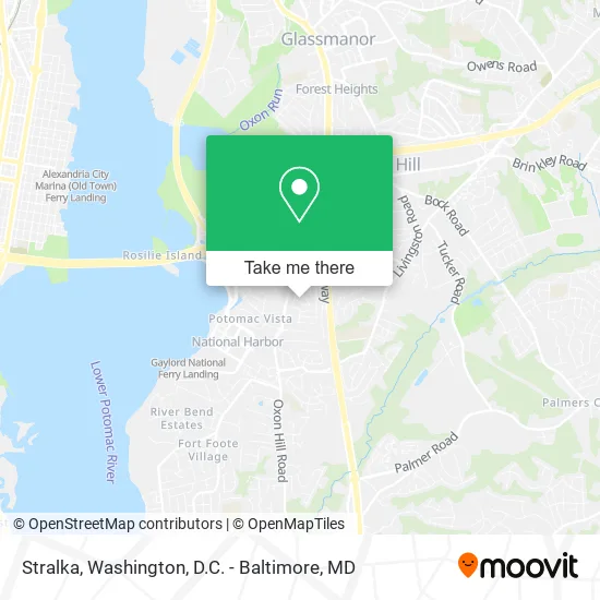
See Stralka, Prince George's County, on the map
Public Transit to Stralka in Prince George's County
Wondering how to get to Stralka in Prince George's County? Moovit helps you find the best way to get to Stralka with step-by-step directions from the nearest public transit station.
Moovit provides free maps and live directions to help you navigate through your city. View schedules, routes, timetables, and find out how long does it take to get to Stralka in real time.
Looking for the nearest stop or station to Stralka? Check out this list of stops closest to your destination: Oxon Hill Rd+Pipers Glen Ln; National Harbor Blvd & St. George Blvd.
Bus: P90, P96, P97, 610, 620, 640, 650.
Want to see if there’s another route that gets you there at an earlier time? Moovit helps you find alternative routes or times. Get directions from and directions to Stralka easily from the Moovit App or Website.
We make riding to Stralka easy, which is why over 1.5 million users, including users in Prince George's County, trust Moovit as the best app for public transit. You don’t need to download an individual bus app or train app, Moovit is your all-in-one transit app that helps you find the best bus time or train time available.
For information on prices of bus and metro, costs and ride fares to Stralka, please check the Moovit app.
Use the app to navigate to popular places including to the airport, hospital, stadium, grocery store, mall, coffee shop, school, college, and university.
Stralka Address: 323 Brockton Rd Oxon Hill, MD 20745 street in Prince George's County
- Faulkner Lawn Care & Landscape,
- River Ridge Estates, Maryland,
- Fowler Laundry 437,
- Stylesbynihh,
- Simply the Best Construction,
- LG Appliance Repair,
- Betty Blume Park,
- KLB Home Repair Services,
- MGM National Harbor Development,
- MD 210 / Wilson Bridge Drive,
- Oxon Hill Commuter Park & Ride,
- Crescent Ridge Adult Day Health Center,
- Indian Head Highway (MD 210),
- Richard G Pombrio,
- Tanger Outlets-West,
- Mariby Corpening,
- St John Knits,
- Furlough Cheesecake,
- Upscale,
- American Job Centers
Places Near Stralka (Prince George's County)
- PG Mall, Prince George's County,
- Washington National Cathedral, Washington,
- Museum Of The Bible, Washington,
- Westfield Montgomery Mall, Montgomery County,
- Marriott Marquis Washington, DC, Washington,
- Washington DC VA Medical Center, Washington,
- Amazon Hq2, Arlington County,
- National Museum of African American History and Culture, Washington,
- National Theatre, Washington,
- Sibley Memorial Hospital, Washington,
- M&T Bank Stadium, Baltimore,
- The Anthem, Washington,
- Basilica of the National Shrine, Washington,
- Rock Creek Tennis Center, Washington,
- Capital One Arena, Washington,
- Camden Yards, Baltimore,
- Georgetown, Washington,
- National Zoo, Washington,
- Pennsylvania Ave NW (3rd st and pennsylvania), Washington,
- Warner Theatre, Washington
How to get to popular places in Washington, D.C. - Baltimore, MD with public transit
Get around Prince George's County by public transit!
Traveling around Prince George's County has never been so easy. See step by step directions as you travel to any attraction, street or major public transit station. View bus and train schedules, arrival times, service alerts and detailed routes on a map, so you know exactly how to get to anywhere in Prince George's County.
When traveling to any destination around Prince George's County use Moovit's Live Directions with Get Off Notifications to know exactly where and how far to walk, how long to wait for your line, and how many stops are left. Moovit will alert you when it's time to get off — no need to constantly re-check whether yours is the next stop.
Wondering how to use public transit in Prince George's County or how to pay for public transit in Prince George's County? Moovit public transit app can help you navigate your way with public transit easily, and at minimum cost. It includes public transit fees, ticket prices, and costs. Looking for a map of Prince George's County public transit lines? Moovit public transit app shows all public transit maps in Prince George's County with all Bus, Train, Metro, Light Rail and Ferry routes and stops on an interactive map.
Washington, D.C. - Baltimore, MD has 5 transit type(s), including: Bus, Train, Metro, Light Rail and Ferry, operated by several transit agencies, including WMATA, Montgomery County Ride On, Fairfax Connector, TheBus, PRTC, DASH - Alexandria, Arlington Transit (ART), RTA of Central Maryland, MDOT MTA, MDOT MTA Light RailLink, MDOT MTA Commuter Bus, MDOT MTA Local Bus, FXBGO!, Virginia Railway Express (VRE) and MARC