How to get to Strategic Design by bus?
Click on the bus route to see step by step directions with maps, line arrival times and updated time schedules.
From Les Folies Bergère, Paris
42 minFrom Paris Gare de Lyon, Paris
43 minFrom Le Zénith, Paris
81 minFrom Institut du Monde Arabe, Paris
47 minFrom Clinique de Bercy, Charenton-Le-Pont
68 minFrom Philharmonie de Paris, Paris
82 minFrom Rue de Patay, Paris
51 minFrom Rosa Parks, Paris
62 minFrom Clinique de la Porte Verte, Versailles
85 minFrom Hôpital Trousseau, Paris
62 min
How to get to Strategic Design by metro?
Click on the metro route to see step by step directions with maps, line arrival times and updated time schedules.
From Les Folies Bergère, Paris
29 minFrom Paris Gare de Lyon, Paris
34 minFrom Le Zénith, Paris
56 minFrom Institut du Monde Arabe, Paris
43 minFrom Clinique de Bercy, Charenton-Le-Pont
62 minFrom Philharmonie de Paris, Paris
47 minFrom Rue de Patay, Paris
43 minFrom Rosa Parks, Paris
48 minFrom Hôpital Trousseau, Paris
47 min
Metro station near Strategic Design in Paris
- Michel-Ange - Auteuil, 3 min walk,VIEW
Bus stops near Strategic Design in Paris
RER station near Strategic Design in Paris
- Boulainvilliers, 7 min walk,VIEW
Bus lines to Strategic Design in Paris
What are the closest stations to Strategic Design?
The closest stations to Strategic Design are:
- Michel-Ange - Auteuil is 203 meters away, 3 min walk.
- Chaussée de la Muette is 240 meters away, 4 min walk.
- Ranelagh is 270 meters away, 4 min walk.
- Avenue Ingres is 434 meters away, 6 min walk.
- Boulainvilliers is 493 meters away, 7 min walk.
- Porte de Passy is 574 meters away, 8 min walk.
Which metro line stops near Strategic Design?
9 (Pont de Sèvres)
Which bus lines stop near Strategic Design?
These bus lines stop near Strategic Design: 32, 52, 62, 63, 72.
What’s the nearest metro station to Strategic Design in Paris?
The nearest metro station to Strategic Design in Paris is Michel-Ange - Auteuil. It’s a 3 min walk away.
What’s the nearest bus station to Strategic Design in Paris?
The nearest bus stations to Strategic Design in Paris are Chaussée de la Muette and Ranelagh. The closest one is a 4 min walk away.
What’s the nearest RER station to Strategic Design in Paris?
The nearest RER station to Strategic Design in Paris is Boulainvilliers. It’s a 7 min walk away.
What time is the first metro to Strategic Design in Paris?
The 9 is the first metro that goes to Strategic Design in Paris. It stops nearby at 5:33 AM.
What time is the last metro to Strategic Design in Paris?
The 9 is the last metro that goes to Strategic Design in Paris. It stops nearby at 1:12 AM.
What time is the first bus to Strategic Design in Paris?
The PC is the first bus that goes to Strategic Design in Paris. It stops nearby at 6:20 AM.
What time is the last bus to Strategic Design in Paris?
The 32 is the last bus that goes to Strategic Design in Paris. It stops nearby at 1:05 AM.
What time is the first RER to Strategic Design in Paris?
The C is the first RER that goes to Strategic Design in Paris. It stops nearby at 5:37 AM.
What time is the last RER to Strategic Design in Paris?
The C is the last RER that goes to Strategic Design in Paris. It stops nearby at 12:22 AM.
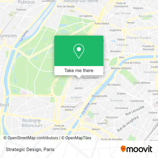
See Strategic Design, Paris, on the map
Public Transit to Strategic Design in Paris
Wondering how to get to Strategic Design in Paris? Moovit helps you find the best way to get to Strategic Design with step-by-step directions from the nearest public transit station.
Moovit provides free maps and live directions to help you navigate through your city. View schedules, routes, timetables, and find out how long does it take to get to Strategic Design in real time.
Looking for the nearest stop or station to Strategic Design? Check out this list of stops closest to your destination: Michel-Ange - Auteuil; Chaussée de la Muette; Ranelagh; Avenue Ingres; Boulainvilliers; Porte de Passy.
RER: C.Metro: 9, 10.Bus: 32, 52, 62, 63, 72, 70, 22, PC.
Want to see if there’s another route that gets you there at an earlier time? Moovit helps you find alternative routes or times. Get directions from and directions to Strategic Design easily from the Moovit App or Website.
We make riding to Strategic Design easy, which is why over 1.5 million users, including users in Paris, trust Moovit as the best app for public transit. You don’t need to download an individual bus app or train app, Moovit is your all-in-one transit app that helps you find the best bus time or train time available.
For information on prices of metro, bus and RER, costs and ride fares to Strategic Design, please check the Moovit app.
Use the app to navigate to popular places including to the airport, hospital, stadium, grocery store, mall, coffee shop, school, college, and university.
Strategic Design Address: 55 Rue de l'Assomption 75016 Paris street in Paris
- Play Connection,
- Golf First,
- Serezo Avocat,
- Mozart Sushi,
- Apprends et Rêve,
- Commissariat de Police,
- E.M.Pu Prokofiev,
- Pressing Mozart,
- Sarl Gauter,
- Fischer Jean-Christian,
- Centre International de Psychosomatique C.I.P.S,
- Agence Apolline Terrier - Architecture Intérieure Paris,
- Serrurerie Mozart,
- Crèche Collective,
- Ecole Maternelle Serge Prokofiev,
- La Pasta 3,
- Regard & Vous,
- S.T.A.L,
- 4 Rue Serge Prokofiev,
- La Parisienne
Places Near Strategic Design (Paris)
- Hôpital Saint-Joseph, Paris,
- Beaugrenelle, Paris,
- Galeries Lafayette, Paris,
- Hôpital Pitié Salpêtrière, Paris,
- Hôpital de la Pitié-Salpêtrière, Paris,
- Galeries Lafayette Haussmann, Paris,
- Théâtre Mogador, Paris,
- Hôpital Beaujon, Clichy,
- Hôpital Necker, Paris,
- Hôpital Henri Mondor, Creteil,
- Atelier Des Lumieres, Paris,
- Gare Routière Flixbus, Paris,
- Centre Hospitalier des 15/20, Paris,
- Hôpital Cochin, Paris,
- Fondation Louis Vuitton, Paris,
- Marché Saint-Pierre, Paris,
- Hopital Lariboisière, Paris,
- 29 Rue Manin, Paris,
- Hopital Foch, Suresnes,
- Créteil Soleil, Creteil
How to get to popular places in Paris with public transit
Get around Paris by public transit!
Traveling around Paris has never been so easy. See step by step directions as you travel to any attraction, street or major public transit station. View bus and train schedules, arrival times, service alerts and detailed routes on a map, so you know exactly how to get to anywhere in Paris.
When traveling to any destination around Paris use Moovit's Live Directions with Get Off Notifications to know exactly where and how far to walk, how long to wait for your line, and how many stops are left. Moovit will alert you when it's time to get off — no need to constantly re-check whether yours is the next stop.
Wondering how to use public transit in Paris or how to pay for public transit in Paris? Moovit public transit app can help you navigate your way with public transit easily, and at minimum cost. It includes public transit fees, ticket prices, and costs. Looking for a map of Paris public transit lines? Moovit public transit app shows all public transit maps in Paris with all Bus, Train, Metro, Light Rail, RER, Funicular and Gondola routes and stops on an interactive map.
Paris has 7 transit type(s), including: Bus, Train, Metro, Light Rail, RER, Funicular and Gondola, operated by several transit agencies, including RATP, RER, RER Bus de remplacement, Train, Train Bus de remplacement, Tramway Bus de remplacement, TER, ADP, Magical Shuttle, Argenteuil - Boucles de Seine, Autocars Dominique, Bièvre, Brie et 2 Morin, Le Bus - C.C. du Clermontois and Cœur d’Essonne