How to get to Streams Inc by bus?
Click on the bus route to see step by step directions with maps, line arrival times and updated time schedules.
From St John's College High School, Washington
76 minFrom Millie’S, Washington
48 minFrom George H.W. Bush Center For Intelligence (CIA Headquarters), Fairfax County
505 minFrom Silver Spring, Maryland, Montgomery County
58 minFrom Holy Cross Hospital, Montgomery County
59 minFrom Glenstone Museum, Montgomery County
88 minFrom Silver Spring Civic Building (Silver Spring Civic Center), Montgomery County
63 minFrom Consulado General de El Salvador en El Dmv, Montgomery County
68 minFrom Massachusetts Ave NW, Washington
51 min
Bus stops near Streams Inc in Montgomery County
Bus lines to Streams Inc in Montgomery County
What are the closest stations to Streams Inc?
The closest stations to Streams Inc are:
- Fernwood Rd+Thomas Spring Wy is 353 yards away, 5 min walk.
- Fernwood Rd & Camalier Bldg is 354 yards away, 5 min walk.
- Fernwood Rd & Camalier Bldg Nb is 358 yards away, 5 min walk.
- Democracy Bv & Fernwood Rd is 468 yards away, 6 min walk.
- Rock Spring Dr & Fernwood Rd is 572 yards away, 7 min walk.
Which bus lines stop near Streams Inc?
These bus lines stop near Streams Inc: 47, 798, M70.
What’s the nearest bus station to Streams Inc in Montgomery County?
The nearest bus stations to Streams Inc in Montgomery County are Fernwood Rd+Thomas Spring Wy, Fernwood Rd & Camalier Bldg and Fernwood Rd & Camalier Bldg Nb. The closest one is a 5 min walk away.
What time is the first bus to Streams Inc in Montgomery County?
The 26 is the first bus that goes to Streams Inc in Montgomery County. It stops nearby at 4:26 AM.
What time is the last bus to Streams Inc in Montgomery County?
The M70 is the last bus that goes to Streams Inc in Montgomery County. It stops nearby at 2:14 AM.
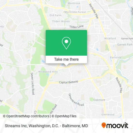
See Streams Inc, Montgomery County, on the map
Public Transit to Streams Inc in Montgomery County
Wondering how to get to Streams Inc in Montgomery County? Moovit helps you find the best way to get to Streams Inc with step-by-step directions from the nearest public transit station.
Moovit provides free maps and live directions to help you navigate through your city. View schedules, routes, timetables, and find out how long does it take to get to Streams Inc in real time.
Looking for the nearest stop or station to Streams Inc? Check out this list of stops closest to your destination: Fernwood Rd+Thomas Spring Wy; Fernwood Rd & Camalier Bldg; Fernwood Rd & Camalier Bldg Nb; Democracy Bv & Fernwood Rd; Rock Spring Dr & Fernwood Rd.
Bus: 47, 798, M70, 505, 515, 96, 6, 26.
Want to see if there’s another route that gets you there at an earlier time? Moovit helps you find alternative routes or times. Get directions from and directions to Streams Inc easily from the Moovit App or Website.
We make riding to Streams Inc easy, which is why over 1.5 million users, including users in Montgomery County, trust Moovit as the best app for public transit. You don’t need to download an individual bus app or train app, Moovit is your all-in-one transit app that helps you find the best bus time or train time available.
For information on prices of bus and metro, costs and ride fares to Streams Inc, please check the Moovit app.
Use the app to navigate to popular places including to the airport, hospital, stadium, grocery store, mall, coffee shop, school, college, and university.
Streams Inc Address: 6701 Democracy Blvd Bethesda, MD 20817 street in Montgomery County
- SJT Improvement Services LLC,
- RE/MAX,
- Pbi2,
- 3rd Party Delivery,
- Nannies,
- Business Objects Americas,
- Radiant Innovative,
- April Muzzatti - Intuit Turbotax Verified Pro,
- The Credle Group,
- Ameriprise Financial,
- Grtcompany,
- Quality Innovation,
- Lifestyle Paving & Masonry,
- Grandview Sales,
- JC & AS Entertainment,
- Travelsfare,
- Renewme Fitness,
- Symantec Corporation,
- Bethesda Mortgage,
- Guaranteed Rate
Places Near Streams Inc (Montgomery County)
- Capital One Arena, Washington,
- Warner Theatre, Washington,
- Georgetown, Washington,
- PG Mall, Prince George's County,
- National Zoo, Washington,
- Sibley Memorial Hospital, Washington,
- Pennsylvania Ave NW (3rd st and pennsylvania), Washington,
- National Mall, Washington,
- Amazon Hq2, Arlington County,
- The Anthem, Washington,
- Museum Of The Bible, Washington,
- National Museum of African American History and Culture, Washington,
- Basilica of the National Shrine, Washington,
- Washington DC VA Medical Center, Washington,
- M&T Bank Stadium, Baltimore,
- Camden Yards, Baltimore,
- Marriott Marquis Washington, DC, Washington,
- Westfield Montgomery Mall, Montgomery County,
- Washington National Cathedral, Washington,
- Rock Creek Tennis Center, Washington
How to get to popular places in Washington, D.C. - Baltimore, MD with public transit
Get around Montgomery County by public transit!
Traveling around Montgomery County has never been so easy. See step by step directions as you travel to any attraction, street or major public transit station. View bus and train schedules, arrival times, service alerts and detailed routes on a map, so you know exactly how to get to anywhere in Montgomery County.
When traveling to any destination around Montgomery County use Moovit's Live Directions with Get Off Notifications to know exactly where and how far to walk, how long to wait for your line, and how many stops are left. Moovit will alert you when it's time to get off — no need to constantly re-check whether yours is the next stop.
Wondering how to use public transit in Montgomery County or how to pay for public transit in Montgomery County? Moovit public transit app can help you navigate your way with public transit easily, and at minimum cost. It includes public transit fees, ticket prices, and costs. Looking for a map of Montgomery County public transit lines? Moovit public transit app shows all public transit maps in Montgomery County with all Bus, Train, Metro, Light Rail and Ferry routes and stops on an interactive map.
Washington, D.C. - Baltimore, MD has 5 transit type(s), including: Bus, Train, Metro, Light Rail and Ferry, operated by several transit agencies, including WMATA, Montgomery County Ride On, Fairfax Connector, TheBus, PRTC, DASH - Alexandria, Arlington Transit (ART), RTA of Central Maryland, MDOT MTA, MDOT MTA Light RailLink, MDOT MTA Commuter Bus, MDOT MTA Local Bus, FXBGO!, Virginia Railway Express (VRE) and MARC