Directions to Stretchlab (Arlington County) with public transportation
The following transit lines have routes that pass near Stretchlab
 Bus: 33, 43, A11, A1X, 598.
- Train: MANASSAS LINE, FREDERICKSBURG LINE.
- Metro: YELLOW, BLUE, METRO STATION CLOSURE SHUTTLE.
How to get to Stretchlab by bus?
Click on the bus route to see step by step directions with maps, line arrival times and updated time schedules.
From Alexandria, VA, Alexandria
35 minFrom Washington Yu Ying Public Charter School, Washington
107 minFrom Rock Creek Park Tennis Center (William Hg Fitzgerald), Washington
85 minFrom William Hg Fitzgerald Tennis Center, Washington
80 minFrom Anacostia Park, Washington
163 minFrom The Home Depot, Washington
98 minFrom Citi Open, Washington
81 minFrom Supra (Supra Restaurant), Washington
63 minFrom Embassy of the Philippines DC USA, Washington
59 minFrom British Embassy, Washington
100 min
How to get to Stretchlab by train?
Click on the train route to see step by step directions with maps, line arrival times and updated time schedules.
How to get to Stretchlab by metro?
Click on the metro route to see step by step directions with maps, line arrival times and updated time schedules.
Bus stops near Stretchlab in Arlington County
Train station near Stretchlab in Arlington County
- Crystal City, 2 min walk,VIEW
Metro station near Stretchlab in Arlington County
- Crystal City, 6 min walk,VIEW
Bus lines to Stretchlab in Arlington County
- 598, 598 Pentagon - Crystal City,VIEW
- A11, Pentagon-Huntington,VIEW
- A27, Pentagon-Shirlington-Van Dorn St,VIEW
- A40, Columbia Pike-National Landing,VIEW
- A66, Pentagon-Shirlington-Culmore,VIEW
- A1X, South To Braddock Rd,VIEW
- 42, Ballston - Pentagon,VIEW
- 74, Arlington Village - Arlington View - Pentagon City,VIEW
- 84, Douglas Park - Nauck - Pentagon City,VIEW
- 87, Pentagon Metro - Army Navy Drive - Shirlington,VIEW
What are the closest stations to Stretchlab?
The closest stations to Stretchlab are:
- 15th St S @ South Hayes St is 58 yards away, 1 min walk.
- 15 St S+S Grant St is 87 yards away, 2 min walk.
- Crystal City is 130 yards away, 2 min walk.
- Pentagon City+Bay A is 235 yards away, 3 min walk.
- S Hayes St Sb @ 12th St S FS is 353 yards away, 5 min walk.
Which bus lines stop near Stretchlab?
These bus lines stop near Stretchlab: 33, 43, A11, A1X.
Which train line stops near Stretchlab?
MANASSAS LINE (Broad Run)
Which metro line stops near Stretchlab?
YELLOW (Huntington)
What’s the nearest metro station to Stretchlab in Arlington County?
The nearest metro station to Stretchlab in Arlington County is Crystal City. It’s a 6 min walk away.
What’s the nearest train station to Stretchlab in Arlington County?
The nearest train station to Stretchlab in Arlington County is Crystal City. It’s a 2 min walk away.
What’s the nearest bus station to Stretchlab in Arlington County?
The nearest bus station to Stretchlab in Arlington County is 15th St S @ South Hayes St. It’s a 1 min walk away.
What time is the first metro to Stretchlab in Arlington County?
The YELLOW is the first metro that goes to Stretchlab in Arlington County. It stops nearby at 5:13 AM.
What time is the last metro to Stretchlab in Arlington County?
The BLUE is the last metro that goes to Stretchlab in Arlington County. It stops nearby at 12:24 AM.
What time is the first train to Stretchlab in Arlington County?
The MANASSAS LINE is the first train that goes to Stretchlab in Arlington County. It stops nearby at 6:04 AM.
What time is the last train to Stretchlab in Arlington County?
The MANASSAS LINE is the last train that goes to Stretchlab in Arlington County. It stops nearby at 7:15 PM.
What time is the first bus to Stretchlab in Arlington County?
The A11 is the first bus that goes to Stretchlab in Arlington County. It stops nearby at 4:58 AM.
What time is the last bus to Stretchlab in Arlington County?
The A40 is the last bus that goes to Stretchlab in Arlington County. It stops nearby at 2:15 AM.
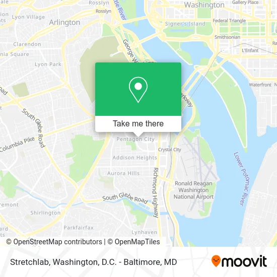
See Stretchlab, Arlington County, on the map
Public Transit to Stretchlab in Arlington County
Wondering how to get to Stretchlab in Arlington County? Moovit helps you find the best way to get to Stretchlab with step-by-step directions from the nearest public transit station.
Moovit provides free maps and live directions to help you navigate through your city. View schedules, routes, timetables, and find out how long does it take to get to Stretchlab in real time.
Looking for the nearest stop or station to Stretchlab? Check out this list of stops closest to your destination: 15th St S @ South Hayes St; 15 St S+S Grant St; Crystal City; Pentagon City+Bay A; S Hayes St Sb @ 12th St S FS.
Bus: 33, 43, A11, A1X, 598, A27, A40, A66, 42, 74, 84, 87.Train: MANASSAS LINE, FREDERICKSBURG LINE.Metro: YELLOW, BLUE, METRO STATION CLOSURE SHUTTLE.
Want to see if there’s another route that gets you there at an earlier time? Moovit helps you find alternative routes or times. Get directions from and directions to Stretchlab easily from the Moovit App or Website.
We make riding to Stretchlab easy, which is why over 1.5 million users, including users in Arlington County, trust Moovit as the best app for public transit. You don’t need to download an individual bus app or train app, Moovit is your all-in-one transit app that helps you find the best bus time or train time available.
For information on prices of bus, metro and train, costs and ride fares to Stretchlab, please check the Moovit app.
Use the app to navigate to popular places including to the airport, hospital, stadium, grocery store, mall, coffee shop, school, college, and university.
Stretchlab Address: 721 15th St S Arlington, VA 22202 street in Arlington County
- The Athlete's Foot,
- The Sleep Number Store by Select Comfort,
- Best Buy,
- Marshalls,
- Chevys Fresh Mex,
- Marketplace Café,
- Pentagon Centre (Pentagon City Mall),
- Best Buy-Pentagon City,
- California Pizza Kitchen Pentagon Centre,
- AT&T,
- Credit Union 1,
- Costco Wholesale,
- Nordstrom (Nordstrom The Fashion Centre at Pentagon City),
- Tesla Supercharger,
- The Ritz-Carlton Pentagon City,
- Wiseguy Pizza,
- The Grill at THR Ritz-Carlton Pentagon City,
- Celebree School,
- Compassionate Therapy Center,
- Post Office
Places Near Stretchlab (Arlington County)
- Marriott Marquis Washington, DC, Washington,
- National Mall, Washington,
- Museum Of The Bible, Washington,
- National Zoo, Washington,
- Camden Yards, Baltimore,
- Rock Creek Tennis Center, Washington,
- The Anthem, Washington,
- Basilica of the National Shrine, Washington,
- National Museum of African American History and Culture, Washington,
- Warner Theatre, Washington,
- Georgetown, Washington,
- Sibley Memorial Hospital, Washington,
- Amazon Hq2, Arlington County,
- Washington National Cathedral, Washington,
- Washington DC VA Medical Center, Washington,
- Capital One Arena, Washington,
- Westfield Montgomery Mall, Montgomery County,
- M&T Bank Stadium, Baltimore,
- Pennsylvania Ave NW (3rd st and pennsylvania), Washington,
- PG Mall, Prince George's County
How to get to popular places in Washington, D.C. - Baltimore, MD with public transit
Get around Arlington County by public transit!
Traveling around Arlington County has never been so easy. See step by step directions as you travel to any attraction, street or major public transit station. View bus and train schedules, arrival times, service alerts and detailed routes on a map, so you know exactly how to get to anywhere in Arlington County.
When traveling to any destination around Arlington County use Moovit's Live Directions with Get Off Notifications to know exactly where and how far to walk, how long to wait for your line, and how many stops are left. Moovit will alert you when it's time to get off — no need to constantly re-check whether yours is the next stop.
Wondering how to use public transit in Arlington County or how to pay for public transit in Arlington County? Moovit public transit app can help you navigate your way with public transit easily, and at minimum cost. It includes public transit fees, ticket prices, and costs. Looking for a map of Arlington County public transit lines? Moovit public transit app shows all public transit maps in Arlington County with all Bus, Train, Metro, Light Rail and Ferry routes and stops on an interactive map.
Washington, D.C. - Baltimore, MD has 5 transit type(s), including: Bus, Train, Metro, Light Rail and Ferry, operated by several transit agencies, including WMATA, Montgomery County Ride On, Fairfax Connector, TheBus, PRTC, DASH - Alexandria, Arlington Transit (ART), RTA of Central Maryland, MDOT MTA, MDOT MTA Light RailLink, MDOT MTA Commuter Bus, MDOT MTA Local Bus, FXBGO!, Virginia Railway Express (VRE) and MARC