How to get to Strong Auto Collision by bus?
Click on the bus route to see step by step directions with maps, line arrival times and updated time schedules.
From Miami Dade College Hialeah Campus, Hialeah
67 minFrom Miami Northwestern Senior High School, Miami
57 minFrom Hialeah, FL, Hialeah
75 minFrom Pembroke Pines, FL, Miramar-Pembroke Pines
64 minFrom NW 79th St / NW 7th Ave, Miami
45 minFrom Amelia Earhart Park, Miami
75 minFrom Hollywood Blvd & 441, Hollywood
70 minFrom Walmart, Miami
49 minFrom Miami Florida, Miami
76 minFrom Social Security Administration, Miramar-Pembroke Pines
82 min
Bus stops near Strong Auto Collision in Miami
Train station near Strong Auto Collision in Miami
- Opa-Locka Station, 55 min walk,VIEW
Bus lines to Strong Auto Collision in Miami
What are the closest stations to Strong Auto Collision?
The closest stations to Strong Auto Collision are:
- Nw 27 Av & Nw 165 Te is 89 yards away, 2 min walk.
- Nw 27 Av & Nw 159 St is 869 yards away, 11 min walk.
- Nw 22 Av & Nw 167 St is 966 yards away, 12 min walk.
- Opa-Locka Station is 4698 yards away, 55 min walk.
Which bus line stops near Strong Auto Collision?
27 (27 - M. Gardens NW 207 St)
What’s the nearest bus station to Strong Auto Collision in Miami?
The nearest bus station to Strong Auto Collision in Miami is Nw 27 Av & Nw 165 Te. It’s a 2 min walk away.
What time is the first train to Strong Auto Collision in Miami?
The TRIRAIL is the first train that goes to Strong Auto Collision in Miami. It stops nearby at 4:02 AM.
What time is the last train to Strong Auto Collision in Miami?
The TRIRAIL is the last train that goes to Strong Auto Collision in Miami. It stops nearby at 10:29 PM.
What time is the first bus to Strong Auto Collision in Miami?
The 401 is the first bus that goes to Strong Auto Collision in Miami. It stops nearby at 3:13 AM.
What time is the last bus to Strong Auto Collision in Miami?
The 27 is the last bus that goes to Strong Auto Collision in Miami. It stops nearby at 2:59 AM.
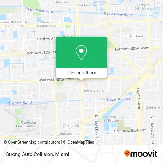
See Strong Auto Collision, Miami, on the map
Public Transit to Strong Auto Collision in Miami
Wondering how to get to Strong Auto Collision in Miami? Moovit helps you find the best way to get to Strong Auto Collision with step-by-step directions from the nearest public transit station.
Moovit provides free maps and live directions to help you navigate through your city. View schedules, routes, timetables, and find out how long does it take to get to Strong Auto Collision in real time.
Looking for the nearest stop or station to Strong Auto Collision? Check out this list of stops closest to your destination: Nw 27 Av & Nw 165 Te; Nw 27 Av & Nw 159 St; Nw 22 Av & Nw 167 St; Opa-Locka Station.
Bus: 27, OPALCKA, OPALKAN, 17, 401.Train: TRIRAIL.
Want to see if there’s another route that gets you there at an earlier time? Moovit helps you find alternative routes or times. Get directions from and directions to Strong Auto Collision easily from the Moovit App or Website.
We make riding to Strong Auto Collision easy, which is why over 1.5 million users, including users in Miami, trust Moovit as the best app for public transit. You don’t need to download an individual bus app or train app, Moovit is your all-in-one transit app that helps you find the best bus time or train time available.
For information on prices of bus and train, costs and ride fares to Strong Auto Collision, please check the Moovit app.
Use the app to navigate to popular places including to the airport, hospital, stadium, grocery store, mall, coffee shop, school, college, and university.
Strong Auto Collision Address: 16571 NW 27th Ave Opa-Locka, FL 33054 street in Miami
- Mabel Gonzalez Reyes Villate Gonzalez Insurance,
- BTS Trading,
- Alibaba Urban Hookah,
- Coast To Coast Wireles,
- Boost Mobile,
- WING STOP,
- Halftime Sports Bar & Grill,
- Family Day Care HOM,
- T-Mobile,
- One Stop Munch Shack,
- Cellmart Communication,
- Centro Biblico Puertas de Sion,
- Newman's Barber Shop,
- Butterflyshi Nails,
- Florida Builders Group,
- Eternal Life Ministries,
- Lost Sock Laundromat - Miami Gardens,
- Palmetto & 27th Ave Exit,
- Coin Cloud DCM,
- Uhealth Jackson Urgent Care - North Dade
Places Near Strong Auto Collision (Miami)
- Marlins Park, Miami,
- Bayside Marketplace, Miami,
- Dolphin Mall, Miami,
- Sawgrass mall ( FL ), Miami Beach,
- Miami-Dade County Courthouse, Miami,
- Aventura Mall, Miami,
- Miami Design District, Miami,
- Keiser University Flagship Campus, West Palm Beach,
- Brickell City Centre, Miami,
- Sawgrass Mall, Miami,
- Wynwood, Miami,
- Little Havana, Miami,
- Hard Rock Stadium, Miami Gardens,
- Richard E. Gerstein Justice Building, Miami,
- Dolphin Mall Bus, Miami,
- Zoo Miami, Miami,
- Aventura Mall, Miami Beach,
- 1351 NW 12th St, Miami,
- Miami Freedom Park, Miami,
- Port of Miami Cruise Terminal, Miami
How to get to popular places in Miami with public transit
Get around Miami by public transit!
Traveling around Miami has never been so easy. See step by step directions as you travel to any attraction, street or major public transit station. View bus and train schedules, arrival times, service alerts and detailed routes on a map, so you know exactly how to get to anywhere in Miami.
When traveling to any destination around Miami use Moovit's Live Directions with Get Off Notifications to know exactly where and how far to walk, how long to wait for your line, and how many stops are left. Moovit will alert you when it's time to get off — no need to constantly re-check whether yours is the next stop.
Wondering how to use public transit in Miami or how to pay for public transit in Miami? Moovit public transit app can help you navigate your way with public transit easily, and at minimum cost. It includes public transit fees, ticket prices, and costs. Looking for a map of Miami public transit lines? Moovit public transit app shows all public transit maps in Miami with all Bus, Train, Light Rail and Ferry routes and stops on an interactive map.
Miami has 4 transit type(s), including: Bus, Train, Light Rail and Ferry, operated by several transit agencies, including Broward County Transit, Miami-Dade Transit, Metrorail, Palm Tran, Tri-Rail, Brightline, MARTY, City of Homestead Trolley, Key West Transit, Treasure Coast Connector, GoLine IRT, Amtrak, Greyhound-us, FlixBus-us and Aventura Express Shuttle Bus