Directions to Stronger Helper (Hagerstown) with public transportation
The following transit lines have routes that pass near Stronger Helper
How to get to Stronger Helper by bus?
Click on the bus route to see step by step directions with maps, line arrival times and updated time schedules.
From Clarksburg Premium Outlets, Montgomery County
363 minFrom Montgomery County Fairgrounds, Montgomery County
180 minFrom Germantown, Maryland, Montgomery County
197 minFrom Clarksburg Premium Outlets, Montgomery County
406 minFrom Walmart Supercenter, Montgomery County
234 minFrom Kentlands, Montgomery County
184 minFrom Montgomery Village, Maryland, Montgomery County
192 minFrom Kaiser Permanente - Gaithersburg Medical Center, Montgomery County
181 min
Bus stops near Stronger Helper in Hagerstown
Bus lines to Stronger Helper in Hagerstown
What are the closest stations to Stronger Helper?
The closest stations to Stronger Helper are:
- Conomar Drive is 1096 yards away, 13 min walk.
- Y.M.C.A. is 1190 yards away, 15 min walk.
Which bus line stops near Stronger Helper?
PREMIUM OUTLETS (Transfer Center)
What’s the nearest bus station to Stronger Helper in Hagerstown?
The nearest bus station to Stronger Helper in Hagerstown is Conomar Drive. It’s a 13 min walk away.
What time is the first bus to Stronger Helper in Hagerstown?
The LONG MEADOW VIA LOCUST is the first bus that goes to Stronger Helper in Hagerstown. It stops nearby at 7:05 AM.
What time is the last bus to Stronger Helper in Hagerstown?
The LONG MEADOW NIGHT RUN is the last bus that goes to Stronger Helper in Hagerstown. It stops nearby at 8:35 PM.
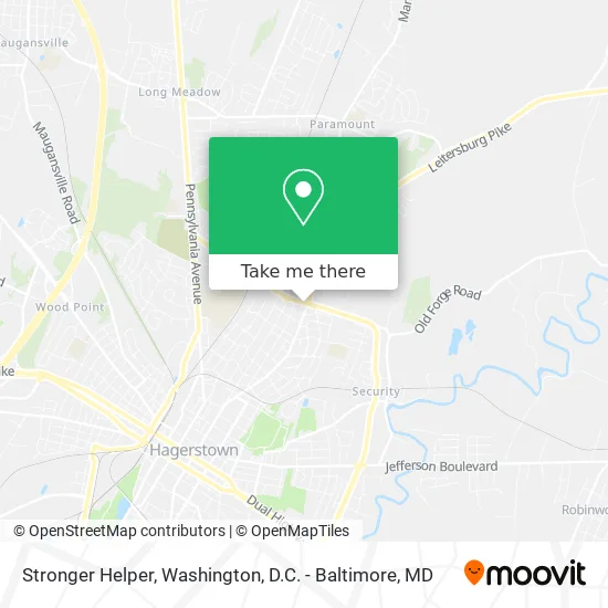
See Stronger Helper, Hagerstown, on the map
Public Transit to Stronger Helper in Hagerstown
Wondering how to get to Stronger Helper in Hagerstown? Moovit helps you find the best way to get to Stronger Helper with step-by-step directions from the nearest public transit station.
Moovit provides free maps and live directions to help you navigate through your city. View schedules, routes, timetables, and find out how long does it take to get to Stronger Helper in real time.
Looking for the nearest stop or station to Stronger Helper? Check out this list of stops closest to your destination: Conomar Drive; Y.M.C.A..
Bus: PREMIUM OUTLETS, LONG MEADOW VIA LOCUST, LONG MEADOW NIGHT RUN, LONG MEADOW VIA EASTERN.
Want to see if there’s another route that gets you there at an earlier time? Moovit helps you find alternative routes or times. Get directions from and directions to Stronger Helper easily from the Moovit App or Website.
We make riding to Stronger Helper easy, which is why over 1.5 million users, including users in Hagerstown, trust Moovit as the best app for public transit. You don’t need to download an individual bus app or train app, Moovit is your all-in-one transit app that helps you find the best bus time or train time available.
For information on prices of bus, costs and ride fares to Stronger Helper, please check the Moovit app.
Use the app to navigate to popular places including to the airport, hospital, stadium, grocery store, mall, coffee shop, school, college, and university.
Stronger Helper Address: Potomac Ave Hagerstown, MD 21742 street in Hagerstown
- Hughes Performance Painting,
- Minute Key,
- Aetna,
- Rankin Physical Therapy,
- Bitcoin ATM Coinhub,
- 12817 Shank Farm Way,
- Standard Register,
- Cortland Apartments Leasing Office,
- Amazon Locker-Escarpment,
- Farmers Insurance - Deanna Mason,
- Center for Dermatology: Erik Hurst, MD,
- Johns Hopkins Community Physicians,
- Sarita Sharma MD,
- First Action Security Team,
- Stump Grinding,
- Vida Dental,
- Michele Emmett LCPC,
- Clark Computer Services,
- Golden Sands Tanning Center,
- FM Seamstress and Curtains Designer LLC
Places Near Stronger Helper (Hagerstown)
- M&T Bank Stadium, Baltimore,
- Marriott Marquis Washington, DC, Washington,
- Warner Theatre, Washington,
- Rock Creek Tennis Center, Washington,
- Georgetown, Washington,
- Westfield Montgomery Mall, Montgomery County,
- Museum Of The Bible, Washington,
- The Anthem, Washington,
- National Zoo, Washington,
- Washington DC VA Medical Center, Washington,
- Pennsylvania Ave NW (3rd st and pennsylvania), Washington,
- Basilica of the National Shrine, Washington,
- Washington National Cathedral, Washington,
- PG Mall, Prince George's County,
- Amazon Hq2, Arlington County,
- National Museum of African American History and Culture, Washington,
- Sibley Memorial Hospital, Washington,
- Capital One Arena, Washington,
- Camden Yards, Baltimore,
- National Mall, Washington
How to get to popular places in Washington, D.C. - Baltimore, MD with public transit
Get around Hagerstown by public transit!
Traveling around Hagerstown has never been so easy. See step by step directions as you travel to any attraction, street or major public transit station. View bus and train schedules, arrival times, service alerts and detailed routes on a map, so you know exactly how to get to anywhere in Hagerstown.
When traveling to any destination around Hagerstown use Moovit's Live Directions with Get Off Notifications to know exactly where and how far to walk, how long to wait for your line, and how many stops are left. Moovit will alert you when it's time to get off — no need to constantly re-check whether yours is the next stop.
Wondering how to use public transit in Hagerstown or how to pay for public transit in Hagerstown? Moovit public transit app can help you navigate your way with public transit easily, and at minimum cost. It includes public transit fees, ticket prices, and costs. Looking for a map of Hagerstown public transit lines? Moovit public transit app shows all public transit maps in Hagerstown with all Bus, Train, Metro, Light Rail and Ferry routes and stops on an interactive map.
Washington, D.C. - Baltimore, MD has 5 transit type(s), including: Bus, Train, Metro, Light Rail and Ferry, operated by several transit agencies, including WMATA, Montgomery County Ride On, Fairfax Connector, TheBus, PRTC, DASH - Alexandria, Arlington Transit (ART), RTA of Central Maryland, MDOT MTA, MDOT MTA Light RailLink, MDOT MTA Commuter Bus, MDOT MTA Local Bus, FXBGO!, Virginia Railway Express (VRE) and MARC