Directions to Stuart, Florida with public transportation
The following transit lines have routes that pass near Stuart, Florida
 Bus: 1, 3.
How to get to Stuart, Florida by bus?
Click on the bus route to see step by step directions with maps, line arrival times and updated time schedules.
Bus stops near Stuart, Florida
- US 1 & KANNER HWY, 8 min walk,
- KIWANIS P-N-R (DOWNTOWN), 15 min walk,
Bus lines to Stuart, Florida
- 1, Robert Morgade Library,
- 3, Indian St,
What are the closest stations to Stuart, Florida?
The closest stations to Stuart, Florida are:
- US 1 & KANNER HWY stop is 655 yards away, 8 min walk.
- KIWANIS P-N-R (DOWNTOWN) stop is 1219 yards away, 15 min walk.
Which bus line stops near Stuart, Florida?
1 (Walmart)
What’s the nearest bus station to Stuart, Florida?
The nearest bus station to Stuart, Florida is US 1 & KANNER HWY. It’s a 8 min walk away.
What time is the first bus to Stuart, Florida?
The 1 is the first bus that goes to Stuart, Florida. It stops nearby at 6:11 AM.
What time is the last bus to Stuart, Florida?
The 3 is the last bus that goes to Stuart, Florida. It stops nearby at 7:52 PM.
See Stuart, Florida on the map
Public Transportation to Stuart, Florida
Wondering how to get to Stuart, Florida? Moovit helps you find the best way to get to Stuart, Florida with step-by-step directions from the nearest public transit station.
Moovit provides free maps and live directions to help you navigate through your city. View schedules, routes, timetables, and find out how long does it take to get to Stuart, Florida in real time.
Looking for the nearest stop or station to Stuart, Florida? Check out this list of stops closest to your destination: US 1 & KANNER HWY; KIWANIS P-N-R (DOWNTOWN).
Bus: 1, 3.
Want to see if there’s another route that gets you there at an earlier time? Moovit helps you find alternative routes or times. Get directions from and directions to Stuart, Florida easily from the Moovit App or Website.
We make riding to Stuart, Florida easy, which is why over 1.7 billion users, including users in Stuart, trust Moovit as the best app for public transit. You don’t need to download an individual bus app or train app, Moovit is your all-in-one transit app that helps you find the best bus time or train time available.
For information on prices of bus, costs and ride fares to Stuart, Florida, please check the Moovit app.
Get to Stuart, Florida with public transit and pay for the ride in the Moovit app. In addition to all info you may need for your trip to Stuart, Florida, including live directions, real-time arrivals and fare prices, you can also buy public transit passes for your rides. No need for cash or paper tickets to get to Stuart, Florida - everything you need is accessible in the app with a click of the button.
Use the app to navigate to popular places including to the airport, hospital, stadium, grocery store, mall, coffee shop, school, college, and university.
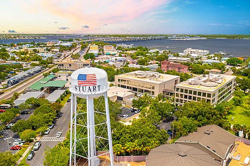
Stuart, Florida Address: Martin, FL street in Stuart
- Premier Port Transfers,
- Daniel Markley - Realtor,
- Stemlessfaceoff Podcast,
- Personal Injury & Mass Tort Claims - Tortadvisor,
- Shanna Neece Realtor,
- Danielle Sabatello- Make-Up Artist,
- Steven Crissien - Uplevel Marketer,
- Celtic Golf,
- Kirsty Smith Innis -Artist,
- Marinemax - Stuart,
- Zeroed In Marketing,
- Crunchi,
- Paver Pros,
- Fin Vs Fin,
- Thomas Mackay - Realtor,
- Stuart Center For Laser Periodontics & Implants,
- Cosmic Barley,
- Culinary Genie,
- Xtreme Rod Bags,
- Truckstop Hooligans
Places Near Stuart, Florida
- Miami Freedom Park, Miami,
- Sawgrass Mall, Miami,
- Miami Design District, Miami,
- Miami VA Hospital, Miami,
- Aventura Mall, Miami,
- Hard Rock Stadium, Miami Gardens,
- Dolphin Mall, Miami,
- Marlins Park, Miami,
- Brickell City Centre, Miami,
- Sawgrass mall ( FL ), Miami Beach,
- Miami-Dade County Courthouse, Miami,
- Wynwood, Miami,
- Keiser University Flagship Campus, West Palm Beach,
- Port of Miami Cruise Terminal, Miami,
- 1351 NW 12th St, Miami,
- Dolphin Mall Bus, Miami,
- Little Havana, Miami,
- Bayside Marketplace, Miami,
- Zoo Miami, Miami,
- Richard E. Gerstein Justice Building, Miami
How to get to popular places in Miami with public transit
Get around Stuart by public transit!
Traveling around Stuart has never been so easy. See step by step directions as you travel to any attraction, street or major public transit station. View bus and train schedules, arrival times, service alerts and detailed routes on a map, so you know exactly how to get to anywhere in Stuart.
When traveling to any destination around Stuart use Moovit's Live Directions with Get Off Notifications to know exactly where and how far to walk, how long to wait for your line, and how many stops are left. Moovit will alert you when it's time to get off — no need to constantly re-check whether yours is the next stop.
Wondering how to use public transit in Stuart or how to pay for public transit in Stuart? Moovit public transit app can help you navigate your way with public transit easily, and at minimum cost. It includes public transit fees, ticket prices, and costs. Looking for a map of Stuart public transit lines? Moovit public transit app shows all public transit maps in Stuart with all Bus, Train, Light Rail and Ferry routes and stops on an interactive map.
Miami has 4 transit type(s), including: Bus, Train, Light Rail and Ferry, operated by several transit agencies, including Broward County Transit, Miami-Dade Transit, Metrorail, Palm Tran, Tri-Rail, Brightline, MARTY, City of Homestead Trolley, Key West Transit, Treasure Coast Connector, GoLine IRT, Amtrak, Greyhound-us, FlixBus-us and Aventura Express Shuttle Bus