How to get to Stuart Services by bus?
Click on the bus route to see step by step directions with maps, line arrival times and updated time schedules.
From Massachusetts Ave NW, Washington
54 minFrom Joint Base Myer – Henderson Hall (JBMHH) | Fort Myer area, Arlington County
100 minFrom The Westin Crystal City Hotel, Arlington County
90 minFrom Fort Myer, Arlington County
99 minFrom Frederick Douglass Memorial Bridge, Washington
83 minFrom Qsa, Arlington County
95 minFrom Sofitel Washington DC Lafayette Square, Washington
42 minFrom Pentagon City Mall, Arlington County
83 minFrom Navy Memorial, Washington
41 minFrom Residence Inn by Marriott Washington Capitol Hill Navy Yard, Washington
65 min
How to get to Stuart Services by metro?
Click on the metro route to see step by step directions with maps, line arrival times and updated time schedules.
From Massachusetts Ave NW, Washington
48 minFrom The Westin Crystal City Hotel, Arlington County
34 minFrom Frederick Douglass Memorial Bridge, Washington
45 minFrom Qsa, Arlington County
36 minFrom Sofitel Washington DC Lafayette Square, Washington
27 minFrom Pentagon City Mall, Arlington County
37 minFrom Navy Memorial, Washington
24 minFrom Residence Inn by Marriott Washington Capitol Hill Navy Yard, Washington
32 min
Bus stops near Stuart Services in Washington
Metro stations near Stuart Services in Washington
Bus lines to Stuart Services in Washington
What are the closest stations to Stuart Services?
The closest stations to Stuart Services are:
- 12 St Ne+Newton St NE is 122 yards away, 2 min walk.
- Monroe St Ne+12 St NE is 225 yards away, 3 min walk.
- 10 St Ne+Michigan Av NE is 282 yards away, 4 min walk.
- Brookland Station & Bus Bay B is 323 yards away, 5 min walk.
- Georgia Ave - Petworth is 4180 yards away, 50 min walk.
- Brookland-Cua is 4692 yards away, 56 min walk.
Which bus lines stop near Stuart Services?
These bus lines stop near Stuart Services: C61, D30, D34.
Which metro line stops near Stuart Services?
RED (Glenmont)
What’s the nearest bus station to Stuart Services in Washington?
The nearest bus station to Stuart Services in Washington is 12 St Ne+Newton St NE. It’s a 2 min walk away.
What time is the first metro to Stuart Services in Washington?
The GREEN is the first metro that goes to Stuart Services in Washington. It stops nearby at 5:11 AM.
What time is the last metro to Stuart Services in Washington?
The GREEN is the last metro that goes to Stuart Services in Washington. It stops nearby at 12:33 AM.
What time is the first bus to Stuart Services in Washington?
The C61 is the first bus that goes to Stuart Services in Washington. It stops nearby at 3:00 AM.
What time is the last bus to Stuart Services in Washington?
The D30 is the last bus that goes to Stuart Services in Washington. It stops nearby at 3:19 AM.
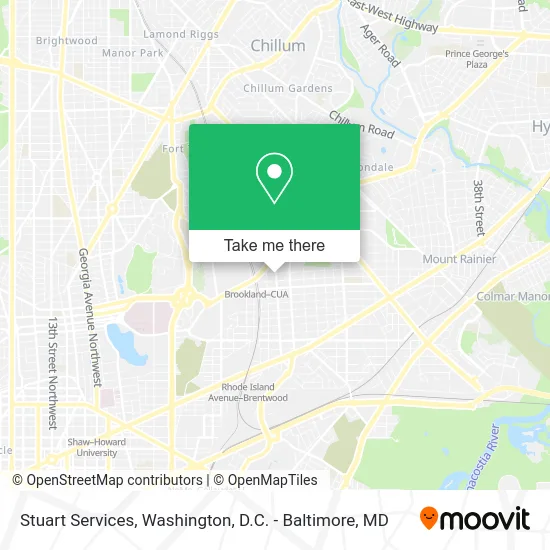
See Stuart Services, Washington, on the map
Public Transit to Stuart Services in Washington
Wondering how to get to Stuart Services in Washington? Moovit helps you find the best way to get to Stuart Services with step-by-step directions from the nearest public transit station.
Moovit provides free maps and live directions to help you navigate through your city. View schedules, routes, timetables, and find out how long does it take to get to Stuart Services in real time.
Looking for the nearest stop or station to Stuart Services? Check out this list of stops closest to your destination: 12 St Ne+Newton St NE; Monroe St Ne+12 St NE; 10 St Ne+Michigan Av NE; Brookland Station & Bus Bay B; Georgia Ave - Petworth; Brookland-Cua.
Bus: C61, D30, D34, C63, P33, D74.Metro: RED, GREEN, YELLOW.
Want to see if there’s another route that gets you there at an earlier time? Moovit helps you find alternative routes or times. Get directions from and directions to Stuart Services easily from the Moovit App or Website.
We make riding to Stuart Services easy, which is why over 1.5 million users, including users in Washington, trust Moovit as the best app for public transit. You don’t need to download an individual bus app or train app, Moovit is your all-in-one transit app that helps you find the best bus time or train time available.
For information on prices of metro and bus, costs and ride fares to Stuart Services, please check the Moovit app.
Use the app to navigate to popular places including to the airport, hospital, stadium, grocery store, mall, coffee shop, school, college, and university.
Stuart Services Address: 3628 12th St NE Washington, DC 20017 street in Washington
- Thos. D. Walsh,
- 10th St NE & Bunker Hill Rd NE,
- Runaway,
- Brookland-Cua Station & Bus Bay B,
- St. Anthony's Catholic Church,
- Comcast Training (Comcast Cable Communication),
- 80 Bus to Fort Totten,
- Luke C. Moore Opportunity Academy,
- Brookland Station,
- Children's National Brookland Parking Garage,
- Brookland-CUA Metro Station,
- RCN of Washington, DC - Brookland,
- Edgewood Arts Center,
- Turkey Thicket,
- Real Estate for Wealth LLC,
- Today's Pizza (Todays Pizza),
- Otis NE and 14th St,
- Turkey Thicket Recreation Center,
- Jared next Day Landscape & Construction (Jared next Day Hardscape & Concrete),
- Potbelly Sandwich Shop
Places Near Stuart Services (Washington)
- Camden Yards, Baltimore,
- M&T Bank Stadium, Baltimore,
- Westfield Montgomery Mall, Montgomery County,
- Georgetown, Washington,
- PG Mall, Prince George's County,
- Amazon Hq2, Arlington County,
- Washington DC VA Medical Center, Washington,
- Museum Of The Bible, Washington,
- Warner Theatre, Washington,
- Pennsylvania Ave NW (3rd st and pennsylvania), Washington,
- Sibley Memorial Hospital, Washington,
- National Museum of African American History and Culture, Washington,
- National Mall, Washington,
- Basilica of the National Shrine, Washington,
- Rock Creek Tennis Center, Washington,
- The Anthem, Washington,
- National Zoo, Washington,
- Capital One Arena, Washington,
- Marriott Marquis Washington, DC, Washington,
- Washington National Cathedral, Washington
How to get to popular places in Washington, D.C. - Baltimore, MD with public transit
Get around Washington by public transit!
Traveling around Washington has never been so easy. See step by step directions as you travel to any attraction, street or major public transit station. View bus and train schedules, arrival times, service alerts and detailed routes on a map, so you know exactly how to get to anywhere in Washington.
When traveling to any destination around Washington use Moovit's Live Directions with Get Off Notifications to know exactly where and how far to walk, how long to wait for your line, and how many stops are left. Moovit will alert you when it's time to get off — no need to constantly re-check whether yours is the next stop.
Wondering how to use public transit in Washington or how to pay for public transit in Washington? Moovit public transit app can help you navigate your way with public transit easily, and at minimum cost. It includes public transit fees, ticket prices, and costs. Looking for a map of Washington public transit lines? Moovit public transit app shows all public transit maps in Washington with all Bus, Train, Metro, Light Rail and Ferry routes and stops on an interactive map.
Washington, D.C. - Baltimore, MD has 5 transit type(s), including: Bus, Train, Metro, Light Rail and Ferry, operated by several transit agencies, including WMATA, Montgomery County Ride On, Fairfax Connector, TheBus, PRTC, DASH - Alexandria, Arlington Transit (ART), RTA of Central Maryland, MDOT MTA, MDOT MTA Light RailLink, MDOT MTA Commuter Bus, MDOT MTA Local Bus, FXBGO!, Virginia Railway Express (VRE) and MARC