How to get to Studio5 Smartcuts & Color by bus?
Click on the bus route to see step by step directions with maps, line arrival times and updated time schedules.
From Allard, Edmonton
122 minFrom Dr. Anne Anderson School, Edmonton
122 minFrom Nisku Fire District Station (Station 1), Leduc County
54 minFrom Art by Sharon Marlow, Edmonton
121 minFrom Donald R. Getty School, Edmonton
121 minFrom Nisku, Leduc County
45 minFrom The Lash Haus Yeg, Edmonton
101 minFrom City Property Services, Edmonton
123 minFrom Cartmell Road & Chappelle Road Sw, Edmonton
100 minFrom Little Learners Daycare, Edmonton
116 min
Bus stop near Studio5 Smartcuts & Color in Leduc
- 50 Street & 57 Avenue, 4 min walk,VIEW
What are the closest stations to Studio5 Smartcuts & Color?
The closest stations to Studio5 Smartcuts & Color are:
- 50 Street & 57 Avenue is 276 meters away, 4 min walk.
Which bus lines stop near Studio5 Smartcuts & Color?
These bus lines stop near Studio5 Smartcuts & Color: 1, 10.
What’s the nearest bus station to Studio5 Smartcuts & Color in Leduc?
The nearest bus station to Studio5 Smartcuts & Color in Leduc is 50 Street & 57 Avenue. It’s a 4 min walk away.
What time is the first bus to Studio5 Smartcuts & Color in Leduc?
The 1 is the first bus that goes to Studio5 Smartcuts & Color in Leduc. It stops nearby at 5:34 AM.
What time is the last bus to Studio5 Smartcuts & Color in Leduc?
The 10 is the last bus that goes to Studio5 Smartcuts & Color in Leduc. It stops nearby at 10:15 PM.
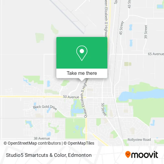
See Studio5 Smartcuts & Color, Leduc, on the map
Public Transit to Studio5 Smartcuts & Color in Leduc
Wondering how to get to Studio5 Smartcuts & Color in Leduc? Moovit helps you find the best way to get to Studio5 Smartcuts & Color with step-by-step directions from the nearest public transit station.
Moovit provides free maps and live directions to help you navigate through your city. View schedules, routes, timetables, and find out how long does it take to get to Studio5 Smartcuts & Color in real time.
Looking for the nearest stop or station to Studio5 Smartcuts & Color? Check out this list of stops closest to your destination: 50 Street & 57 Avenue.
Bus: 1, 10.
Want to see if there’s another route that gets you there at an earlier time? Moovit helps you find alternative routes or times. Get directions from and directions to Studio5 Smartcuts & Color easily from the Moovit App or Website.
We make riding to Studio5 Smartcuts & Color easy, which is why over 1.5 million users, including users in Leduc, trust Moovit as the best app for public transit. You don’t need to download an individual bus app or train app, Moovit is your all-in-one transit app that helps you find the best bus time or train time available.
For information on prices of bus, costs and ride fares to Studio5 Smartcuts & Color, please check the Moovit app.
Use the app to navigate to popular places including to the airport, hospital, stadium, grocery store, mall, coffee shop, school, college, and university.
Studio5 Smartcuts & Color Address: Discovery Way street in Leduc
- Phoxpress,
- Original Joe's,
- Steven Zwack - TD Financial Planner,
- Roger Magnin - TD Investment Specialist,
- Candace Lusok - TD Financial Planner,
- Michael Nikolai - TD Financial Planner,
- Tom Krystynak - TD Financial Planner,
- MERRELL,
- The Chopped Leaf,
- Shamrock Burgers,
- Divine Spine,
- Bone & Biscuit,
- Hello Mobile,
- Fit Forward,
- Q-Nails,
- The Canadian Brewhouse,
- Winners,
- Sport Check,
- Jiffy Lube,
- Exit 517/Calmar/S
Places Near Studio5 Smartcuts & Color (Leduc)
- Kingsway Mall, Edmonton,
- Edmonton EXPO Centre, Edmonton,
- Edmonton Valley Zoo, Edmonton,
- Royal Alexandra Hospital, Edmonton,
- Northgate Centre, Edmonton,
- Borden Park, Edmonton,
- West Edmonton Mall, Edmonton,
- MacEwan University, Edmonton,
- Alberta Legislature Building, Edmonton,
- Edmonton VIA Rail Station, Edmonton,
- Londonderry Mall, Edmonton,
- Whyte Avenue, Edmonton,
- Kaye Edmonton Clinic, Edmonton,
- Fort Edmonton Park, Edmonton,
- Edmonton Commonwealth Stadium, Edmonton,
- Rogers Place, Edmonton,
- Grey Nuns Community Hospital, Edmonton,
- Canada Place Service Canada Centre, Edmonton,
- Cross Cancer Institute, Edmonton,
- University of Alberta, Edmonton
How to get to popular places in Edmonton with public transit
Get around Leduc by public transit!
Traveling around Leduc has never been so easy. See step by step directions as you travel to any attraction, street or major public transit station. View bus and train schedules, arrival times, service alerts and detailed routes on a map, so you know exactly how to get to anywhere in Leduc.
When traveling to any destination around Leduc use Moovit's Live Directions with Get Off Notifications to know exactly where and how far to walk, how long to wait for your line, and how many stops are left. Moovit will alert you when it's time to get off — no need to constantly re-check whether yours is the next stop.
Wondering how to use public transit in Leduc or how to pay for public transit in Leduc? Moovit public transit app can help you navigate your way with public transit easily, and at minimum cost. It includes public transit fees, ticket prices, and costs. Looking for a map of Leduc public transit lines? Moovit public transit app shows all public transit maps in Leduc with all Bus and Light Rail routes and stops on an interactive map.
Edmonton has 2 transit type(s), including: Bus and Light Rail, operated by several transit agencies, including ETS LRT, ETS, Strathcona County Transit, St. Albert Transit, Spruce Grove Transit, Fort Saskatchewan Transit, Beaumont Transit and Leduc Transit