How to get to Studio A.M by bus?
Click on the bus route to see step by step directions with maps, line arrival times and updated time schedules.
From Walmart, Baltimore County
69 minFrom Arundel Mills, Anne Arundel County
77 minFrom I-95 Exit 33 - Laurel/Burtonsville (Sandy Spring Rd/MD 198), Prince George's County
89 minFrom MD Live Casino Arundel Mills, Anne Arundel County
75 minFrom Elkridge, MD, Howard County
70 minFrom Lincoln Tech, Howard County
39 minFrom Laurel, Maryland, Prince George's County
88 minFrom Maryland Live! Casino, Anne Arundel County
79 minFrom University Of Maryland Baltimore (Umbc), Baltimore County
109 minFrom I-695 @ Exit 17 (Security Blvd/MD 122), Baltimore County
105 min
Bus stops near Studio A.M in Howard County
Bus lines to Studio A.M in Howard County
What are the closest stations to Studio A.M?
The closest stations to Studio A.M are:
- Twin Rivers Rd / Harpers Farm Rd (Westbound) is 136 yards away, 2 min walk.
- Twin Rivers Rd & Harpers Farm Rd Wb is 142 yards away, 2 min walk.
- Twin Rivers Rd & Harpers Farm Rd FS Eb is 148 yards away, 2 min walk.
- Little Patuxent & Harper's Farm is 630 yards away, 8 min walk.
Which bus lines stop near Studio A.M?
These bus lines stop near Studio A.M: 401, 505.
What’s the nearest bus station to Studio A.M in Howard County?
The nearest bus stations to Studio A.M in Howard County are Twin Rivers Rd / Harpers Farm Rd (Westbound), Twin Rivers Rd & Harpers Farm Rd Wb and Twin Rivers Rd & Harpers Farm Rd FS Eb. The closest one is a 2 min walk away.
What time is the first bus to Studio A.M in Howard County?
The 325 is the first bus that goes to Studio A.M in Howard County. It stops nearby at 5:44 AM.
What time is the last bus to Studio A.M in Howard County?
The 401 is the last bus that goes to Studio A.M in Howard County. It stops nearby at 11:05 PM.
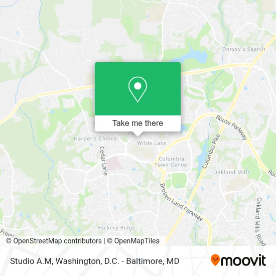
See Studio A.M, Howard County, on the map
Public Transit to Studio A.M in Howard County
Wondering how to get to Studio A.M in Howard County? Moovit helps you find the best way to get to Studio A.M with step-by-step directions from the nearest public transit station.
Moovit provides free maps and live directions to help you navigate through your city. View schedules, routes, timetables, and find out how long does it take to get to Studio A.M in real time.
Looking for the nearest stop or station to Studio A.M? Check out this list of stops closest to your destination: Twin Rivers Rd / Harpers Farm Rd (Westbound); Twin Rivers Rd & Harpers Farm Rd Wb; Twin Rivers Rd & Harpers Farm Rd FS Eb; Little Patuxent & Harper's Farm.
Bus: 401, 505, 325, 150, 404.
Want to see if there’s another route that gets you there at an earlier time? Moovit helps you find alternative routes or times. Get directions from and directions to Studio A.M easily from the Moovit App or Website.
We make riding to Studio A.M easy, which is why over 1.7 million users, including users in Howard County, trust Moovit as the best app for public transit. You don’t need to download an individual bus app or train app, Moovit is your all-in-one transit app that helps you find the best bus time or train time available.
For information on prices of bus, costs and ride fares to Studio A.M, please check the Moovit app.
Get to Studio A.M with public transit and pay for the ride in the Moovit app. In addition to all info you may need for your trip to Studio A.M, including live directions, real-time arrivals and fare prices, you can also buy public transit passes for your rides. No need for cash or paper tickets to get to Studio A.M - everything you need is accessible in the app with a click of the button.
Use the app to navigate to popular places including to the airport, hospital, stadium, grocery store, mall, coffee shop, school, college, and university.
Studio A.M Address: 5410 Lynx Ln street in Howard County
- Gerard G Magrogan Lawyer,
- Wilde Lake High School,
- Howard Community College - Duncan Hall,
- Rep Stage (Dreier Outdoor Stage),
- Howard Community College,
- Howard County General Hospital, Johns Hopkins Medicine,
- Shell Recharge,
- Columbia, Maryland,
- 10300 Little Patuxent Parkway,
- The Mall In Columbia,
- Little Patuxent Pkwy & Governor Warfield Pkwy SB,
- Aspiring Communityservice,
- International Union of Elevator Constructors,
- Columbia, MD,
- Merriweather Post Pavilion,
- Whole Foods,
- Howard County Library - Central Branch,
- Merriweather Lakehouse, Autograph Collection,
- Merriweather District,
- Centennial Park (Centennial Pk W Ellicott Cty MD)
Places Near Studio A.M (Howard County)
- National Zoo, Washington,
- National Theatre, Washington,
- National Museum of African American History and Culture, Washington,
- Museum Of The Bible, Washington,
- Amazon Hq2, Arlington County,
- Georgetown, Washington,
- Westfield Montgomery Mall, Montgomery County,
- Washington DC VA Medical Center, Washington,
- PG Mall, Prince George's County,
- Marriott Marquis Washington, DC, Washington,
- Warner Theatre, Washington,
- Camden Yards, Baltimore,
- Pennsylvania Ave NW (3rd st and pennsylvania), Washington,
- Capital One Arena, Washington,
- M&T Bank Stadium, Baltimore,
- Rock Creek Tennis Center, Washington,
- Basilica of the National Shrine, Washington,
- The Anthem, Washington,
- Sibley Memorial Hospital, Washington,
- Washington National Cathedral, Washington
How to get to popular places in Washington, D.C. - Baltimore, MD with public transit
Get around Howard County by public transit!
Traveling around Howard County has never been so easy. See step by step directions as you travel to any attraction, street or major public transit station. View bus and train schedules, arrival times, service alerts and detailed routes on a map, so you know exactly how to get to anywhere in Howard County.
When traveling to any destination around Howard County use Moovit's Live Directions with Get Off Notifications to know exactly where and how far to walk, how long to wait for your line, and how many stops are left. Moovit will alert you when it's time to get off — no need to constantly re-check whether yours is the next stop.
Wondering how to use public transit in Howard County or how to pay for public transit in Howard County? Moovit public transit app can help you navigate your way with public transit easily, and at minimum cost. It includes public transit fees, ticket prices, and costs. Looking for a map of Howard County public transit lines? Moovit public transit app shows all public transit maps in Howard County with all Bus, Train, Metro, Light Rail and Ferry routes and stops on an interactive map.
Washington, D.C. - Baltimore, MD has 5 transit type(s), including: Bus, Train, Metro, Light Rail and Ferry, operated by several transit agencies, including WMATA, Montgomery County Ride On, Fairfax Connector, TheBus, PRTC, DASH - Alexandria, Arlington Transit (ART), RTA of Central Maryland, MDOT MTA, MDOT MTA Light RailLink, MDOT MTA Commuter Bus, MDOT MTA Local Bus, FXBGO!, Virginia Railway Express (VRE) and MARC