How to get to Data Studio by bus?
Click on the bus route to see step by step directions with maps, line arrival times and updated time schedules.
From San Giuseppe Hospital, Empoli
116 minFrom Castelfranco Di Sotto, Castelfranco Di Sotto
66 minFrom Vinci, Vinci
368 minFrom St. Joseph Hospital, Empoli
114 minFrom Via Curtatone and Montanara, 78, Empoli
119 minFrom A1 Highway Exit Calenzano Sesto Fiorentino, Montelupo Fiorentino
226 minFrom Petroio Sports Field, Vinci
362 minFrom Santa Maria A Monte, Santa Maria A Monte
76 minFrom Serravalle Park, Empoli
199 min
How to get to Data Studio by train?
Click on the train route to see step by step directions with maps, line arrival times and updated time schedules.
Bus stops near Data Studio in San Miniato
Train station near Data Studio in San Miniato
- San Miniato-Fucecchio, 54 min walk,VIEW
Bus lines to Data Studio in San Miniato
What are the closest stations to Data Studio?
The closest stations to Data Studio are:
- San Miniato Via Codignola is 289 meters away, 5 min walk.
- San Miniato Basso is 495 meters away, 7 min walk.
- San Miniato Depot is 630 meters away, 10 min walk.
- San Miniato-Fucecchio is 4185 meters away, 54 min walk.
Which bus lines stop near Data Studio?
These bus lines stop near Data Studio: 290, 876.
Which train line stops near Data Studio?
R (Empoli/Grosseto/Pisa)
What’s the nearest bus station to Data Studio in San Miniato?
The nearest bus station to Data Studio in San Miniato is San Miniato Via Codignola. It’s a 5 min walk away.
What time is the first train to Data Studio in San Miniato?
The R is the first train that goes to Data Studio in San Miniato. It stops nearby at 4:45 AM.
What time is the last train to Data Studio in San Miniato?
The R is the last train that goes to Data Studio in San Miniato. It stops nearby at 1:22 AM.
What time is the first bus to Data Studio in San Miniato?
The 210 is the first bus that goes to Data Studio in San Miniato. It stops nearby at 1:45 PM.
What time is the last bus to Data Studio in San Miniato?
The 210 is the last bus that goes to Data Studio in San Miniato. It stops nearby at 8:08 PM.
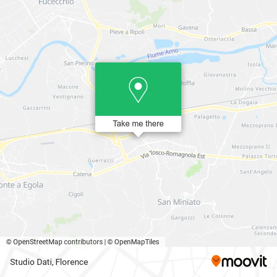
See Data Studio, San Miniato, on the map
Public Transit to Data Studio in San Miniato
Wondering how to get to Data Studio in San Miniato? Moovit helps you find the best way to get to Data Studio with step-by-step directions from the nearest public transit station.
Moovit provides free maps and live directions to help you navigate through your city. View schedules, routes, timetables, and find out how long does it take to get to Data Studio in real time.
Looking for the nearest stop or station to Data Studio? Check out this list of stops closest to your destination: San Miniato Via Codignola; San Miniato Basso; San Miniato Depot; San Miniato-Fucecchio.
Bus: 290, 876, 320, 320, LAP109, APIE.Train: R.
Want to see if there’s another route that gets you there at an earlier time? Moovit helps you find alternative routes or times. Get directions from and directions to Data Studio easily from the Moovit App or Website.
We make riding to Data Studio easy, which is why over 1.5 million users, including users in San Miniato, trust Moovit as the best app for public transit. You don’t need to download an individual bus app or train app, Moovit is your all-in-one transit app that helps you find the best bus time or train time available.
For information on prices of bus and train, costs and ride fares to Data Studio, please check the Moovit app.
Use the app to navigate to popular places including to the airport, hospital, stadium, grocery store, mall, coffee shop, school, college, and university.
Data Studio Address: Via Ferrante Aporti, 26 56028 San Miniato street in San Miniato
- Ciampini Mario & C.,
- Aedes 2000,
- Nelli Telephony by Tinacci Paolo,
- Special Pharmacy Company San Miniato,
- Sergio Scarpa,
- Helvetia Swiss Insurance Company by Alessandro Susini,
- Alei Avv. Lucia,
- Paytipper SpA / 1276,
- Italian Group,
- Dr. Marchianò Ester Angela Nutritional Biologist,
- Simply Shop,
- Vincenza Armilla,
- San Miniato Medical Studio,
- Digebeau,
- Unicoop Florence,
- Cooperative,
- Manipura Commercial Company,
- Sanminiato Shoes,
- Carlo Giuntoli,
- Life Lab
Places Near Data Studio (San Miniato)
- Asmana, Campi Bisenzio,
- Campi Bisenzio, Campi Bisenzio,
- Cascine Park, Florence,
- Santa Maria Novella Station, Florence,
- Piero Palagi Hospital Facility-Florence, Florence,
- Michelangelo Square, Florence,
- Visarno Hippodrome, Florence,
- Torregalli Hospital Scandicci *, Scandicci,
- Field of Mars, Florence,
- Verdi Theater, Florence,
- OOO, Florence,
- Santa Maria Nuova Hospital, Florence,
- Tobacco Manufacture, Florence,
- I Gigli, Campi Bisenzio,
- Nelson Mandela Forum, Florence,
- Visarno Arena, Florence,
- IKEA Florence, Sesto Fiorentino,
- Michelangelo Square, Florence,
- Artemio Franchi Municipal Stadium, Florence,
- Mandela Forum (Nelson Mandela Forum), Florence
How to get to popular places in Florence with public transit
Get around San Miniato by public transit!
Traveling around San Miniato has never been so easy. See step by step directions as you travel to any attraction, street or major public transit station. View bus and train schedules, arrival times, service alerts and detailed routes on a map, so you know exactly how to get to anywhere in San Miniato.
When traveling to any destination around San Miniato use Moovit's Live Directions with Get Off Notifications to know exactly where and how far to walk, how long to wait for your line, and how many stops are left. Moovit will alert you when it's time to get off — no need to constantly re-check whether yours is the next stop.
Wondering how to use public transit in San Miniato or how to pay for public transit in San Miniato? Moovit public transit app can help you navigate your way with public transit easily, and at minimum cost. It includes public transit fees, ticket prices, and costs. Looking for a map of San Miniato public transit lines? Moovit public transit app shows all public transit maps in San Miniato with all Bus, Train, Light Rail, Ferry and Funicular routes and stops on an interactive map.
Florence has 5 transit type(s), including: Bus, Train, Light Rail, Ferry and Funicular, operated by several transit agencies, including Florence Urban - Tuscan Bus Lines, GEST, Livorno and Province - Tuscan Bus Lines, Arezzo, Florence and Provinces - Tuscan Bus Lines, Prato and Province - Tuscan Bus Lines, Lucca and Province - Tuscan Bus Lines, Massa, Carrara and Province - Tuscan Bus Lines, Pisa and Province - Tuscan Bus Lines, Grosseto, Siena and Provinces - Tuscan Bus Lines, Arezzo, Siena and Provinces - Tuscan Bus Lines, Florence and Province - Tuscan Bus Lines, Pistoia and Province - Tuscan Bus Lines, Siena and Province - Tuscan Bus Lines, Arezzo and Province - Tuscan Bus Lines and Trenitalia