Directions to Studio Derrick Anthony (Baltimore) with public transportation
The following transit lines have routes that pass near Studio Derrick Anthony
 Bus: 53, 54, 91, 94, CITYLINK LIME.
- Train: MARC.
- Metro: METRO.
- Light Rail: LIGHT RAILLINK.
How to get to Studio Derrick Anthony by bus?
Click on the bus route to see step by step directions with maps, line arrival times and updated time schedules.
From Bwi2 Employee Shuttles, Baltimore
39 minFrom Johns Hopkins Bayview Medical Center, Baltimore
47 minFrom Maryland, Baltimore
39 minFrom Towson, MD, Baltimore County
44 minFrom Good Samaritan Hospital, Baltimore
43 minFrom Towson Town Center, Baltimore County
47 minFrom Medstar Harbor Hospital, Baltimore
34 minFrom I-695 @ Exit 17 (Security Blvd/MD 122), Baltimore County
50 minFrom Guinness Open Gate Brewery & Barrel House, Baltimore County
78 minFrom Walmart, Baltimore County
52 min
How to get to Studio Derrick Anthony by train?
Click on the train route to see step by step directions with maps, line arrival times and updated time schedules.
Bus stops near Studio Derrick Anthony in Baltimore
Light Rail stations near Studio Derrick Anthony in Baltimore
- Cultural Center / State Center, 4 min walk,VIEW
Metro station near Studio Derrick Anthony in Baltimore
- State Center Metro, 8 min walk,VIEW
Train station near Studio Derrick Anthony in Baltimore
- Penn Station Marc Nb, 20 min walk,VIEW
Bus lines to Studio Derrick Anthony in Baltimore
What are the closest stations to Studio Derrick Anthony?
The closest stations to Studio Derrick Anthony are:
- Howard St & John St Sb is 163 yards away, 3 min walk.
- Dolphin St & Howard St Eb is 206 yards away, 3 min walk.
- Howard St & Preston St Sb is 293 yards away, 4 min walk.
- Cultural Center / State Center is 295 yards away, 4 min walk.
- Maryland Ave & Preston St Sb is 459 yards away, 6 min walk.
- Maryland Ave & Mt. Royal is 580 yards away, 8 min walk.
- State Center Metro is 588 yards away, 8 min walk.
- Penn Station Marc Nb is 1643 yards away, 20 min walk.
Which bus lines stop near Studio Derrick Anthony?
These bus lines stop near Studio Derrick Anthony: 53, 54, 91, 94, CITYLINK LIME, CITYLINK PINK, CITYLINK SILVER.
Which train line stops near Studio Derrick Anthony?
MARC (Inbound - Penn)
Which light rail line stops near Studio Derrick Anthony?
LIGHT RAILLINK (Northbound)
What’s the nearest light rail station to Studio Derrick Anthony in Baltimore?
The nearest light rail station to Studio Derrick Anthony in Baltimore is Cultural Center / State Center. It’s a 4 min walk away.
What’s the nearest metro station to Studio Derrick Anthony in Baltimore?
The nearest metro station to Studio Derrick Anthony in Baltimore is State Center Metro. It’s a 8 min walk away.
What’s the nearest train station to Studio Derrick Anthony in Baltimore?
The nearest train station to Studio Derrick Anthony in Baltimore is Penn Station Marc Nb. It’s a 20 min walk away.
What’s the nearest bus station to Studio Derrick Anthony in Baltimore?
The nearest bus stations to Studio Derrick Anthony in Baltimore are Howard St & John St Sb and Dolphin St & Howard St Eb. The closest one is a 3 min walk away.
What time is the first light rail to Studio Derrick Anthony in Baltimore?
The LIGHT RAILLINK is the first light rail that goes to Studio Derrick Anthony in Baltimore. It stops nearby at 3:48 AM.
What time is the last light rail to Studio Derrick Anthony in Baltimore?
The LIGHT RAILLINK is the last light rail that goes to Studio Derrick Anthony in Baltimore. It stops nearby at 1:28 AM.
What time is the first metro to Studio Derrick Anthony in Baltimore?
The METRO is the first metro that goes to Studio Derrick Anthony in Baltimore. It stops nearby at 5:07 AM.
What time is the last metro to Studio Derrick Anthony in Baltimore?
The METRO is the last metro that goes to Studio Derrick Anthony in Baltimore. It stops nearby at 12:22 AM.
What time is the first train to Studio Derrick Anthony in Baltimore?
The MARC is the first train that goes to Studio Derrick Anthony in Baltimore. It stops nearby at 5:15 AM.
What time is the last train to Studio Derrick Anthony in Baltimore?
The MARC is the last train that goes to Studio Derrick Anthony in Baltimore. It stops nearby at 11:05 PM.
What time is the first bus to Studio Derrick Anthony in Baltimore?
The 54 is the first bus that goes to Studio Derrick Anthony in Baltimore. It stops nearby at 3:04 AM.
What time is the last bus to Studio Derrick Anthony in Baltimore?
The 54 is the last bus that goes to Studio Derrick Anthony in Baltimore. It stops nearby at 3:04 AM.
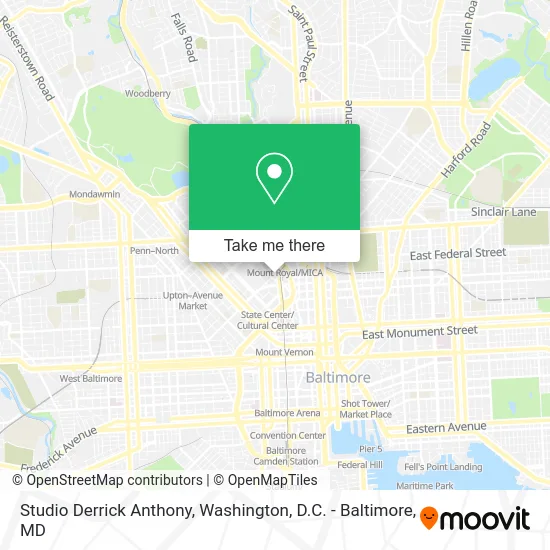
See Studio Derrick Anthony, Baltimore, on the map
Public Transit to Studio Derrick Anthony in Baltimore
Wondering how to get to Studio Derrick Anthony in Baltimore? Moovit helps you find the best way to get to Studio Derrick Anthony with step-by-step directions from the nearest public transit station.
Moovit provides free maps and live directions to help you navigate through your city. View schedules, routes, timetables, and find out how long does it take to get to Studio Derrick Anthony in real time.
Looking for the nearest stop or station to Studio Derrick Anthony? Check out this list of stops closest to your destination: Howard St & John St Sb; Dolphin St & Howard St Eb; Howard St & Preston St Sb; Cultural Center / State Center; Maryland Ave & Preston St Sb; Maryland Ave & Mt. Royal; State Center Metro; Penn Station Marc Nb.
Bus: 53, 54, 91, 94, CITYLINK LIME, CITYLINK PINK, CITYLINK SILVER, 410, 154, 51.Train: MARC.Metro: METRO.Light Rail: LIGHT RAILLINK.
Want to see if there’s another route that gets you there at an earlier time? Moovit helps you find alternative routes or times. Get directions from and directions to Studio Derrick Anthony easily from the Moovit App or Website.
We make riding to Studio Derrick Anthony easy, which is why over 1.5 million users, including users in Baltimore, trust Moovit as the best app for public transit. You don’t need to download an individual bus app or train app, Moovit is your all-in-one transit app that helps you find the best bus time or train time available.
For information on prices of bus, light rail and train, costs and ride fares to Studio Derrick Anthony, please check the Moovit app.
Use the app to navigate to popular places including to the airport, hospital, stadium, grocery store, mall, coffee shop, school, college, and university.
Studio Derrick Anthony Address: 1111 Park Ave Baltimore, MD 21201 street in Baltimore
- The Bolton Hill Open Mic Series,
- Sutton Place,
- Mount Royal Station,
- Maryland Institute College of Art,
- F Scott Fitzgerald Park,
- Duke, James,
- Rotary Club of Baltimore,
- Fifth Regiment Armory - Maryland National Guard 29th Div,
- Cultural Center Light Raillink,
- Mayson-Dixon Consulting,
- Classic Speed Towing,
- Neighborhood Impact Investment Fund,
- UB / Mt. Royal Light Rail Station,
- Lyric Opera House (Lyric Theater),
- The Lyric,
- Maryland Institute College of Art (Maryland Institute College of Art Painting Department),
- Chiropractic Auto Accidents Treatment,
- Wells Fargo,
- Black Violin,
- Bso Orchkids
Places Near Studio Derrick Anthony (Baltimore)
- Capital One Arena, Washington,
- Washington DC VA Medical Center, Washington,
- Museum Of The Bible, Washington,
- M&T Bank Stadium, Baltimore,
- National Museum of African American History and Culture, Washington,
- PG Mall, Prince George's County,
- Basilica of the National Shrine, Washington,
- National Mall, Washington,
- Rock Creek Tennis Center, Washington,
- National Zoo, Washington,
- Sibley Memorial Hospital, Washington,
- Camden Yards, Baltimore,
- Georgetown, Washington,
- Amazon Hq2, Arlington County,
- Marriott Marquis Washington, DC, Washington,
- Warner Theatre, Washington,
- Washington National Cathedral, Washington,
- Westfield Montgomery Mall, Montgomery County,
- Pennsylvania Ave NW (3rd st and pennsylvania), Washington,
- The Anthem, Washington
How to get to popular places in Washington, D.C. - Baltimore, MD with public transit
Get around Baltimore by public transit!
Traveling around Baltimore has never been so easy. See step by step directions as you travel to any attraction, street or major public transit station. View bus and train schedules, arrival times, service alerts and detailed routes on a map, so you know exactly how to get to anywhere in Baltimore.
When traveling to any destination around Baltimore use Moovit's Live Directions with Get Off Notifications to know exactly where and how far to walk, how long to wait for your line, and how many stops are left. Moovit will alert you when it's time to get off — no need to constantly re-check whether yours is the next stop.
Wondering how to use public transit in Baltimore or how to pay for public transit in Baltimore? Moovit public transit app can help you navigate your way with public transit easily, and at minimum cost. It includes public transit fees, ticket prices, and costs. Looking for a map of Baltimore public transit lines? Moovit public transit app shows all public transit maps in Baltimore with all Bus, Train, Metro, Light Rail and Ferry routes and stops on an interactive map.
Washington, D.C. - Baltimore, MD has 5 transit type(s), including: Bus, Train, Metro, Light Rail and Ferry, operated by several transit agencies, including WMATA, Montgomery County Ride On, Fairfax Connector, TheBus, PRTC, DASH - Alexandria, Arlington Transit (ART), RTA of Central Maryland, MDOT MTA, MDOT MTA Light RailLink, MDOT MTA Commuter Bus, MDOT MTA Local Bus, FXBGO!, Virginia Railway Express (VRE) and MARC