How to get to Styl'Line by bus?
Click on the bus route to see step by step directions with maps, line arrival times and updated time schedules.
From Clinique Maussins-Nollet, Paris
73 minFrom BNP Paribas - Mac 19, Paris
54 minFrom Cimetière Parisien, Pantin
58 minFrom Boulevard Macdonald, Paris
53 minFrom Hopital De Gonesse, Gonesse
41 minFrom Orange Stadium, Saint-Denis
64 minFrom Basilique Saint-Denis, Saint-Denis
74 minFrom IKEA Roissy-Paris Nord 2, Roissy-En-France
65 minFrom Vaujours, Vaujours
46 minFrom Action, Paris
53 min
How to get to Styl'Line by train?
Click on the train route to see step by step directions with maps, line arrival times and updated time schedules.
Bus stops near Styl'Line in Aulnay-Sous-Bois
RER station near Styl'Line in Aulnay-Sous-Bois
- Aulnay-Sous-Bois, 15 min walk,VIEW
Bus lines to Styl'Line in Aulnay-Sous-Bois
What are the closest stations to Styl'Line?
The closest stations to Styl'Line are:
- Vieux Pays is 116 meters away, 2 min walk.
- Marceau is 175 meters away, 3 min walk.
- Francisco Ferrer is 323 meters away, 5 min walk.
- Soleil Levant is 530 meters away, 7 min walk.
- Lefèvre is 692 meters away, 9 min walk.
- Aulnay-Sous-Bois is 1159 meters away, 15 min walk.
Which train line stops near Styl'Line?
K (Paris Nord)
Which RER line stops near Styl'Line?
E (Tournan/ Chelles - Gournay)
Which bus lines stop near Styl'Line?
These bus lines stop near Styl'Line: 23, 607, 610, 615, 617.
What’s the nearest bus station to Styl'Line in Aulnay-Sous-Bois?
The nearest bus station to Styl'Line in Aulnay-Sous-Bois is Vieux Pays. It’s a 2 min walk away.
What’s the nearest RER station to Styl'Line in Aulnay-Sous-Bois?
The nearest RER station to Styl'Line in Aulnay-Sous-Bois is Aulnay-Sous-Bois. It’s a 15 min walk away.
What time is the first light rail to Styl'Line in Aulnay-Sous-Bois?
The T4 is the first light rail that goes to Styl'Line in Aulnay-Sous-Bois. It stops nearby at 4:48 AM.
What time is the last light rail to Styl'Line in Aulnay-Sous-Bois?
The T4 is the last light rail that goes to Styl'Line in Aulnay-Sous-Bois. It stops nearby at 1:35 AM.
What time is the first train to Styl'Line in Aulnay-Sous-Bois?
The K is the first train that goes to Styl'Line in Aulnay-Sous-Bois. It stops nearby at 7:20 AM.
What time is the last train to Styl'Line in Aulnay-Sous-Bois?
The K is the last train that goes to Styl'Line in Aulnay-Sous-Bois. It stops nearby at 9:53 PM.
What time is the first bus to Styl'Line in Aulnay-Sous-Bois?
The FILÉO RS is the first bus that goes to Styl'Line in Aulnay-Sous-Bois. It stops nearby at 3:15 AM.
What time is the last bus to Styl'Line in Aulnay-Sous-Bois?
The FILÉO RS is the last bus that goes to Styl'Line in Aulnay-Sous-Bois. It stops nearby at 3:01 AM.
What time is the first RER to Styl'Line in Aulnay-Sous-Bois?
The B is the first RER that goes to Styl'Line in Aulnay-Sous-Bois. It stops nearby at 5:00 AM.
What time is the last RER to Styl'Line in Aulnay-Sous-Bois?
The B is the last RER that goes to Styl'Line in Aulnay-Sous-Bois. It stops nearby at 1:09 AM.
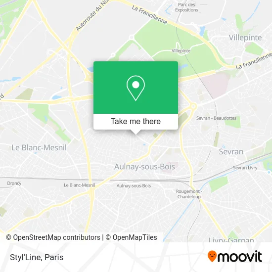
See Styl'Line, Aulnay-Sous-Bois, on the map
Public Transit to Styl'Line in Aulnay-Sous-Bois
Wondering how to get to Styl'Line in Aulnay-Sous-Bois? Moovit helps you find the best way to get to Styl'Line with step-by-step directions from the nearest public transit station.
Moovit provides free maps and live directions to help you navigate through your city. View schedules, routes, timetables, and find out how long does it take to get to Styl'Line in real time.
Looking for the nearest stop or station to Styl'Line? Check out this list of stops closest to your destination: Vieux Pays; Marceau; Francisco Ferrer; Soleil Levant; Lefèvre; Aulnay-Sous-Bois.
Train: K.RER: E, B, K, T4.Bus: 23, 607, 610, 615, 617, FILÉO RS, 1, 15.
Want to see if there’s another route that gets you there at an earlier time? Moovit helps you find alternative routes or times. Get directions from and directions to Styl'Line easily from the Moovit App or Website.
We make riding to Styl'Line easy, which is why over 1.5 million users, including users in Aulnay-Sous-Bois, trust Moovit as the best app for public transit. You don’t need to download an individual bus app or train app, Moovit is your all-in-one transit app that helps you find the best bus time or train time available.
For information on prices of bus, RER, metro, light rail and train, costs and ride fares to Styl'Line, please check the Moovit app.
Use the app to navigate to popular places including to the airport, hospital, stadium, grocery store, mall, coffee shop, school, college, and university.
Styl'Line Address: 13 Rue Jacques Duclos 93600 Aulnay-sous-Bois street in Aulnay-Sous-Bois
- Confort Optique,
- Pizza Com,
- Laria Festif,
- Sedo 93,
- S20 Supermarché,
- Marisca,
- Marché du Vieux Pays,
- Elye,
- Paris Imparator Media Groupe,
- Le Créa,
- La Poste,
- La Poste Principale,
- Aulnay Energy,
- Pharmacie Parinor,
- Dpam,
- Boutique Sfr,
- Aftral,
- Parking Avenue Kleber,
- Groupe Scolaire Bourg,
- École Élémentaire Bourg 1
Places Near Styl'Line (Aulnay-Sous-Bois)
- Atelier Des Lumieres, Paris,
- Hopital Lariboisière, Paris,
- Hôpital Necker, Paris,
- Hôpital Pitié Salpêtrière, Paris,
- Théâtre Mogador, Paris,
- Galeries Lafayette, Paris,
- Galeries Lafayette Haussmann, Paris,
- Beaugrenelle, Paris,
- 29 Rue Manin, Paris,
- Fondation Louis Vuitton, Paris,
- Marché Saint-Pierre, Paris,
- Gare Routière Flixbus, Paris,
- Hôpital Henri Mondor, Creteil,
- Hopital Foch, Suresnes,
- Hôpital Saint-Joseph, Paris,
- Hôpital Cochin, Paris,
- Hôpital de la Pitié-Salpêtrière, Paris,
- Créteil Soleil, Creteil,
- Centre Hospitalier des 15/20, Paris,
- Hôpital Beaujon, Clichy
How to get to popular places in Paris with public transit
Get around Aulnay-Sous-Bois by public transit!
Traveling around Aulnay-Sous-Bois has never been so easy. See step by step directions as you travel to any attraction, street or major public transit station. View bus and train schedules, arrival times, service alerts and detailed routes on a map, so you know exactly how to get to anywhere in Aulnay-Sous-Bois.
When traveling to any destination around Aulnay-Sous-Bois use Moovit's Live Directions with Get Off Notifications to know exactly where and how far to walk, how long to wait for your line, and how many stops are left. Moovit will alert you when it's time to get off — no need to constantly re-check whether yours is the next stop.
Wondering how to use public transit in Aulnay-Sous-Bois or how to pay for public transit in Aulnay-Sous-Bois? Moovit public transit app can help you navigate your way with public transit easily, and at minimum cost. It includes public transit fees, ticket prices, and costs. Looking for a map of Aulnay-Sous-Bois public transit lines? Moovit public transit app shows all public transit maps in Aulnay-Sous-Bois with all Bus, Train, Metro, Light Rail, RER, Funicular and Gondola routes and stops on an interactive map.
Paris has 7 transit type(s), including: Bus, Train, Metro, Light Rail, RER, Funicular and Gondola, operated by several transit agencies, including RATP, RER, RER Bus de remplacement, Train, Train Bus de remplacement, Tramway Bus de remplacement, TER, ADP, Magical Shuttle, Argenteuil - Boucles de Seine, Autocars Dominique, Bièvre, Brie et 2 Morin, Le Bus - C.C. du Clermontois and Cœur d’Essonne