How to get to Subway by bus?
Click on the bus route to see step by step directions with maps, line arrival times and updated time schedules.
From Bowie Town Center, Prince George's County
168 minFrom Prince George's Community College, Prince George's County
298 minFrom Motor Vehicle Administration (Mva) Largo, Prince George's County
309 minFrom PGCC, Prince George's County
297 minFrom Largo, Maryland, Prince George's County
159 minFrom Kaiser Permanente - Largo Medical Center, Prince George's County
301 minFrom Joint Base Andrews, Prince George's County
189 minFrom Marlboro Pike, Prince George's County
181 minFrom Andrews Air Force Base, Prince George's County
188 min
Bus stop near Subway in Anne Arundel County
- Wayson's Corner Md 4 Near Md 408, 6 min walk,VIEW
Bus lines to Subway in Anne Arundel County
What are the closest stations to Subway?
The closest stations to Subway are:
- Wayson's Corner Md 4 Near Md 408 is 445 yards away, 6 min walk.
Which bus lines stop near Subway?
These bus lines stop near Subway: 820, 850.
What’s the nearest bus station to Subway in Anne Arundel County?
The nearest bus station to Subway in Anne Arundel County is Wayson's Corner Md 4 Near Md 408. It’s a 6 min walk away.
What time is the first bus to Subway in Anne Arundel County?
The 850 is the first bus that goes to Subway in Anne Arundel County. It stops nearby at 5:01 AM.
What time is the last bus to Subway in Anne Arundel County?
The 820 is the last bus that goes to Subway in Anne Arundel County. It stops nearby at 7:01 PM.
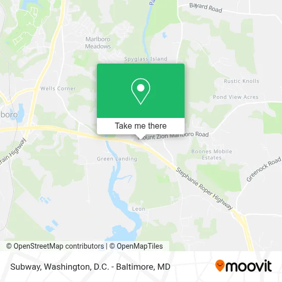
See Subway, Anne Arundel County, on the map
Public Transit to Subway in Anne Arundel County
Wondering how to get to Subway in Anne Arundel County? Moovit helps you find the best way to get to Subway with step-by-step directions from the nearest public transit station.
Moovit provides free maps and live directions to help you navigate through your city. View schedules, routes, timetables, and find out how long does it take to get to Subway in real time.
Looking for the nearest stop or station to Subway? Check out this list of stops closest to your destination: Wayson's Corner Md 4 Near Md 408.
Bus: 820, 850, 810.
Want to see if there’s another route that gets you there at an earlier time? Moovit helps you find alternative routes or times. Get directions from and directions to Subway easily from the Moovit App or Website.
We make riding to Subway easy, which is why over 1.7 million users, including users in Anne Arundel County, trust Moovit as the best app for public transit. You don’t need to download an individual bus app or train app, Moovit is your all-in-one transit app that helps you find the best bus time or train time available.
For information on prices of bus and metro, costs and ride fares to Subway, please check the Moovit app.
Use the app to navigate to popular places including to the airport, hospital, stadium, grocery store, mall, coffee shop, school, college, and university.
Subway Address: 5408 Southern Maryland Blvd Unit N street in Anne Arundel County
- Waysons Corner,
- Waysons corner bingo,
- Shell,
- Wayson's Corner Park And Ride,
- Wayson's Corner MD 4 Near MD 408,
- Anne Arundel County / Prince George's County Border,
- Glendening Walking Trails at Jug Bay Nature Preserve,
- 190 Boones Dr,
- Air Duct Cleaning,
- Pindell Plummer Ln,
- 121 Sonnys Ct,
- 403 Boones Dr,
- 1169 Wrighton Rd,
- Anytime Any Place Locksmith,
- Marlboro Rd Lee Jackson Dr,
- Former Confederate Soldier Benjamin Welch Owens,
- Mount Calvary Cemetery,
- Dollar General,
- Weis,
- 408 Branch Ln
Places Near Subway (Anne Arundel County)
- Rock Creek Tennis Center, Washington,
- Warner Theatre, Washington,
- PG Mall, Prince George's County,
- National Museum of African American History and Culture, Washington,
- Basilica of the National Shrine, Washington,
- M&T Bank Stadium, Baltimore,
- Amazon Hq2, Arlington County,
- Camden Yards, Baltimore,
- National Zoo, Washington,
- Marriott Marquis Washington, DC, Washington,
- Washington National Cathedral, Washington,
- Sibley Memorial Hospital, Washington,
- National Theatre, Washington,
- Museum Of The Bible, Washington,
- Westfield Montgomery Mall, Montgomery County,
- Pennsylvania Ave NW (3rd st and pennsylvania), Washington,
- Washington DC VA Medical Center, Washington,
- Georgetown, Washington,
- The Anthem, Washington,
- Capital One Arena, Washington
How to get to popular places in Washington, D.C. - Baltimore, MD with public transit
Get around Anne Arundel County by public transit!
Traveling around Anne Arundel County has never been so easy. See step by step directions as you travel to any attraction, street or major public transit station. View bus and train schedules, arrival times, service alerts and detailed routes on a map, so you know exactly how to get to anywhere in Anne Arundel County.
When traveling to any destination around Anne Arundel County use Moovit's Live Directions with Get Off Notifications to know exactly where and how far to walk, how long to wait for your line, and how many stops are left. Moovit will alert you when it's time to get off — no need to constantly re-check whether yours is the next stop.
Wondering how to use public transit in Anne Arundel County or how to pay for public transit in Anne Arundel County? Moovit public transit app can help you navigate your way with public transit easily, and at minimum cost. It includes public transit fees, ticket prices, and costs. Looking for a map of Anne Arundel County public transit lines? Moovit public transit app shows all public transit maps in Anne Arundel County with all Bus, Train, Metro, Light Rail and Ferry routes and stops on an interactive map.
Washington, D.C. - Baltimore, MD has 5 transit type(s), including: Bus, Train, Metro, Light Rail and Ferry, operated by several transit agencies, including WMATA, Montgomery County Ride On, Fairfax Connector, TheBus, PRTC, DASH - Alexandria, Arlington Transit (ART), RTA of Central Maryland, MDOT MTA, MDOT MTA Light RailLink, MDOT MTA Commuter Bus, MDOT MTA Local Bus, FXBGO!, Virginia Railway Express (VRE) and MARC