Directions to Sugarpine Drive-In (Troutdale) with public transportation
The following transit lines have routes that pass near Sugarpine Drive-In
 Bus: 77, 80, 25.
How to get to Sugarpine Drive-In by bus?
Click on the bus route to see step by step directions with maps, line arrival times and updated time schedules.
Bus stop near Sugarpine Drive-In in Troutdale
- SW Cherry Park & Troutdale Rd (East), 20 min walk,
Bus lines to Sugarpine Drive-In in Troutdale
- 25, Gateway TC (Drop Off Only Stop),
What are the closest stations to Sugarpine Drive-In?
The closest stations to Sugarpine Drive-In are:
- SW Cherry Park & Troutdale Rd (East) stop is 1681 yards away, 20 min walk.
Which bus lines stop near Sugarpine Drive-In?
These bus lines stop near Sugarpine Drive-In: 77, 80.
What time is the first bus to Sugarpine Drive-In in Troutdale?
The 25 is the first bus that goes to Sugarpine Drive-In in Troutdale. It stops nearby at 4:59 AM.
What time is the last bus to Sugarpine Drive-In in Troutdale?
The 25 is the last bus that goes to Sugarpine Drive-In in Troutdale. It stops nearby at 10:32 PM.
See Sugarpine Drive-In, Troutdale, on the map
Public Transit to Sugarpine Drive-In in Troutdale
Wondering how to get to Sugarpine Drive-In in Troutdale? Moovit helps you find the best way to get to Sugarpine Drive-In with step-by-step directions from the nearest public transit station.
Moovit provides free maps and live directions to help you navigate through your city. View schedules, routes, timetables, and find out how long does it take to get to Sugarpine Drive-In in real time.
Looking for the nearest stop or station to Sugarpine Drive-In? Check out this list of stops closest to your destination: SW Cherry Park & Troutdale Rd (East).
Bus: 77, 80, 25.
Want to see if there’s another route that gets you there at an earlier time? Moovit helps you find alternative routes or times. Get directions from and directions to Sugarpine Drive-In easily from the Moovit App or Website.
We make riding to Sugarpine Drive-In easy, which is why over 1.7 billion users, including users in Troutdale, trust Moovit as the best app for public transit. You don’t need to download an individual bus app or train app, Moovit is your all-in-one transit app that helps you find the best bus time or train time available.
For information on prices of bus and light rail, costs and ride fares to Sugarpine Drive-In, please check the Moovit app.
Use the app to navigate to popular places including to the airport, hospital, stadium, grocery store, mall, coffee shop, school, college, and university.
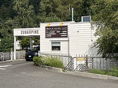
Sugarpine Drive-In Address: East Historic Columbia River Highway street in Troutdale
- Community Park (Glenn Otto Park),
- Sandy River Bridge,
- Glenn Otto Park,
- Caswell Sculpture,
- Sandy River RV Resort,
- Ur Invited Custom Invitations Etc,
- Troutdale Burrito Shop,
- Lewis and Clark State Park,
- EV Charging Station,
- Columbia Gorge RV Village,
- Gateway To the Gorge Visitor Center,
- The Confluence Pop-Up,
- Gorge Community Wellness,
- Columbia Ridge Community Church,
- Axleplay,
- A&C Innovative Contractors,
- Troutdale, Oregon,
- Real Clean Portland,
- Health Insurance Brokers Troutdale,
- Yrc Freight
Places Near Sugarpine Drive-In (Troutdale)
- The Woodburn Premium Outlet Stores,
- Oregon Convention Center, Portland,
- Portland Art Museum, Portland,
- Hillsboro Hops Shuttle, Hillsboro,
- The Grotto, Portland,
- Powell's City of Books (Powell's Books), Portland,
- Gov. Tom McCall Waterfront Park, Portland,
- Intel Shuttle - Orenco MAX, Hillsboro,
- Multnomah County Courthouse, Portland,
- Legacy Emanuel Medical Center, Portland,
- Powell's City of Books, Portland,
- Veterans Memorial Coliseum, Portland,
- Ilani Casino,
- Moda Center, Portland,
- Pearl District, Portland,
- Portland Saturday Market, Portland,
- Washington Square Mall, Tigard,
- Crystal Ballroom, Portland,
- Keller Auditorium, Portland,
- Oregon Zoo, Portland
How to get to popular places in Portland, OR with public transit
Get around Troutdale by public transit!
Traveling around Troutdale has never been so easy. See step by step directions as you travel to any attraction, street or major public transit station. View bus and train schedules, arrival times, service alerts and detailed routes on a map, so you know exactly how to get to anywhere in Troutdale.
When traveling to any destination around Troutdale use Moovit's Live Directions with Get Off Notifications to know exactly where and how far to walk, how long to wait for your line, and how many stops are left. Moovit will alert you when it's time to get off — no need to constantly re-check whether yours is the next stop.
Wondering how to use public transit in Troutdale or how to pay for public transit in Troutdale? Moovit public transit app can help you navigate your way with public transit easily, and at minimum cost. It includes public transit fees, ticket prices, and costs. Looking for a map of Troutdale public transit lines? Moovit public transit app shows all public transit maps in Troutdale with all Bus, Train, Light Rail, Ferry, Streetcar and Gondola routes and stops on an interactive map.
Portland, OR has 6 transit type(s), including: Bus, Train, Light Rail, Ferry, Streetcar and Gondola, operated by several transit agencies, including Mount Adams Transportation Service, RiverCities Transit, TriMet , TriMet , TriMet, Portland Streetcar, Portland Aerial Tram, C-TRAN, Multnomah County Transit, Washington Park, SMART, Canby Area Transit, South Clackamas Transportation District, The Wave and Lincoln County Transit