How to get to Sultan Kabob by bus?
Click on the bus route to see step by step directions with maps, line arrival times and updated time schedules.
From Department of State SA 34, Fairfax County
294 minFrom Rose Gaming Resort, Prince William County
232 minFrom Potomac Mills Mall, Prince William County
207 minFrom Lorton, VA - Amtrak Auto Train Station (LOR), Fairfax County
222 minFrom Lorton, VA, Fairfax County
216 minFrom Manassas, VA, Manassas
386 minFrom Woodbridge, VA, Prince William County
151 min
Bus stop near Sultan Kabob in Stafford County
- 409 - Stafford Marketplace (Center Point), 5 min walk,VIEW
What are the closest stations to Sultan Kabob?
The closest stations to Sultan Kabob are:
- 409 - Stafford Marketplace (Center Point) is 361 yards away, 5 min walk.
Which bus lines stop near Sultan Kabob?
These bus lines stop near Sultan Kabob: 942, ROUTE 22.
What’s the nearest bus station to Sultan Kabob in Stafford County?
The nearest bus station to Sultan Kabob in Stafford County is 409 - Stafford Marketplace (Center Point). It’s a 5 min walk away.
What time is the first bus to Sultan Kabob in Stafford County?
The ROUTE 22 is the first bus that goes to Sultan Kabob in Stafford County. It stops nearby at 7:45 AM.
What time is the last bus to Sultan Kabob in Stafford County?
The ROUTE 22 is the last bus that goes to Sultan Kabob in Stafford County. It stops nearby at 5:53 PM.
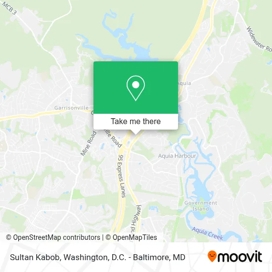
See Sultan Kabob, Stafford County, on the map
Public Transit to Sultan Kabob in Stafford County
Wondering how to get to Sultan Kabob in Stafford County? Moovit helps you find the best way to get to Sultan Kabob with step-by-step directions from the nearest public transit station.
Moovit provides free maps and live directions to help you navigate through your city. View schedules, routes, timetables, and find out how long does it take to get to Sultan Kabob in real time.
Looking for the nearest stop or station to Sultan Kabob? Check out this list of stops closest to your destination: 409 - Stafford Marketplace (Center Point).
Bus: 942, ROUTE 22, ROUTE 23.
Want to see if there’s another route that gets you there at an earlier time? Moovit helps you find alternative routes or times. Get directions from and directions to Sultan Kabob easily from the Moovit App or Website.
We make riding to Sultan Kabob easy, which is why over 1.7 million users, including users in Stafford County, trust Moovit as the best app for public transit. You don’t need to download an individual bus app or train app, Moovit is your all-in-one transit app that helps you find the best bus time or train time available.
For information on prices of bus, metro and train, costs and ride fares to Sultan Kabob, please check the Moovit app.
Use the app to navigate to popular places including to the airport, hospital, stadium, grocery store, mall, coffee shop, school, college, and university.
Sultan Kabob Address: 2983 Richmond Hwy street in Stafford County
- Aquia Harbour, Virginia,
- Tj Maxx,
- Apple Federal Credit Union,
- Saint William of York Catholic Sch (Saint William Of York Catholic School & Preschool),
- Saint William Of York,
- Saint William Of York School,
- 104 Coachman Cir,
- Aquia Pines Campground,
- 1012 Atlantic Drive,
- Tricord Homes Inc,
- 1200 Richmond Dr,
- Autobility,
- Ajd & Associates,
- 1430 Aquia Dr,
- James Smith,
- Mega Auto Center,
- R & D Collision Ctr Inc,
- Jefferson VA-637,
- Aquia Dr,
- Giese Electric Inc
Places Near Sultan Kabob (Stafford County)
- Pennsylvania Ave NW (3rd st and pennsylvania), Washington,
- Amazon Hq2, Arlington County,
- Marriott Marquis Washington, DC, Washington,
- Camden Yards, Baltimore,
- National Museum of African American History and Culture, Washington,
- PG Mall, Prince George's County,
- Museum Of The Bible, Washington,
- Washington DC VA Medical Center, Washington,
- Georgetown, Washington,
- National Theatre, Washington,
- Rock Creek Tennis Center, Washington,
- Basilica of the National Shrine, Washington,
- Westfield Montgomery Mall, Montgomery County,
- Warner Theatre, Washington,
- National Zoo, Washington,
- Capital One Arena, Washington,
- Sibley Memorial Hospital, Washington,
- Washington National Cathedral, Washington,
- M&T Bank Stadium, Baltimore,
- The Anthem, Washington
How to get to popular places in Washington, D.C. - Baltimore, MD with public transit
Get around Stafford County by public transit!
Traveling around Stafford County has never been so easy. See step by step directions as you travel to any attraction, street or major public transit station. View bus and train schedules, arrival times, service alerts and detailed routes on a map, so you know exactly how to get to anywhere in Stafford County.
When traveling to any destination around Stafford County use Moovit's Live Directions with Get Off Notifications to know exactly where and how far to walk, how long to wait for your line, and how many stops are left. Moovit will alert you when it's time to get off — no need to constantly re-check whether yours is the next stop.
Wondering how to use public transit in Stafford County or how to pay for public transit in Stafford County? Moovit public transit app can help you navigate your way with public transit easily, and at minimum cost. It includes public transit fees, ticket prices, and costs. Looking for a map of Stafford County public transit lines? Moovit public transit app shows all public transit maps in Stafford County with all Bus, Train, Metro, Light Rail and Ferry routes and stops on an interactive map.
Washington, D.C. - Baltimore, MD has 5 transit type(s), including: Bus, Train, Metro, Light Rail and Ferry, operated by several transit agencies, including WMATA, Montgomery County Ride On, Fairfax Connector, TheBus, PRTC, DASH - Alexandria, Arlington Transit (ART), RTA of Central Maryland, MDOT MTA, MDOT MTA Light RailLink, MDOT MTA Commuter Bus, MDOT MTA Local Bus, FXBGO!, Virginia Railway Express (VRE) and MARC