How to get to Summit Ridge Energy by bus?
Click on the bus route to see step by step directions with maps, line arrival times and updated time schedules.
From Fort McNair, Washington
59 minFrom Alexandria Courthouse, Alexandria
51 minFrom Library Of Congress, Washington
53 minFrom United States Patent & Trademark Office (USPTO), Alexandria
80 minFrom Penn Quarter, Washington DC, Washington
55 minFrom Dirksen Senate Building, Washington
58 minFrom Old Town Alexandria, Alexandria
50 minFrom The Westin Alexandria Old Town, Alexandria
81 minFrom Kaiser Permanente, Washington
57 min
How to get to Summit Ridge Energy by metro?
Click on the metro route to see step by step directions with maps, line arrival times and updated time schedules.
From Fort McNair, Washington
46 minFrom Alexandria Courthouse, Alexandria
43 minFrom Library Of Congress, Washington
29 minFrom United States Patent & Trademark Office (USPTO), Alexandria
33 minFrom Penn Quarter, Washington DC, Washington
30 minFrom Dirksen Senate Building, Washington
33 minFrom Old Town Alexandria, Alexandria
41 minFrom The Westin Alexandria Old Town, Alexandria
35 minFrom Kaiser Permanente, Washington
35 min
Bus stops near Summit Ridge Energy in Arlington County
- Wilson Blvd Eb @ Fort Myer Dr Ns, 2 min walk,VIEW
- Wilson Blvd @ N Kent St, 3 min walk,VIEW
- N Lynn St+Wilson Bl, 4 min walk,VIEW
- Arlington (Rosslyn), 4 min walk,VIEW
- N Moore St Sb at Rosslyn Station Bay A, 6 min walk,VIEW
- N Nash St & Wilson Blvd, 6 min walk,VIEW
- Rosslyn, Va, 7 min walk,VIEW
- N Moore St Sb at Rosslyn Station Bay E, 7 min walk,VIEW
- Rosslyn PM, 8 min walk,VIEW
Metro stations near Summit Ridge Energy in Arlington County
Bus lines to Summit Ridge Energy in Arlington County
- 43, Crystal City,VIEW
- 622, Haymarket,VIEW
- 932, Rosslyn Ballston / Xfer at Pentagon To 981 For State Department,VIEW
- 972-R, Pentagon / Horner / Telegraph / Dale City Lots Via Minnieville,VIEW
- A76, North To Rosslyn,VIEW
- FLIXBUS 2601, New York Midtown (31st St & 8th Ave),VIEW
- FLIXBUS 2605, Richmond (Main St Station Plaza),VIEW
- 55, East Falls Church,VIEW
- 45, Arlington Mill,VIEW
- A58, East To Farragut Sq,VIEW
- F62, West To Dunn Loring,VIEW
- DC, Front Royal,VIEW
- 56, Madison Community Center,VIEW
- 682, East Gate Via Stone Ridge II,VIEW
- 882, Loudoun Gateway,VIEW
What are the closest stations to Summit Ridge Energy?
The closest stations to Summit Ridge Energy are:
- Wilson Blvd Eb @ Fort Myer Dr Ns is 101 yards away, 2 min walk.
- Wilson Blvd @ N Kent St is 227 yards away, 3 min walk.
- N Lynn St+Wilson Bl is 238 yards away, 4 min walk.
- Arlington (Rosslyn) is 283 yards away, 4 min walk.
- N Moore St Sb at Rosslyn Station Bay A is 445 yards away, 6 min walk.
- N Nash St & Wilson Blvd is 445 yards away, 6 min walk.
- Rosslyn, Va is 564 yards away, 7 min walk.
- N Moore St Sb at Rosslyn Station Bay E is 582 yards away, 7 min walk.
- Rosslyn PM is 646 yards away, 8 min walk.
- Arlington Cemetery is 2580 yards away, 31 min walk.
- Clarendon is 2594 yards away, 31 min walk.
Which bus lines stop near Summit Ridge Energy?
These bus lines stop near Summit Ridge Energy: 43, A58, A76.
Which metro lines stop near Summit Ridge Energy?
These metro lines stop near Summit Ridge Energy: BLUE, ORANGE, SILVER.
What’s the nearest bus station to Summit Ridge Energy in Arlington County?
The nearest bus station to Summit Ridge Energy in Arlington County is Wilson Blvd Eb @ Fort Myer Dr Ns. It’s a 2 min walk away.
What time is the first metro to Summit Ridge Energy in Arlington County?
The ORANGE is the first metro that goes to Summit Ridge Energy in Arlington County. It stops nearby at 5:17 AM.
What time is the last metro to Summit Ridge Energy in Arlington County?
The BLUE is the last metro that goes to Summit Ridge Energy in Arlington County. It stops nearby at 12:18 AM.
What time is the first bus to Summit Ridge Energy in Arlington County?
The 972-R is the first bus that goes to Summit Ridge Energy in Arlington County. It stops nearby at 5:30 AM.
What time is the last bus to Summit Ridge Energy in Arlington County?
The A58 is the last bus that goes to Summit Ridge Energy in Arlington County. It stops nearby at 2:16 AM.
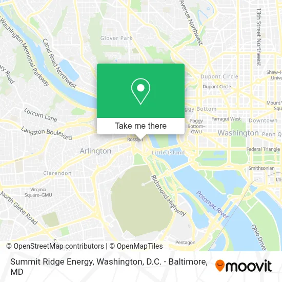
See Summit Ridge Energy, Arlington County, on the map
Public Transit to Summit Ridge Energy in Arlington County
Wondering how to get to Summit Ridge Energy in Arlington County? Moovit helps you find the best way to get to Summit Ridge Energy with step-by-step directions from the nearest public transit station.
Moovit provides free maps and live directions to help you navigate through your city. View schedules, routes, timetables, and find out how long does it take to get to Summit Ridge Energy in real time.
Looking for the nearest stop or station to Summit Ridge Energy? Check out this list of stops closest to your destination: Wilson Blvd Eb @ Fort Myer Dr Ns; Wilson Blvd @ N Kent St; N Lynn St+Wilson Bl; Arlington (Rosslyn); N Moore St Sb at Rosslyn Station Bay A; N Nash St & Wilson Blvd; Rosslyn; N Moore St Sb at Rosslyn Station Bay E; Rosslyn PM; Arlington Cemetery; Clarendon.
Bus: 43, A58, A76, 622, 932, 972-R, FLIXBUS 2601, FLIXBUS 2605.Metro: BLUE, ORANGE, SILVER.
Want to see if there’s another route that gets you there at an earlier time? Moovit helps you find alternative routes or times. Get directions from and directions to Summit Ridge Energy easily from the Moovit App or Website.
We make riding to Summit Ridge Energy easy, which is why over 1.7 million users, including users in Arlington County, trust Moovit as the best app for public transit. You don’t need to download an individual bus app or train app, Moovit is your all-in-one transit app that helps you find the best bus time or train time available.
For information on prices of metro and bus, costs and ride fares to Summit Ridge Energy, please check the Moovit app.
Use the app to navigate to popular places including to the airport, hospital, stadium, grocery store, mall, coffee shop, school, college, and university.
Summit Ridge Energy Address: 1000 Wilson Blvd street in Arlington County
- 1000-1100 Wilson Owner,
- Grant Thornton LLP,
- Wilson Blvd Arlington,
- PRTC Rosslyn OmniRide Bus Stop,
- UVA Darden DC Metro,
- U.S State Department,
- DoS Badging Office,
- Salt,
- Convene at 1201 Wilson Blvd,
- Open Road - Rosslyn,
- Open Road,
- GW Parkway at I-395 N exit,
- River Place North Housing,
- DOD Shuttle Rosslyn,
- Plaza East (1800 N Kent St),
- Flixbus Rosslyn,
- Hyatt Centric Arlington (HYATT HOTELS & RESORTS),
- Hyatt Centric Arlington,
- Hyatt Arlington,
- Nestle USA
Places Near Summit Ridge Energy (Arlington County)
- Amazon Hq2, Arlington County,
- Washington National Cathedral, Washington,
- Sibley Memorial Hospital, Washington,
- National Theatre, Washington,
- PG Mall, Prince George's County,
- Pennsylvania Ave NW (3rd st and pennsylvania), Washington,
- Rock Creek Tennis Center, Washington,
- Washington DC VA Medical Center, Washington,
- National Museum of African American History and Culture, Washington,
- Marriott Marquis Washington, DC, Washington,
- The Anthem, Washington,
- Capital One Arena, Washington,
- Warner Theatre, Washington,
- Basilica of the National Shrine, Washington,
- Camden Yards, Baltimore,
- Georgetown, Washington,
- M&T Bank Stadium, Baltimore,
- National Zoo, Washington,
- Westfield Montgomery Mall, Montgomery County,
- Museum Of The Bible, Washington
How to get to popular places in Washington, D.C. - Baltimore, MD with public transit
Get around Arlington County by public transit!
Traveling around Arlington County has never been so easy. See step by step directions as you travel to any attraction, street or major public transit station. View bus and train schedules, arrival times, service alerts and detailed routes on a map, so you know exactly how to get to anywhere in Arlington County.
When traveling to any destination around Arlington County use Moovit's Live Directions with Get Off Notifications to know exactly where and how far to walk, how long to wait for your line, and how many stops are left. Moovit will alert you when it's time to get off — no need to constantly re-check whether yours is the next stop.
Wondering how to use public transit in Arlington County or how to pay for public transit in Arlington County? Moovit public transit app can help you navigate your way with public transit easily, and at minimum cost. It includes public transit fees, ticket prices, and costs. Looking for a map of Arlington County public transit lines? Moovit public transit app shows all public transit maps in Arlington County with all Bus, Train, Metro, Light Rail and Ferry routes and stops on an interactive map.
Washington, D.C. - Baltimore, MD has 5 transit type(s), including: Bus, Train, Metro, Light Rail and Ferry, operated by several transit agencies, including WMATA, Montgomery County Ride On, Fairfax Connector, TheBus, PRTC, DASH - Alexandria, Arlington Transit (ART), RTA of Central Maryland, MDOT MTA, MDOT MTA Light RailLink, MDOT MTA Commuter Bus, MDOT MTA Local Bus, FXBGO!, Virginia Railway Express (VRE) and MARC