Directions to Sunny Slope Stable (Rutland) with public transportation
The following transit lines have routes that pass near Sunny Slope Stable
 Bus: MANCHESTER, SOUTH.
How to get to Sunny Slope Stable by bus?
Click on the bus route to see step by step directions with maps, line arrival times and updated time schedules.
Bus stop near Sunny Slope Stable in Rutland
- Route 7b Cottages, 12 min walk,VIEW
Bus lines to Sunny Slope Stable in Rutland
- MANCHESTER, Manchester Village Post Office,VIEW
What are the closest stations to Sunny Slope Stable?
The closest stations to Sunny Slope Stable are:
- Route 7b Cottages is 972 yards away, 12 min walk.
Which bus lines stop near Sunny Slope Stable?
These bus lines stop near Sunny Slope Stable: MANCHESTER, SOUTH.
What’s the nearest bus station to Sunny Slope Stable in Rutland?
The nearest bus station to Sunny Slope Stable in Rutland is Route 7b Cottages. It’s a 12 min walk away.
What time is the first bus to Sunny Slope Stable in Rutland?
The MANCHESTER is the first bus that goes to Sunny Slope Stable in Rutland. It stops nearby at 6:44 AM.
What time is the last bus to Sunny Slope Stable in Rutland?
The MANCHESTER is the last bus that goes to Sunny Slope Stable in Rutland. It stops nearby at 5:29 PM.
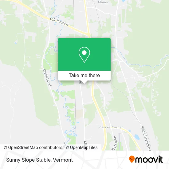
See Sunny Slope Stable, Rutland, on the map
Public Transit to Sunny Slope Stable in Rutland
Wondering how to get to Sunny Slope Stable in Rutland? Moovit helps you find the best way to get to Sunny Slope Stable with step-by-step directions from the nearest public transit station.
Moovit provides free maps and live directions to help you navigate through your city. View schedules, routes, timetables, and find out how long does it take to get to Sunny Slope Stable in real time.
Looking for the nearest stop or station to Sunny Slope Stable? Check out this list of stops closest to your destination: Route 7b Cottages.
Bus: MANCHESTER, SOUTH.
Want to see if there’s another route that gets you there at an earlier time? Moovit helps you find alternative routes or times. Get directions from and directions to Sunny Slope Stable easily from the Moovit App or Website.
We make riding to Sunny Slope Stable easy, which is why over 1.5 million users, including users in Rutland, trust Moovit as the best app for public transit. You don’t need to download an individual bus app or train app, Moovit is your all-in-one transit app that helps you find the best bus time or train time available.
For information on prices of bus, costs and ride fares to Sunny Slope Stable, please check the Moovit app.
Use the app to navigate to popular places including to the airport, hospital, stadium, grocery store, mall, coffee shop, school, college, and university.
Sunny Slope Stable Address: 3046 Middle Rd street in Rutland
- Mikes Country Store,
- USPS Collection Box - Po Lobby,
- Green Mountain Taxidermy,
- North Clarendon,
- Blume Vermont,
- Airport Driving Range,
- Pike Industries,
- North Clarendon,
- Garden Center at Tractor Supply,
- Columbia,
- Kinney Motors,
- Gouchberg Farms Market and Deli,
- Alternative Kleening,
- Wow Family Entertainment,
- The Maple Angus,
- Mission City Church,
- VICTORIA'S SECRET,
- Rutland Collectibles,
- Joe's Nursery & Landscaping,
- Williams Farmstead
Places Near Sunny Slope Stable (Rutland)
- Derby Line Stanstead Border Crossing,
- Missisquoi River Basin Association,
- Richford Auto,
- Castleton University, Rutland,
- Barre, VT,
- Hannaford, Rutland,
- Ecco,
- MVU,
- Waterbury, VT,
- Castleton, VT, Rutland,
- Xxxxxxxxxxxxx, Chittenden,
- WXXX, Chittenden,
- Champlain Valley Exposition, Chittenden,
- GLOBALFOUNDRIES, Chittenden,
- Spring Step,
- Dartmouth-Hitchcock Medical Center, Clinical Systems, Grafton,
- Rutland, VT, Rutland,
- Sugarbush Resort,
- Springfield, VT, Windsor,
- University of Vermont Medical Center - Fanny Allen Campus, Chittenden
How to get to popular places in Vermont with public transit
Get around Rutland by public transit!
Traveling around Rutland has never been so easy. See step by step directions as you travel to any attraction, street or major public transit station. View bus and train schedules, arrival times, service alerts and detailed routes on a map, so you know exactly how to get to anywhere in Rutland.
When traveling to any destination around Rutland use Moovit's Live Directions with Get Off Notifications to know exactly where and how far to walk, how long to wait for your line, and how many stops are left. Moovit will alert you when it's time to get off — no need to constantly re-check whether yours is the next stop.
Wondering how to use public transit in Rutland or how to pay for public transit in Rutland? Moovit public transit app can help you navigate your way with public transit easily, and at minimum cost. It includes public transit fees, ticket prices, and costs. Looking for a map of Rutland public transit lines? Moovit public transit app shows all public transit maps in Rutland with all Bus, Train and Ferry routes and stops on an interactive map.
Vermont has 3 transit type(s), including: Bus, Train and Ferry, operated by several transit agencies, including Green Mountain Transit, Wilmington MOOver, Advance Transit, Vermont Translines, Rockingham MOOver, The Bus (Marble Valley Regional Transit District), Green Mountain Express, Rural Community Transportation, Addison County Transit Resources, Stagecoach Transportation Services, Amtrak, Greyhound-us, Dartmouth Campus Connector and Lake Champlain Ferries